New Version v1.9.7.2 for 2025 - Multi-Satellite Viewing with Frequency Display. Unique Country-Pairs Display for PskReporter Data. Live Feed from Logging Programs. Plot any ADIF file.

 Introducing the Time Mapper UHD program
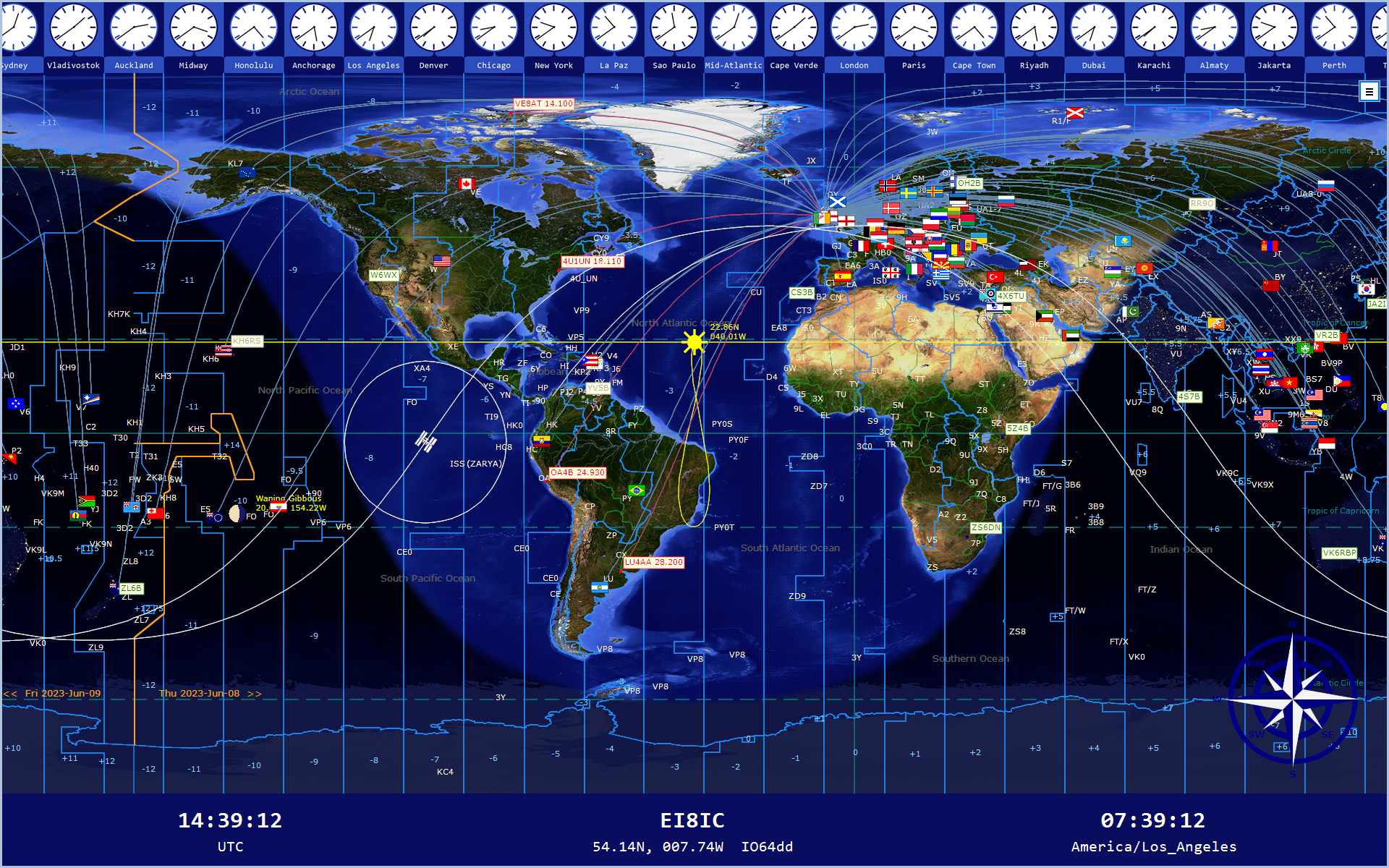
Welcome to the 'Time Mapper UHD' - a visually stunning new program that combines mapping and time functions to produce an ever-changing 4K or HD World Clock display that will enhance whatever location it is displayed in.
Ideal for school, office, or amateur radio station, the Time Mapper UHD can be customized to produce an infinite number of display configurations to suit every requirement.
Compare some HD Basemaps:
HD Map 1 - HD Map 2 - HD Map 3 - HD Map 4
Compare some 4K Basemaps:
4K Map 1 - 4K Map 2 - 4K Map 3 - 4K Map 4
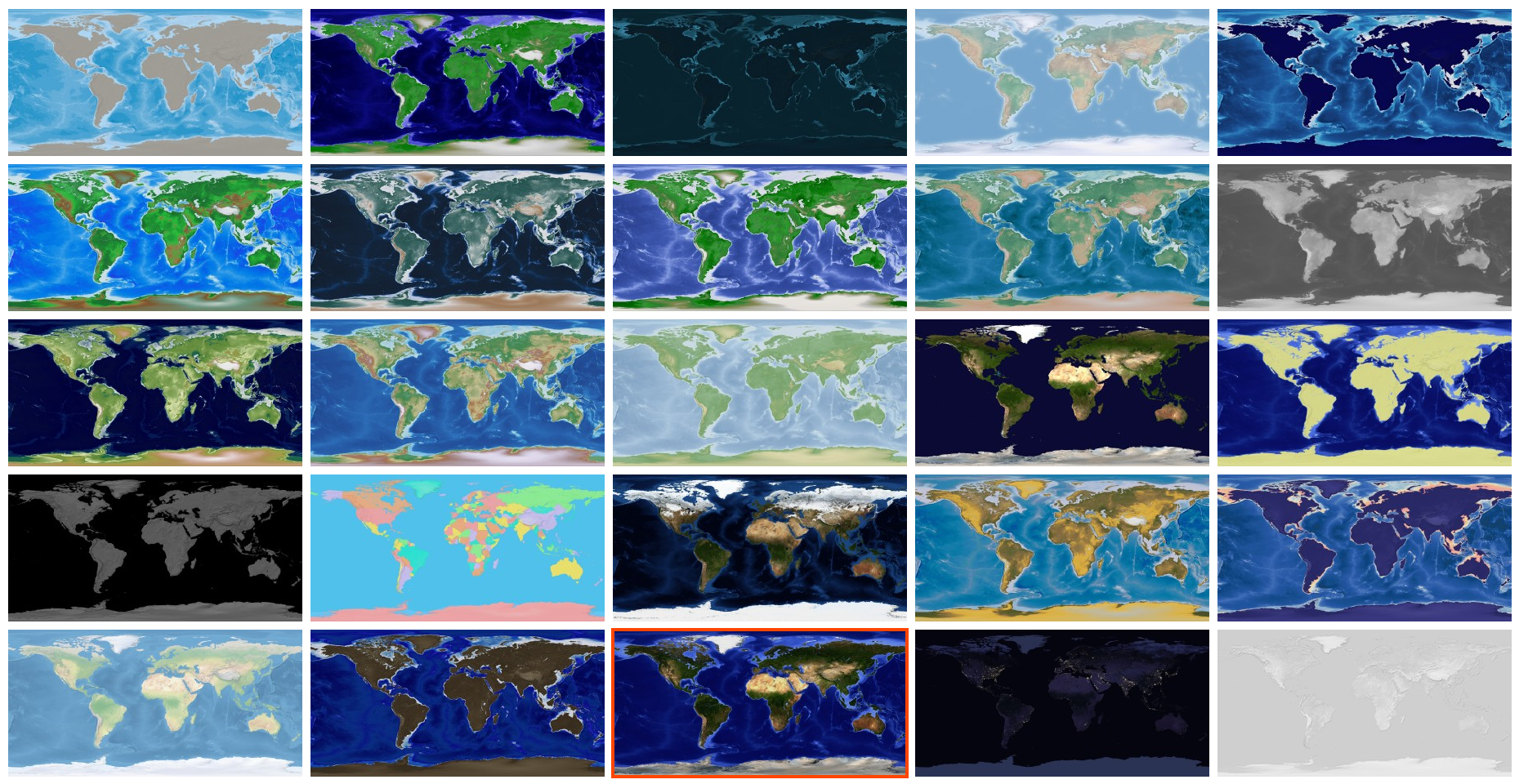
The Time Mapper UHD has 25 different Base Maps:

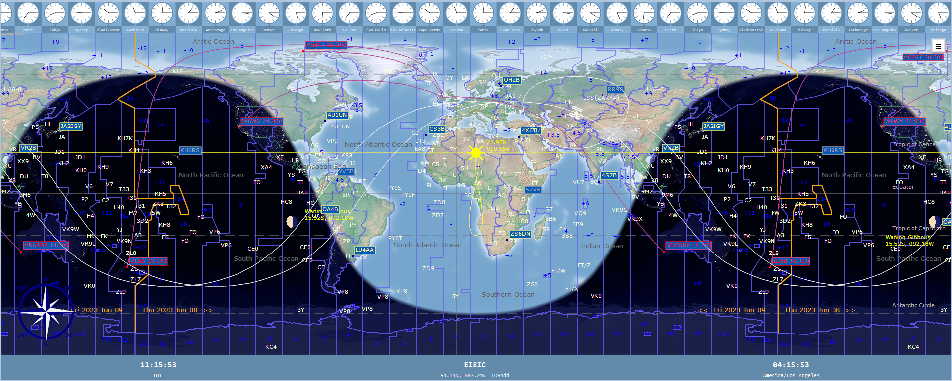
Need more screen space? You can show up to 720° of Longitude:

4K Map 1 - 4K Map 2 - HD Map 1 - HD Map 2
There are 60 different Layers that can be shown over those Base Maps.
Many of the layers have selectable options that you can configure to suit your own requirements.
Each layer may contain one or more of these entities: Raster image, Vector Point, Vector Line, and Vector Label.
The Points, Lines, and Labels can be altered in many different ways: size, color, font, background, border, width, padding, etc.
These settings are remembered separately for each Layer as it is shown on each Base Map. Change a Base Map, and the layers can appear completely different to how they were shown on a different Base Map.
The Layers can also be displayed in different stacking-orders to compare or enhance selected layer-details and data. Here is a list of the current Map Layers:
Land Use > Cropland, Land Use > Pastureland, Land Use > Forest Cover, Land Use > Leaf Area Index, Land Use > Population Density, Physical > Magnetic Model, Communication > Sea Routes, Communication > Submarine Cables, Communication > Roads, Communication > Railroads, Natural > Ocean Currents, Natural > Tectonic Plates, Natural > Rivers, Natural > Land Temp Day, Natural > Land Temp Night, Natural > Albedo, Natural > Permafrost, Physical > Continents, Physical > Regions, Physical > Time Zones, Physical > Latitude Longitude, Physical > Base Lines, Physical > Date Line, Physical > Compass Rose, Physical > OpenLocationCode, Cultural > Country Borders, Cultural > Country Names, Cultural > Capital Cities, Cultural > Country Info, Cultural > Flags, Cultural > Pacific Groupings, Cultural > Polar Bases, Cultural > Antarctic Claims, Natural > Oceans and Seas, Natural > Marine Features, Natural > Mountain Ranges, Natural > Mountain Names, Natural > Earthquakes, Natural > Active Fire Data, Natural > Volcanoes, Ham Radio > CQ Zones, Ham Radio > ITU Zones, Ham Radio > IARU Regions, Ham Radio > Grid Locators, Ham Radio > Ham Prefixes, Ham Radio > NCDXF Beacons, Ham Radio > Ham Logs, Ham Radio > Logger Feed, Ham Radio > Worked Grid Squares, Ham Radio > PSK Reporter, Communication > Airports, Communication > Sea Ports, Communication > Lighthouses, Communication > Satellite Footprint, Communication > Satellite Track, Communication > Space Watch, User > Map Markers, Celestial > Eclipses, Celestial > Moon Tracker, Celestial > Sun Tracker.
The numerous Time Functions can be adapted in many ways. Each Time Zone has its own clock, in analog or digital format, and a choice of label-content. Then, at the bottom of the screen you can display up to 5 large clocks, each with their own Time Zone value and choice of format. You can also add your own Map Markers, which can show the local time at their locations.
The Time Mapper UHD is of special interest to the Amateur Radio Operator, with many useful features not seen in other programs: CQ Zones, ITU Zones, Ham Prefixes, NCDXF Beacons, Log import, Live QSO display from the N1MM Logger, Live Grid Square display, DX News Feed, Contest Calendar, DX Spots, Polar Bases, UDP Monitor, UDP Simulator.
The Time Mapper UHD can import 3 separate logs in ADIF or Cabrillo format, calculate log statistics, georeference them from Internal and Online Databases, and then plot them in a variety of ways, showing individual QSOs, Country Details, Flags, or Grid Squares.
For further reference, see the comprehensive Time Mapper UHD Help Guide.
 Program FAQs
- Q: What operating system does the program run on?
A: Windows: 10 or 11.
- Q: Is there a Mac or Linux version?
A: Sorry, no.
- Q: Does the program have a minimum window size?
A: Yes: it's 1024 x 512 pixels, but sensibly you should use an HD monitor as a minimum - that's 1920 x 1200 pixels.
- Q: Does the program have a recommended window size?
A: Yes: it's 4K - that's 3840 x 2160 pixels.
- Q: Any computer requirments?
A: Yes: something not too old, with SSD and 4GB of RAM.
- Q: Can I see some screenshots of the program?
A: Yes, you'll find them on the Screenshots page.
- Q: Is there a list of program-features?
A: Yes, please visit the Features page.
- Q: Can I see the Help Guide online?
A: Yes, over 100 pages - just click here: Help Guide
- Q: Is there a free evaluation period?
A: Yes, you can trial the program with full functionality for 30 days. After that, you'll need a license.
- Q: How much is the license and where do I get it?
A: The Time Mapper UHD is purposely priced at a level that makes it accessible to all. You can buy a one year license for just $10 USD. Who knows: there might be a better product next year! Or you can buy a 50 year license for $25 USD, because we all know that it will be some time before the Time Mapper UHD is bettered.
- Q: Any discounts for Club Stations?
A: Yes. I offer a free license for clubs and youth organisations that can't otherwise afford it. Write and tell me about your club.
- Q: How much is the optional Ham Radio package?
A: Nothing. There isn't one. Everything is included with the standard license.
- Q: How much is the optional Earthquake package?
A: Nothing. There isn't one of those either. Everything is included with the standard license. There aren't any extras to pay.
- Q: What is the latest version and what is new?
A: Current Version: v1.9.7.2
- Fixed PSK 'Filter-By-Grid Locator' Bug.
- Improved speed of Psk Plotting Routine.
- New Psk Plot-Method: Unique Country Pairs - Prefix
- New Psk Plot-Method: Unique Country Pairs - Flag
- Added Current Received Callsigns for ease of Psk Filter Creation.
- Corrected Position for VE8AT, 5Z4B NCDXF Beacons.
- Added a number of new NOAA Propagation and Solar Images (Shortcut: ID).
- Added InfoBar Page-Refresh Pause (Shortcut: PI) and Resume (Shortcut: PR).
- Re-write of Earthquake Plot, with variable Icon Size and Magnitude Labels.
- Added Satellite Frequency Data to the Satellite InfoBar Page: (Shortcut: IG).
- Added Total Daylight Values for Equinox Periods to InfoBar Solar Info (IE).
- Added Time Difference From User for Markers in InfoBar (Shortcut: IR).
- Aligned DataBar Sunrise/Sunset Times to the User Time Zone.
- Add Daylight Savings Time Suffix Option to Appropriate Times.
- Added User Time-Format and DST Suffix to Markers.
- Added Pre-filled Country Names to PskFilter ADIF Selection.
- Preserved User Settings when installing New Program-Version.
- DataBar Satellite Info Shows Selected Satellite.
- Add 'Hours-Only' Option for the TimeBar.
- Slowed InfoBar Refresh-Rate for Specific InfoBar Pages.
- Added Option in Settings to Disable the News Ticker..
- Maximize Map at Startup now includes Last Monitor.
- Display 1-8 Satellites At Once.
- When viewing in Satellite InfoBar page (Shortcut: IG),
- select rotating view (SA) or single satellite (S1-S8).
- New InfoBar Page: Earthquake Info (Shortcut: IQ).
- New Icons for Earthquake Plotting.
- New InfoBar Page: Map Markers (Shortcut: IR).
- New InfoBar SubPage: PskReporter > Best Frequency.
- Plot PskReporter Grid Squares.
 Time Mapper UHD Download
To obtain your copy of the Time Mapper UHD program (v1.9.7.2), please enter your details in the boxes below. An email will be sent with the Download Link.
|