|
The contesting season will soon be upon us again, and what can be more useful than a large map? I've supplied the official CQ Zone map for some years, but if you want a dynamic map to fit your 4K monitor, then the 'Time Mapper UHD' is the ideal program to create it.
Click any image to show that full sized image in a new browser-tab.
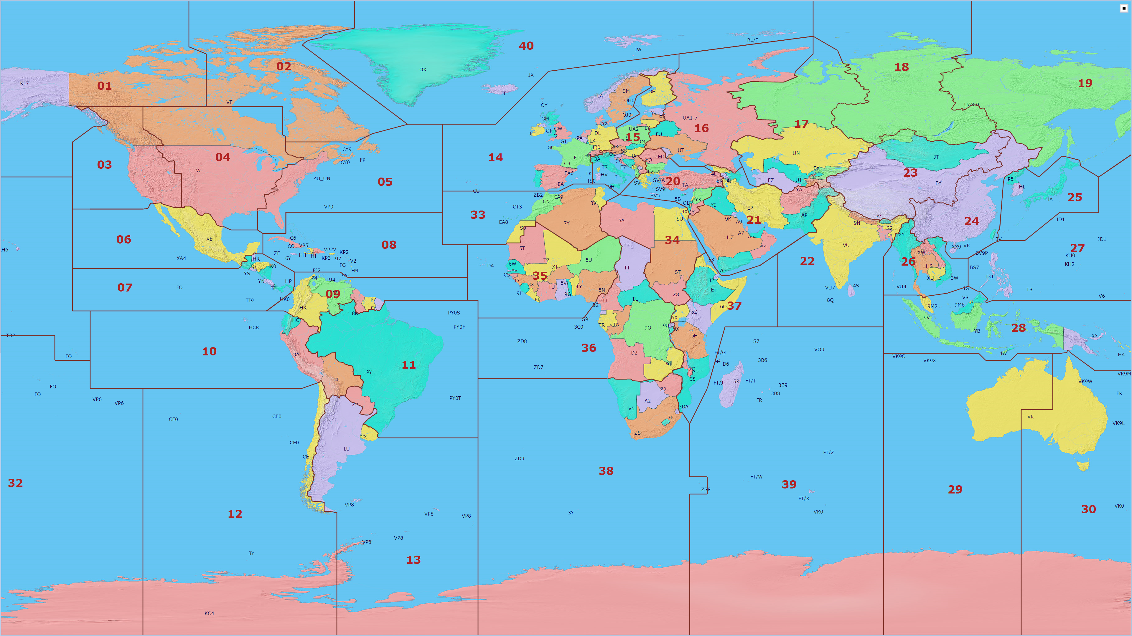
Here is the 'Time Mapper UHD' showing a static map of CQ Zones and Amateur Radio Prefixes, fixed at a longitude of 0W.
|
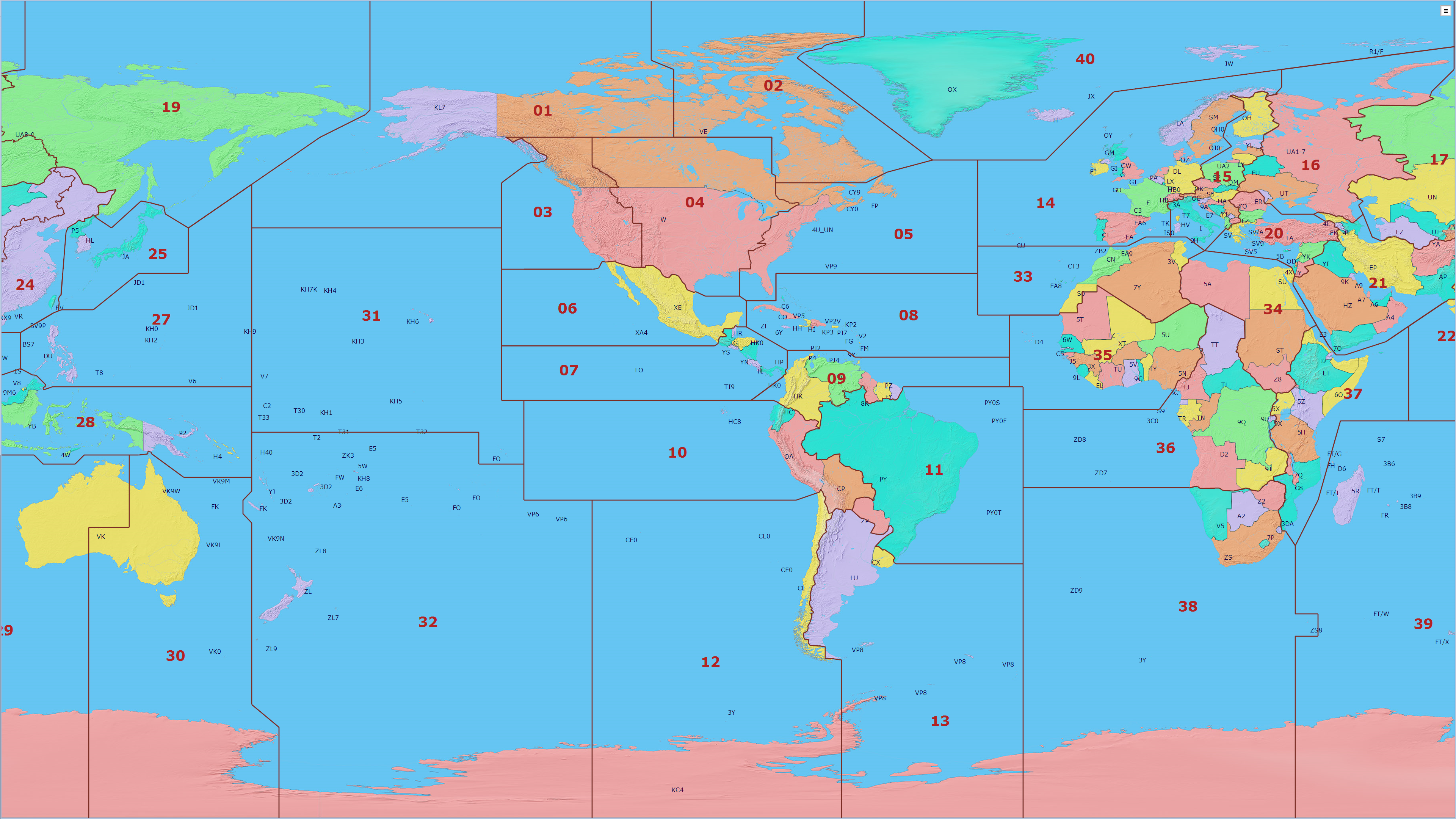
For our friends in the Americas, here is the same map fixed at a longitude of 90W. You can choose any center-longitude value that you like.
|
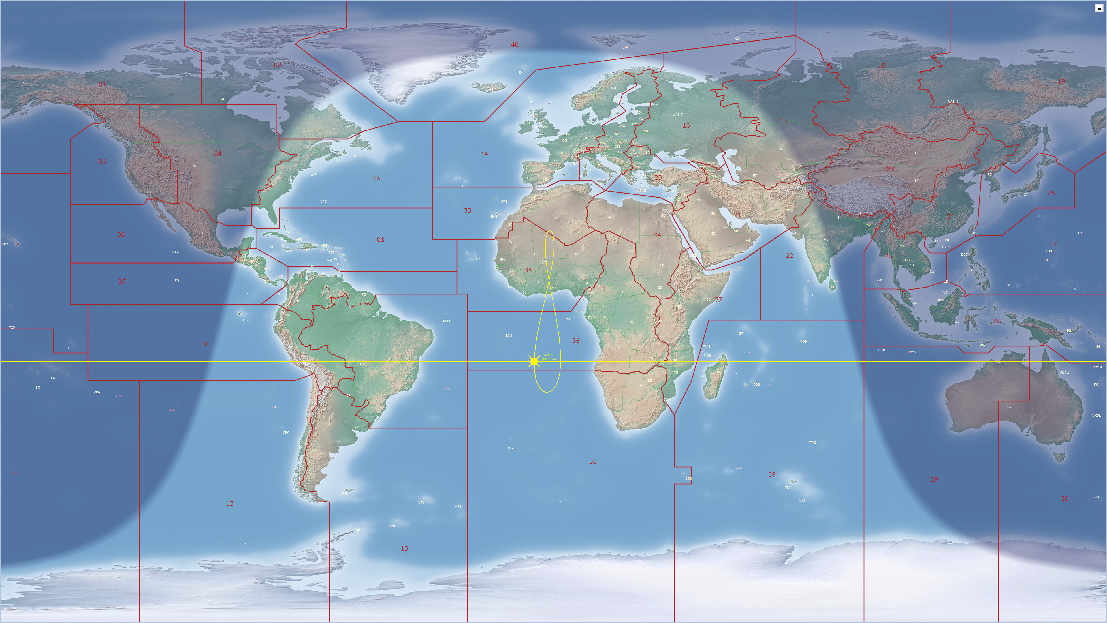
Or you might like to fix the center-position to the current sun-position, and maybe add a gray-line layer for reference so you can anticipate the next DX opening.
|
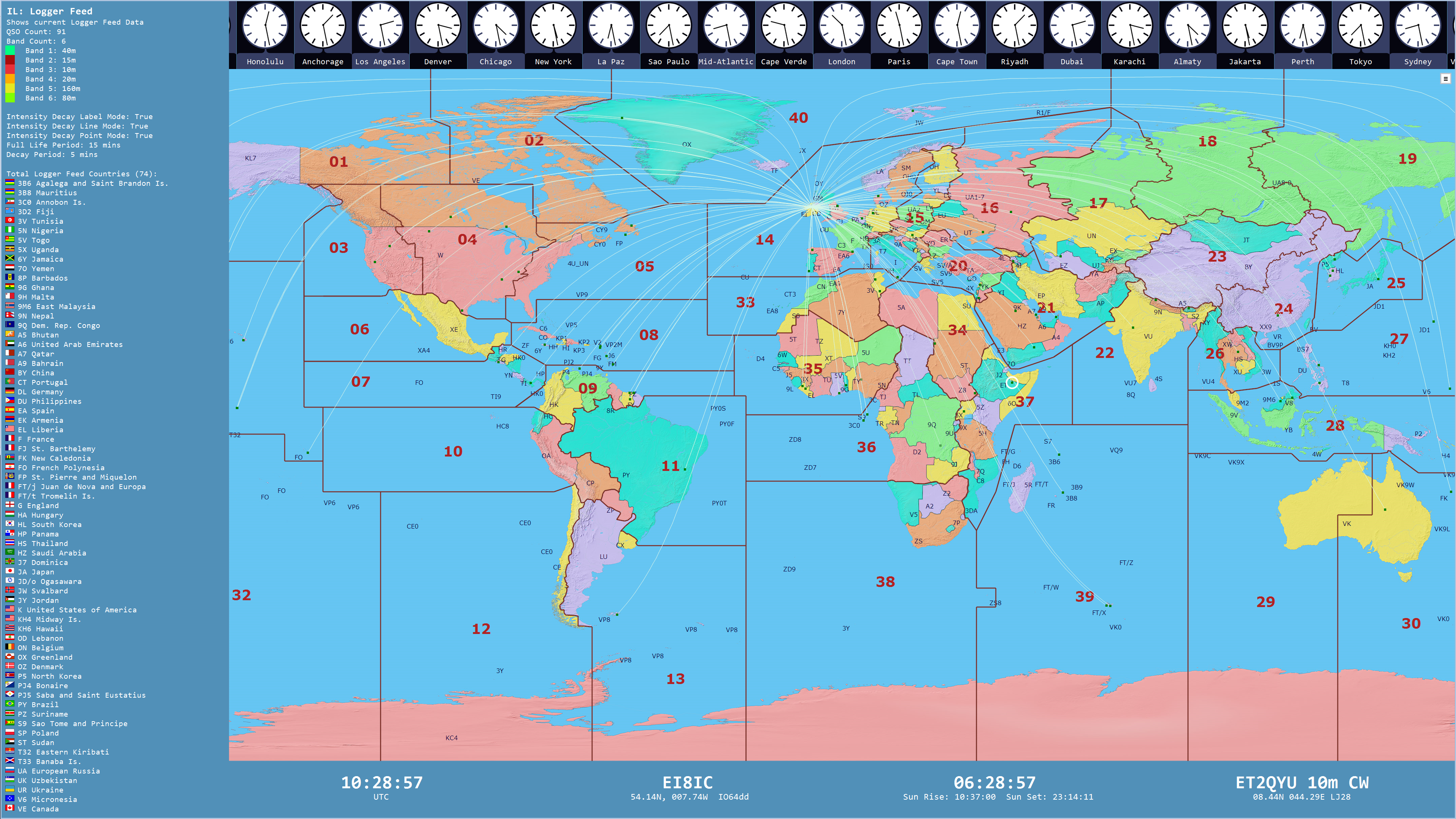
If you are a contester, wouldn't it be neat to plot all your QSOs on your big-screen CQ Zone map, as you make them? No need to upload your log for geo-referencing: the 'Time Mapper UHD' plots your Live QSOs from DXLog, Ham Radio Deluxe, LOG4OM, N1MM, N3FJP, WriteLog.
|
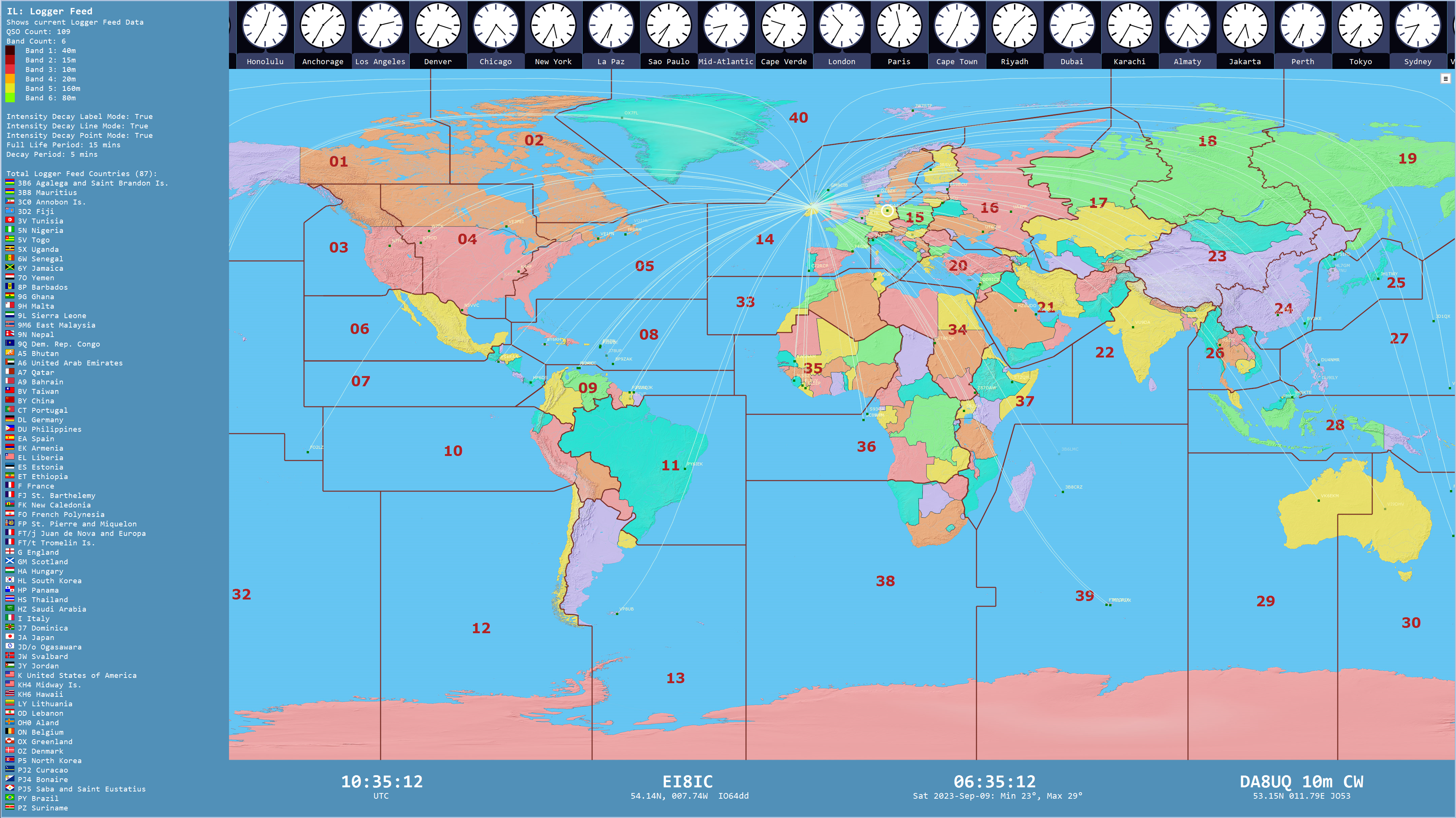
In this view, we have turned off the Prefix layer, and added labels for the callsign of each QSO that has been logged. The map never gets too crowded, as the optional 'Intensity Decay' is enabled to make QSOs fade from the map after a pre-determined period. Note the white circle around the latest QSO with German station DA8UQ. The latest QSO details are also shown on the lower 'Data Bar'. This looks great on a large screen 4K monitor at a public event.
|
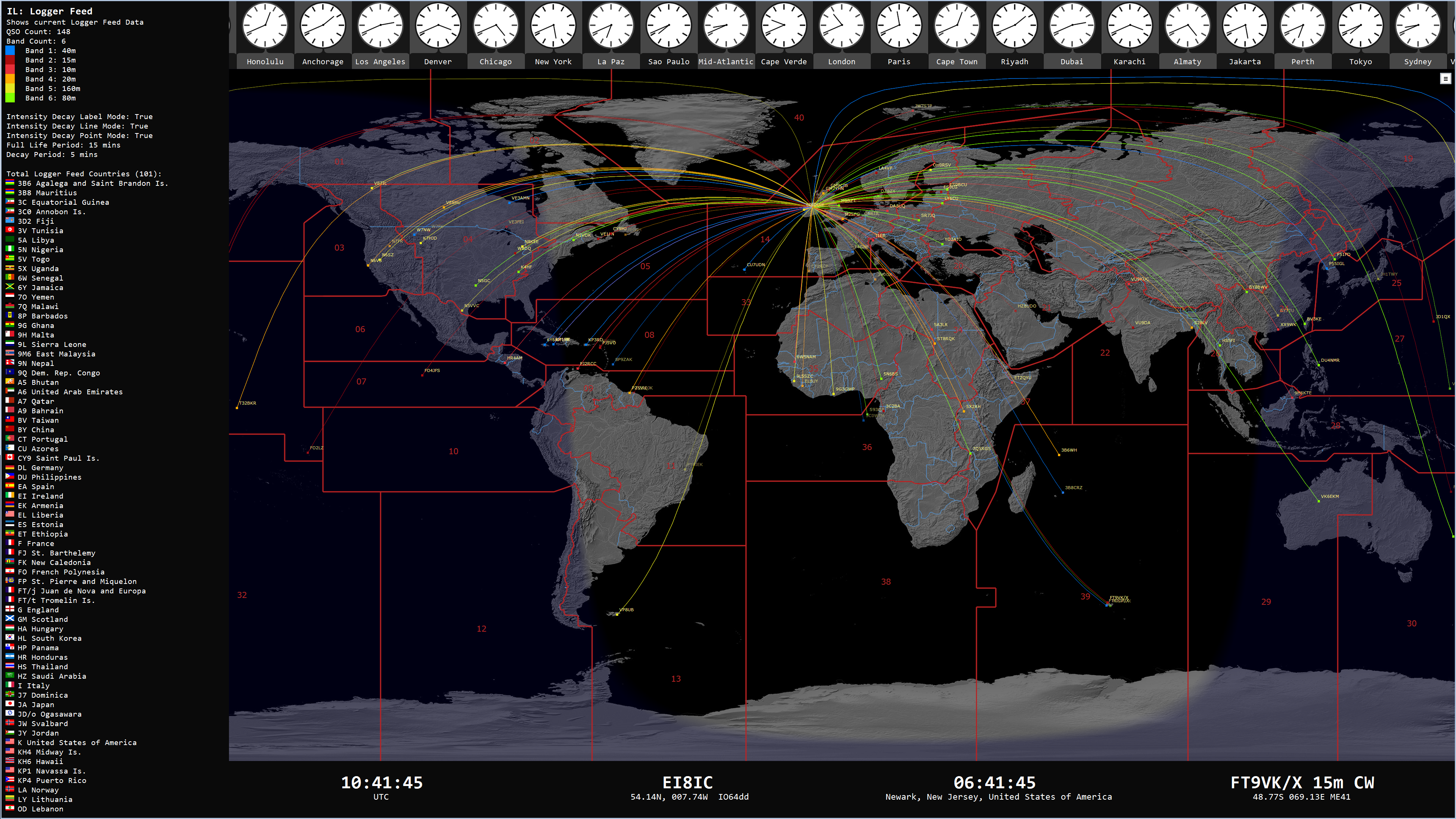
A different Base Map has been chosen from the 25 available Base Maps. The lines to the QSO positions have been colored to correspond to the band in use. The Information Bar on the left is currently showing Countries Contacted, and will cycle through a number of panels to show a wealth of real-time information: List of most recent QSOs with Call, DateTime, Band, Mode, Short Path Bearing, Distance; List of Total Countries; List of Total Grid Squares; List of Countries by Band; List of Countries by Mode; List of Grid Squares by Band; List of Grid Squares by Mode.
|
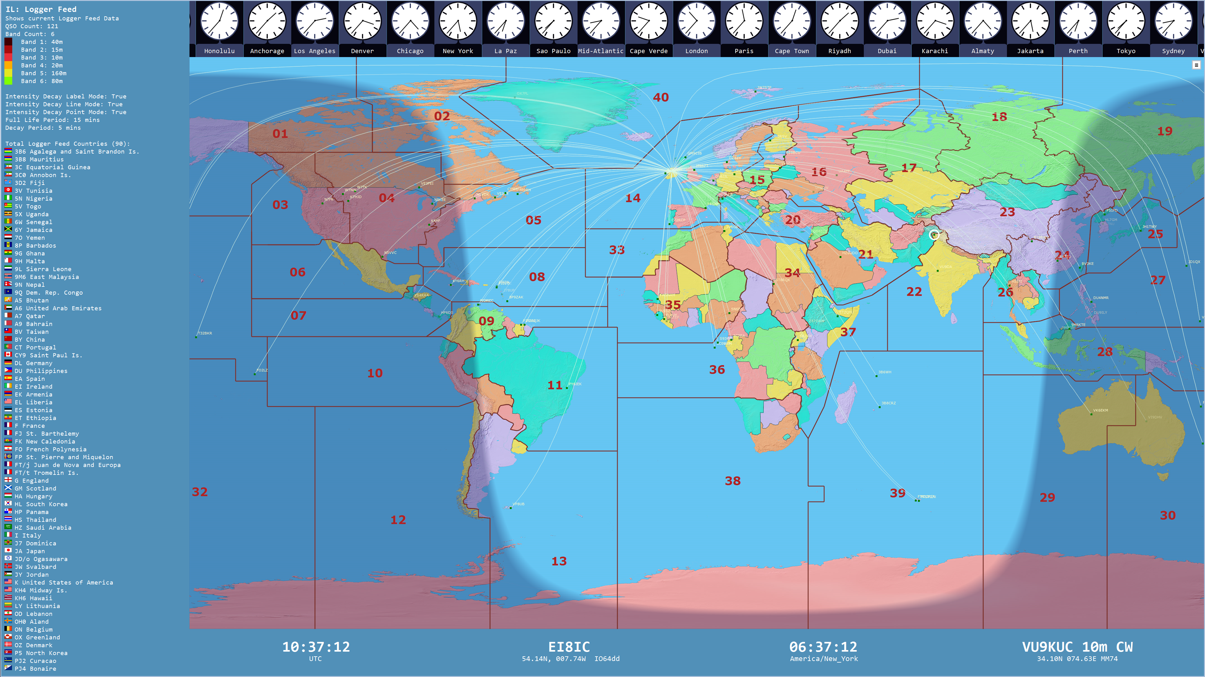
The Gray Line layer has been turned on, so you can anticipate the next DX opening and take advantage of the special propagation effects that can occur when both stations are located on the Terminator Line, enabling low-power communications over many thousands of kilometers. You can choose the base-color and transparency of the Gray Line layer to suit your current requirements.
|
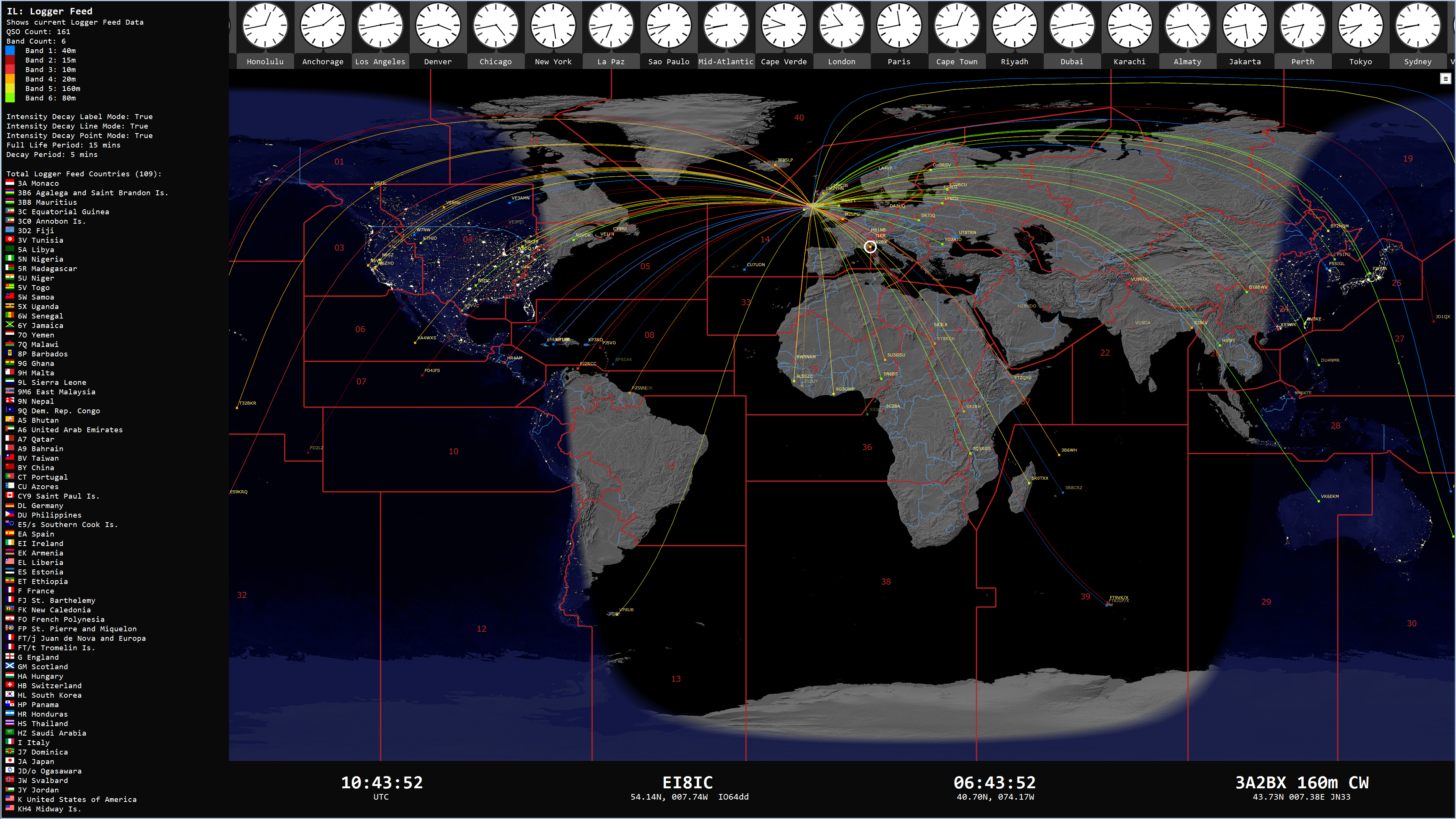
A Gray Line alternative is to use the Night Image, showing the world at night, as compiled from historical satellite views.
|
|