New Version v1.2.6.0 for 2022 - Many New Features
 - More Screenshots - More Screenshots
 Introducing the Great Circle Mapper
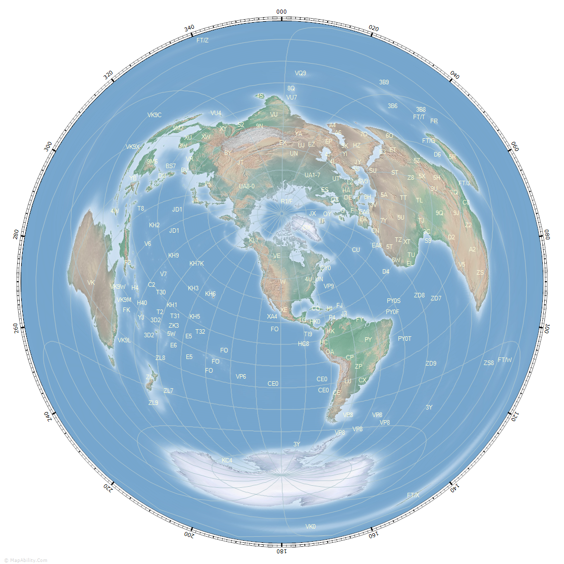
Welcome to 'GCM v10' - the latest incarnation of EI8IC's Great Circle Mapper, a Windows mapping program for Radio Amateurs, Contesters, and DXers that produces a range of unique and distinctive circular maps in 4 different projections, with user-controls for Gray Line information, Beacon Monitoring, Grid Locators, Range Rings, Magnetic Variation, Beam Direction Plotting, Antenna Coverage Plotting, Callsign and Amateur Radio Country Lookup, Prefix, Capital City and Country Labels, plus other database facilities. There are many settings and adjustments possible, or the controls can all be hidden, leaving a stand-alone square map that can be easily integrated into a Contesting or DXer desktop workflow.
Maps are created with over 20 different backgrounds. You can export them for your own programs, or online use. Full Mouse-Position Information includes Latitude/Longitude, Grid Locator, Distance with Unit-Choice, Short and Long-Path Bearings from QTH and Map-Center.
For further reference, see the comprehensive GCM v10 Help Guide.
We support YOTA - Youngsters On The Air
EI8IC supports the Youngsters On The Air Program. Are you a licensed Amateur operator aged 18 or less? Contact Me to claim a free license for the Great Circle Mapper.
Program FAQs
- Q: What operating system does the program run on?
A: Windows: 10.
- Q: Is there a Mac or Linux version?
A: Sorry, no.
- Q: Does the program have a minimum window size?
A: Yes: 600 x 600 pixels with no controls, 893 x 740 pixels with controls.
- Q: Can I see some screenshots of the program?
A: Yes, you'll find them on the Screenshots page.
- Q: Is there a list of program-features?
A: Yes, please visit the Features page.
- Q: Can I see the Help Guide online?
A: Yes, just click here: Help Guide
- Q: Is there a free evaluation period?
A: Yes, you can trial the program with full functionality for 30 days. After that, you'll need a license.
- Q: How much is the license and where do I get it?
A: Click this link: Buy a license: 11.00 USD or equiv in GBP, EUR, AUD.
- Q: What is the latest version and what is new?
A: Current Version: v1.2.6.0
- Form-State and Size Saved on Exit.
- TabPage for Route A to B Plotting.
- New Widgets for Mouse and Country Bearing.
- New Widget Align Features.
- Improved Position Entry.
- Draw Bearing to Right-Click.
- Draw Range-Ring to Right-Click.
- Sun Track and Analemma Plotting for any Date/Time.
- Extra Range Ring and Beam Heading Features.
- More User Colors Stored.
- New Background Maps with Shaded Relief.
- Callsign Parsing - identify entered Call for DXCC Country Details.
- Magnetic Variation - show the Declination for any point on Earth.
- Beamwidth and Bearing Display - plot Lines and Antenna Beamwidth.
- Time Zones - get Time-Zone for any location, show Local Time.
- Solar Data - display Sun Rise and Set for Gray Line Propagation.
- Range-Rings - show Single or Multiple Rings in chosen Distant Units.
- Country Names and Capital Cities - add Labels with Mouseover Info.
- Grid Locators - plot grids on the map, and show 6-character StatusBar Data.
GCM v10 Download
To obtain your copy of the Great Circle Mapper program (v1.2.6.0), please enter your details in the boxes below. An email will be sent with the Download Link.
|