New for 2020 - tested on Win 7, 8, 10
Click to see full-size image in a new window
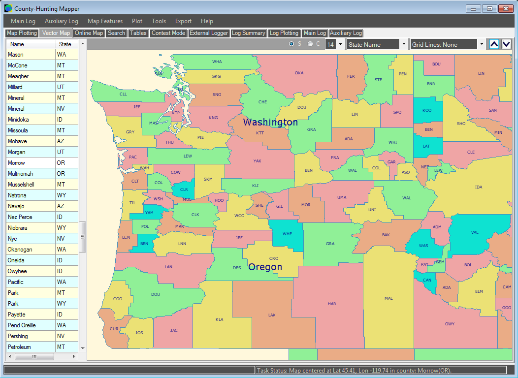
 Introducing the County-Hunting Mapper
Welcome to the 'County-Hunting Mapper' - a unique, easy-to-use Amateur Radio program for creating County, State, Section and Grid Locator outline maps of North America that can be filled by Hand, from a Contest Logger UDP Feed, or from Imported ADIF or Cabrillo Logs.
Create a base map, add text, colors, and lat/lon or Grid Locator Lines, then fill regions to create maps that reflect your County Hunting activities, or operating achievements, or contest results: either by hand, or from imported log files, or as those events actually happen, by automatically plotting regions worked during a contest from your N1MM loggeer, and building up a map that shows the exact state of your contest so far.
You can edit logs, check for errors, parse for counties, export data in different formats, search the county databases, overlay GPS files, export the maps for use in other applications, or to share online. For further reference, see the comprehensive Help Guide.
Program FAQs
- Q: What operating system does the program run on?
A: Any recent version of Windows: 7, 8, 10.
- Q: Does the program have a minimum window size?
A: Yes: it's 1024 x 730 pixels.
- Q: Can I see some screenshots of the program?
A: Yes, here are a few on the Screenshots page.
- Q: Is there a list of program-features?
A: Yes, please visit the Features page.
- Q: Can I see the Help Guide online?
A: Yes, just click here: Help Guide
- Q: Is there a free evaluation period?
A: Yes, you can trial the program with full functionality for 30 days. After that, you'll need a license.
- Q: How much is the license and where do I get it?
A: Click this link: Buy a Standard license: 15.00 USD or equiv in GBP, EUR, AUD.
- Q: What is the latest version and what is new?
A: Current Version: v1.4.1.0
- Quicker program-startup.
- Faster import of large logs.
- Improved log-value error-trapping.
- Allow up to 12 bands or modes per log.
- More comprehensive log-summary.
- List modes per band when the log not collecting a specific entity.
- Log Plotting shows Band/Mode values when hovering over a column-header.
- Fixed errors when deleting/merging log lines.
- Alaska Boroughs converted to Counties.
- Improved County Name parsing.
- Added new Section: PE - Prince Edward Island.
- Changed ONS/GTA border to meet new RAC specifications.
County-Hunting Mapper Download
To obtain your copy of the County-Hunting Mapper program (v1.4.1.0), please enter your details in the boxes below. An email will be sent with the Download Link.
|