
Examples of the Great Circle Mapper when using Background Map 0.
Here are the others: 0, 1, 2, 3, 4, 5, 6, 7, 8, 9, 10, 11, 12, 13, 14, 15, 16, 17, 18, 19, 20, 21, 22.
The Great Circle Mapper program shows maps in 4 different projections: Azimuthal Equidistant (aka Great Circle), Lambert Azimuthal Equal Area North and South (for Arctic and Antarctic views), and Orthographic (aka The World from Space), and can add a variety of overlay extras: Gray Line information, Beacon Monitoring, Grid Locators, Magnetic Variation, Beam Direction Plotting, Beam Heading Display, Antenna Coverage Plotting, Callsign and Amateur Radio Country Lookup, Prefix and Country Labels, plus other database facilities. Maps are created using 23 different Background Maps. Here are some examples of map #0:
Here we see a Great Circle Map for background #0. The view has been zoomed slightly, for a closer look. Latitude/Longitude lines are added, and a compass rose showing bearings to True North, with major divisions every 20 degrees. An additional rose can be added to show the Magnetic Variation for the center-position. All values, plus many colors, can be altered by the user, and stored automatically for each background.
Background number '0' is sourced from the Natural Earth Bathymetry Raster.
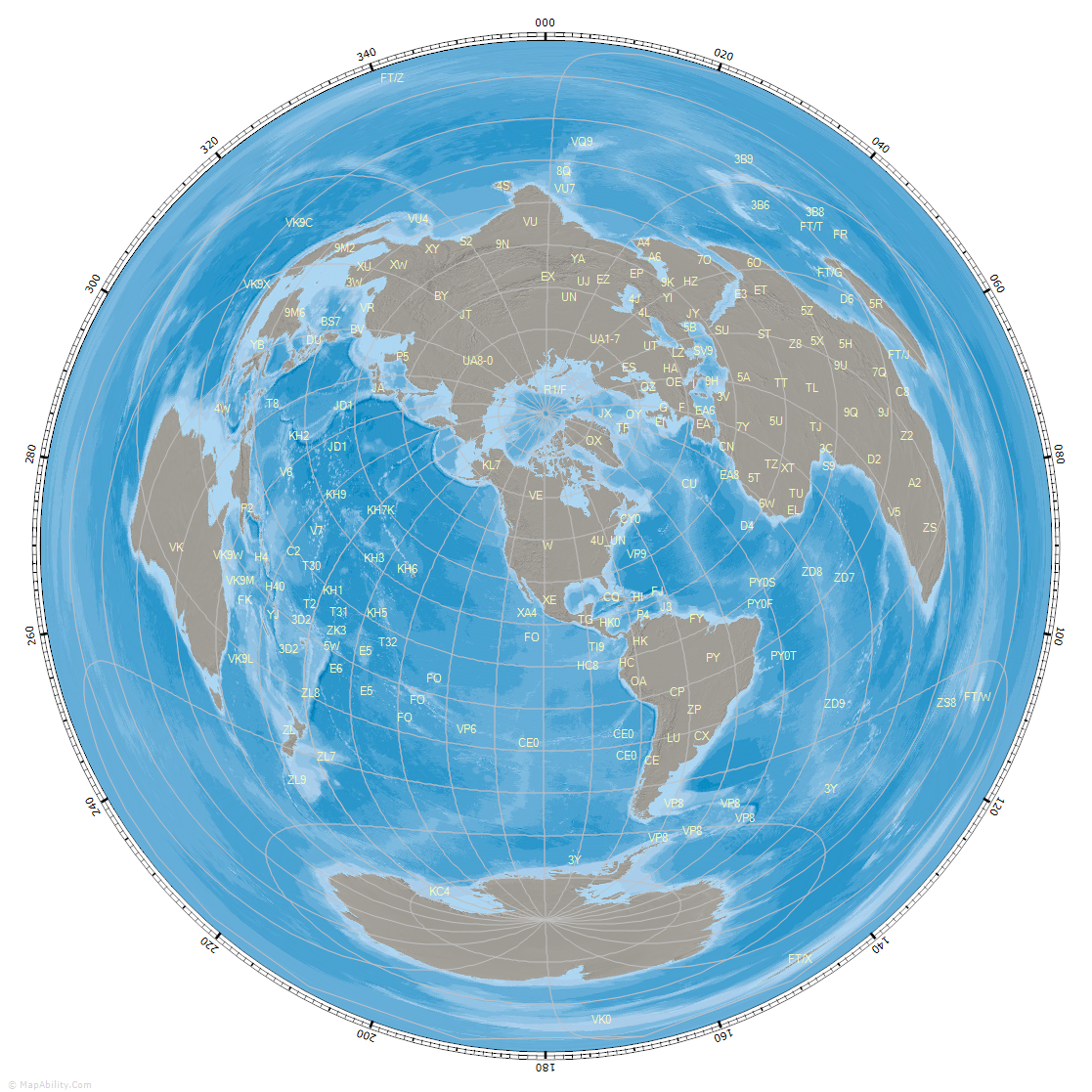
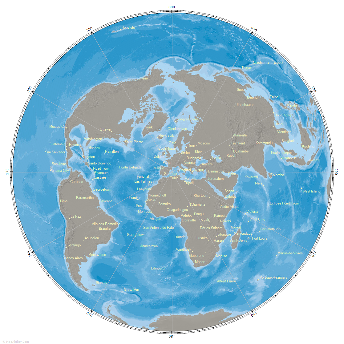
This map is in the 'Orthographic' projection, showing the familiar 'Earth from Space' view, centered on the Kyrgyz Republic, prefix 'EX'. A Grid Locator mesh has been added, with Latitude lines spaced every 10 degrees, and Longitude lines spaced every 20 degrees. The center of each resulting area is marked with a 2-character Grid Locator, though as the mouse moves across the map, then positions are converted to a 6-character Grid Locator on the Status Bar. Amateur Radio prefixes are also plotted. A special routine stops overlapping labels. As you zoom in, or increase the window-size, more prefix labels will show. As you move your mouse across a Prefix Label, additional information will show: Country Name, Continent, CQ and ITU Zones for that DXCC entity.
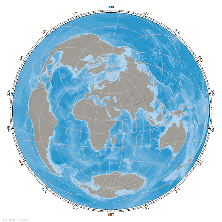
This map is in the 'Lambert Azimuthal Equal Area - North' projection, centered on the North Pole. It can be rotated by any Longitude-value. Radial Lines have been turned on, and set to a spacing of 30 degrees. We are plotting Country Names, and as before, the same routines show only the labels that do not overlap, and are appropriate for the map size and zoom-level. As you move your mouse across a Country Label, additional information will show: Standard Prefix, Continent, CQ and ITU Zones for that DXCC entity.
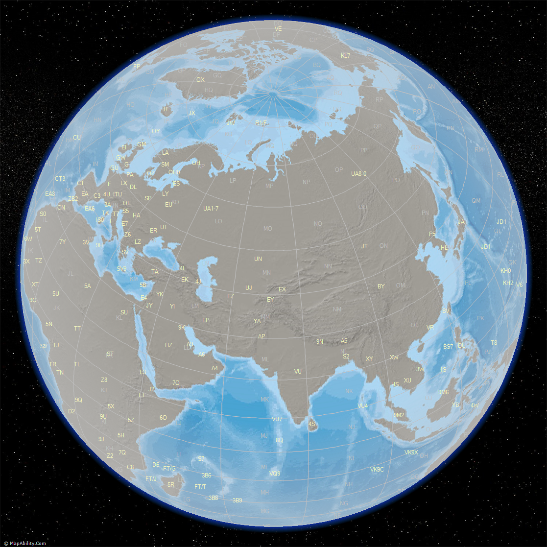
Here is a larger Great Circle Map, centered on the United States of America. Latitude/Longitude lines are set to a spacing of 15 degrees, though the radial divisions are left at 20 degrees. Prefixes are plotted - you can choose their color, font and size for each background.
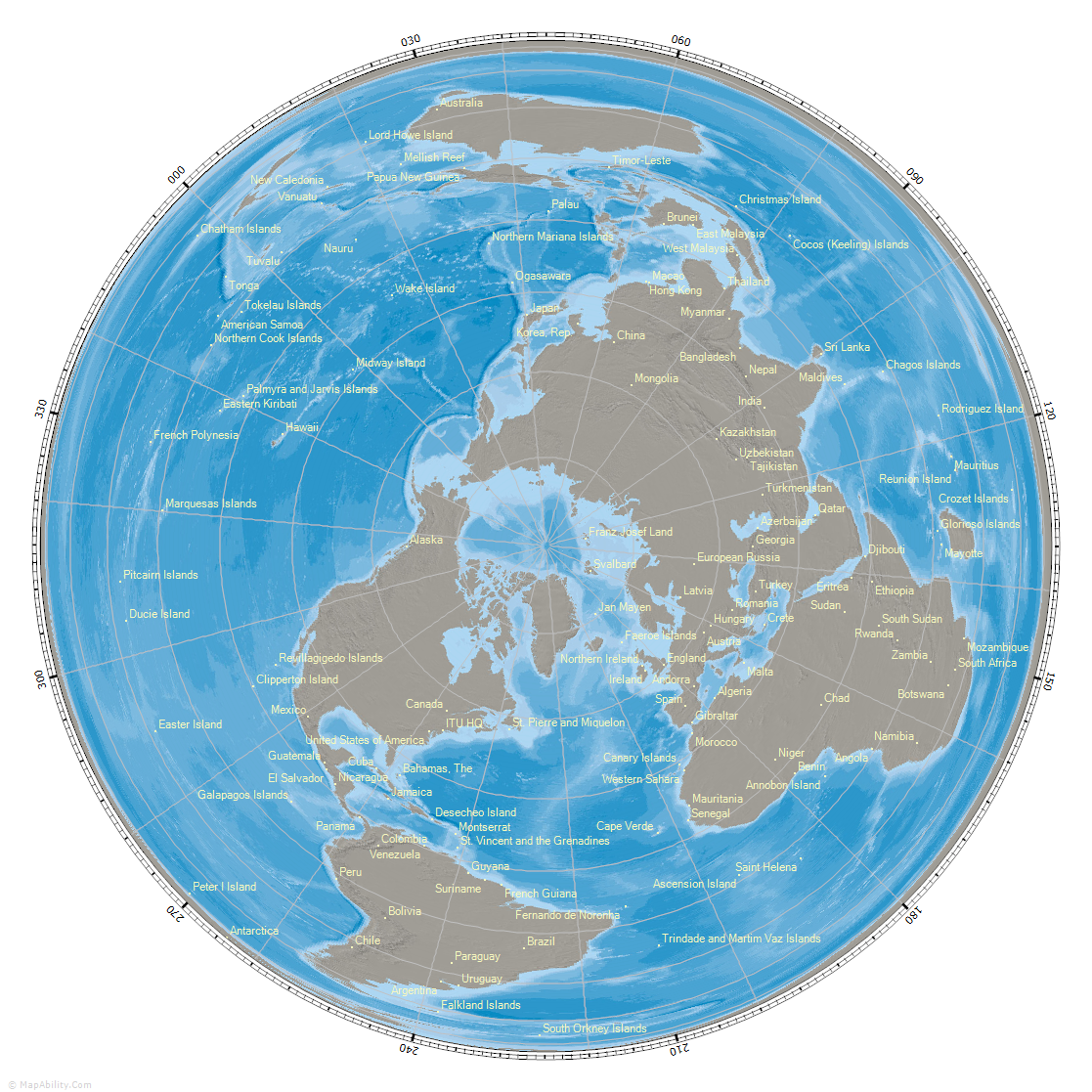
This map is centered on EA6: the Balearic Islands. We are plotting Capital Cities. As you move your mouse across a Capital City Label, additional information will show: Country Name, and the current Local Date and time for that DXCC entity.
To learn more about the Great Circle Mapper, visit the 'Features' or 'Screenshots' page. You can Download your own copy here. Click the following links to compare this background map with the others: 0, 1, 2, 3, 4, 5, 6, 7, 8, 9, 10, 11, 12, 13, 14, 15, 16, 17, 18, 19, 20, 21, 22.
|