« How to Geo-Tag Photos | Main
September 11, 2007
East Sussex Walks Online
Having recently purchased an Ordnance Survey 'Explorer' map of the area (No 124) I have discovered all kinds of paths and bridleways around the Pestalozzi International Village that previously I didn't know existed. England is very fortunate in having its many footpaths and other rights of way well documented, well maintained, and well signposted by the local authorities, though many of the signposts are quite discrete, so its is only with the help of a large scale map of the area that you can discover where they all are. Also, some local residents or land-owners are not that keen on having a footpath on or next to their property, so can hide or remove the signs that indicate a right of way, or just allow the undergrowth to naturally envelop them! With the right map, though, its easy to see where all these footpaths are.
 I am not a great fan of sport, but find that walking in the countryside is not only an excellent form of exercise to help combat the effects of the excellent food here at Pestalozzi, but also a very enjoyable way to pass a sunny weekend, looking at the beautiful scenery of the area, and spotting the fauna and flora of the area. With the aid of my new map, I have been on a number of very interesting walks - both locally, around the estate here, and further afield.
To share my walks with friends and family I thought of taking some photos and placing them on-line. However, following some research I realised that there was another, even more exciting possibility: showing the position of each photograph on a background map. This can be achieved by 'geo-tagging' the photos. The way this is done is explained in detail later on in this page, but basically the method used is to match the time that each photo is taken with a log of the walk that is collected automatically by a GPS receiver. I had been meaning to buy a GPS receiver anyway, for a new project I had in mind, and after some research of the different models available, I settled on a Garmin GPSmap60cx, and found one at the Global Gizmos site for a very good price.
The GPS receiver can perform a number of tasks. It can show my position and altitude, and display this on a basic map. It can monitor all my movements, and tell me how long I have been walking, how far I've been, and the speed I walk at. It can even tell me how long my lunch-break was! It records the route I take, and this 'track file' is the one that I match up with my photos when I get back from my walk. More about that on another page, if you are interested in the technical details. For now, I'll share my walks with you...
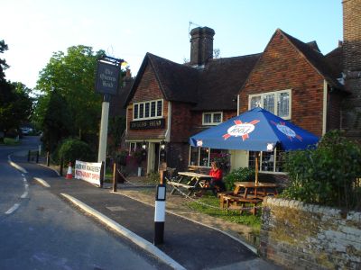
Walk No. 1 - Pestalozzi to Sedlescombe
Walk No.1 (See on map : See in Gallery) was an exploratory walk through some of the woods on the Pestalozzi estate, then past the Sedlescombe playing fields and into the village of Sedlescombe, as far as the pub, just to 'test the technology'. Click HERE to open the map and photographs in a new browser. The route of my walk is overlaid on a combined map and satellite photo. Each of the red markers corresponds to a photo that I took along the way. Click on any one to see a thumbnail of the photo, with descriptive text. You can also click on the thumbnail to display the full-sized image in a new browser. Pretty neat, eh ?!
Useful tips: You can zoom in and out using the '+' and '-' buttons. To move the map, you can either click-and-drag with your left mouse-button, or use the directional buttons in the top-left of the screen. You can also click-and-drag the tiny blue overview-map at the bottom right of the screen. You can chose a background of either a map, the satellite image, or a hybrid of the two using the buttons at the top-right of the screen.
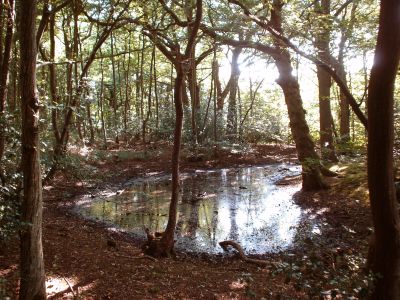
Walk No. 2 - Pestalozzi via Battle and Whatlington
Walk No.2 (See on map : See in Gallery),a total of 20Km, saw me being a bit more adventurous. I started at Pestalozzi on a sunny August morning, and walked east then south to pick up the 1066 Country Walk, which is a 50km footpath from Pevensey to Rye. The footpath follows, or so it is claimed, the actual footsteps of William the Conqueror when he landed at Pevensey and then marched to the town of Battle, where he defeated King Harold in in what many people know as the battle of Hastings. It is a lovely route, through stunning countryside, fields and woodland with comparatively few people about. Crossing the busy A21 London Road, the walk continues across the Sedlescombe Golf Club, then through the Great Wood to the town of Battle, with its ancient church of St Marys, and the famous Abbey of St Martin, built in 1338. Battle is a very popular tourist destination, and was quite busy that day, so I didn't stay long, but headed up the Netherfield Road to the Battle Golf Club. A pleasant walk by the side of the fairways took me into Archer Wood, an ancient piece of English woodland with a very special atmosphere to it. Hidden right in the middle, I saw one of the most beautiful Beech trees ever - do look at the photograph. Crossing the busy A2100 London Road again, I headed across countryside again, through woods and down tiny leafy lanes. Just before Whatlington the path diverts along a little riverbank, with some of the biggest willows I have ever seen. Sitting on a little foot-bridge, eating my sandwiches, I was startled by the sudden appearance of a Mink which came dashing through the undergrowth and leapt on to the bridge. Whether he had smelt the Sandwich Spread, or whether he was just passing through, I don't know, but when he spotted me he leapt straight off the bridge and back into the bushes. I don't know which of us was the more startled! My walk finished by crossing the A21 road, then taking a tiny footpath that follows the water-meadows next to the River Brede, back to Sedlescombe village, and thence to Pestalozzi.
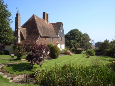
Walk No. 3 - Pestalozzi via Brede to Powdermill Reservoir
Walk No.3 (See on map : See in Gallery), also a total of 20Km, took place a couple of weekends later, once the rainy weather had come to an end. I headed back to the 1066 Country Walk, joining it at the same place as before, but this time I went east, to the village of Westfield. Through pleasant nut woods, then across open fields with fine views of the surrounding countryside. The path went under the railway line near Doleman, affording me a close look at a fine brick bridge, only seen these days by cattle and walkers. Continuing by the side of the pleasant Doleman Ditch, with views of the local swans, I met an elderly walker coming in the other direction. We stopped for a chat, and when he learnt where I had come from, he told me that he was involved in the original survey of land for the buildings at Pestalozzi! Its a small world, sometimes! After a break for lunch, watched by cormorants, I continued on to the quaint village of Brede, which has an imposing old church. Nearby is a beacon, one of a chain of more than 1000 that are sited on high points all over England. Originally designed to warn the countryside of invasion or other catastrophe, they are lit these days to celebrate great national events, such as the Queen's Golden Jubilee or the anniversary of the Battle of Trafalgar. Continuing on over fields and through woodland, I reached the picturesque Wards Wood, which surrounds the Powdermill Reservoir. Unfortunately the reservoir isn't open to the public, and the walk through the woods keeps well away from the water's edge, but the woods are a lovely place in themselves to walk through, with many broad-leaved and coniferous trees to be spotted. One area was obviously a hazel coppice at one time, but now has been left to run to its own devices, which is a pity. I guess there are just too few bodgers around these days. Heading south towards Sedlescombe, I came across a tiny stand of hop poles, with the hop vines growing up the strings in the traditional way. There used to be 1000s of acres of hops grown in the south of England, but these days, like the bodgers, they are few and far between. I finished my walk in the village of Sedlescombe, passing the pub and the village pump, then back across the River Brede to Pestalozzi International Village.
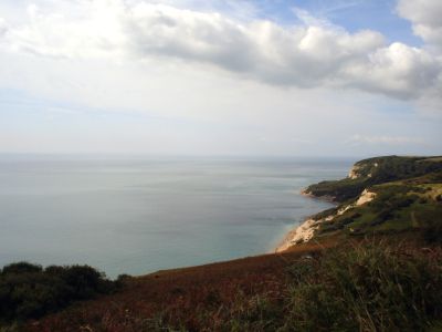
Walk No. 4 - Hastings via Country Park to Covehurst Bay
Walk No.4 (See on map : See in Gallery), a total of 10Km, took place along the cliffs just next to Hastings, my nearest large town. I had had to drive two people to the railway station: Amod, one of the 2nd year students, who was leaving to go to university in Boston, USA, and Alejandra, a Spanish volunteer who had spent the summer at Pestalozzi, helping in Swiss Hall. It seemed a good idea to take advantage of being in Hastings, and go for a walk along the picturesque Saxon Shore Way, another long distance path that runs the 262km from Hastings to Gravesend. This morning, though, I was just to do a few miles of it, as I had to get back to Pestalozzi for luncheon. For a change, I had a companion with me: Prawash Gautam, a Nepali student who had also spent the last 2 years at Pestalozzi and was due to fly to a university at Bremen tomorrow. We set out from the Hastings 'Old Town' with its iconic 'Net Shops'" — these are wooden constructions, weatherboarded and tarred, of various shapes and sizes, used for storage. The buildings were built tall and narrow to avoid payment of ground tax. Hastings has a small funicular railway that takes passengers to the top of the cliffs, but as this was closed for maintenance, we climbed the possibly-hundreds of steps to the top, 111 metres above the sea. The walk continues along the coast, though there is not as much view of the sea as you might expect, due to large bramble patches. This is a popular walk for the locals, especially on such a sunny day as this was, though it is not for the unfit or infirm as the path frequently descends and ascends large numbers of steps when ever a new bay or cove is crossed. Much of the walk is through mixed deciduous woodland, especially in Covehurst Wood, a protected National Park. We continued as far as Covehurst Bay to see the impressive though deserted Coastguard Lookout Station, with its tower of direction-finding and communications aerials and its huge coastal radar installation. Our path then joined the Hastings-link of the 1066 Country Walk, mentioned elsewhere on this page, and thus back across inland fields and footpaths to Hastings Old Town, and our parked car.
Walk No. 5 - Brede High Woods to Robertsbridge
Walk No.5 (See on map : See in Gallery), a total of 27Km, was the longest one so far. With a weekend of driving duties ahead of me, I took the day off on the Friday beforehand. It was a lovely day for a walk - some clouds, and not as hot as it has been recently. Starting at Pestalozzi, I took a footpath that bypasses Sedlescombe village and heads for Lower Jacobs farm, and the suprise sighting of a lama. Continuing north to Brede High Woods again, I took a different path through some atractive woodland cleared of undergrowth, though still no views of the Powdermill Reservoir. Crossing the busy B2089 my walk took me across a picturesque valley to Colliers Green. Bypassing Staplecross, I walked north on tiny footpaths across farmland, orchards, and woodland, to the River Rother. I was hoping to have my luncheon at Robertsbridge Abbey, which is shown on the map as 'Remains of Cistercian Abbey' but this is now in private hands, and doesn't welcome visitors. At nearby Redlands Farm it was nice to see not only a large field of hop poles and hops still present in the English countryside, but also those hops being harvested and then dried and packed into the traditional long hop pockets. Crossing the A21 London Road via a convenient footbridge, I entered Roberstbridge, which a most attractive country town, with some lovely old houses. Unfortunately too many of these are obscured by a multitude of cars parked on every possible bit of road. Roberstbridge was to be the furthest north I would go that day. Leaving it, I crossed under the railway line and took the footpath that runs next to it, past the Darvell community, whose children I could hear playing in the distance. After more woods, the path crossed under the railway line again and headed for Mountfield Court, a beautiful and large country house set on a hilltop, with excellent views over the surrounding parkland. Apparently the house is open to the public occasionally, for charity, but today all was quiet and the house closed. The path passes the large walled garden, once providing food for the big house, though what it is being used for these days is hard to say. The satellite image below shows little activity in the garden, though this may have been a photo taken in the winter-time.
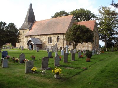
Leaving Mountfield Court, I walked to the tiny village of Mountfield itself, which has a beautiful country church of All Saints. I spent a bit of time looking both inside and out, then noticing how time was getting on, I carried on across fields to Hoath Wood, and thence to the A2100 London Road, which was busy with evening commuters. The path after this leads through Spring Wood, though the owner would obviously prefer people not to go on this public right of way, as the gates are clearly marked 'No Access'. Obviously most people are put off entering by this, so the path through the woods is little used, though easy enough to follow as it runs along one of the tributaries of the River Line. It reminded me of 'The Wild Wood' from Kenneth Grahame's famous book The Wind in the Willows. Passing a flock of black sheep, I arrived at Whatlington. The rest of my route back to Sedlescombe and the Pestalozzi International village was on familar ground, as it duplicated a walk that I had done before. I arrived back at Swiss Hall just in time for dinner - very welcome after a walk of over 27kms!
Posted by travellingtim at September 11, 2007 09:00 PM
