Travelling Tim http://www.mapability.com/travel/ A voyage of discovery into other minds and cultures. 2007-09-11T21:00:00+05:30 East Sussex Walks Online http://www.mapability.com/travel/blogs/2007/09/east_sussex_wal_1.html Having recently purchased an Ordnance Survey 'Explorer' map of the area (No 124) I have discovered all kinds of paths and bridleways around the Pestalozzi International Village that previously I didn't know existed. England is very fortunate in having its many footpaths and other rights of way well documented, well maintained, and well signposted by the local authorities, though many of the signposts are quite discrete, so its is only with the help of a large scale map of the area that you can discover where they all are. Also, some local residents or land-owners are not that keen on having a footpath on or next to their property, so can hide or remove the signs that indicate a right of way, or just allow the undergrowth to naturally envelop them! With the right map, though, its easy to see where all these footpaths are.

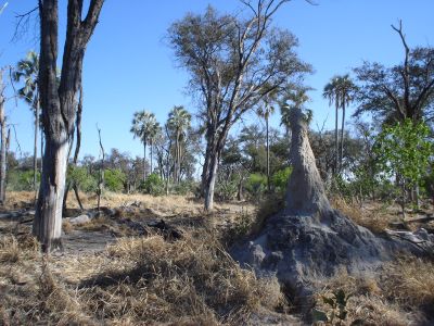
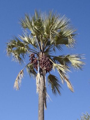
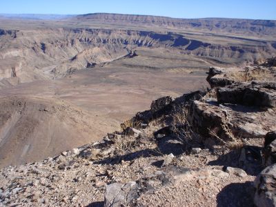
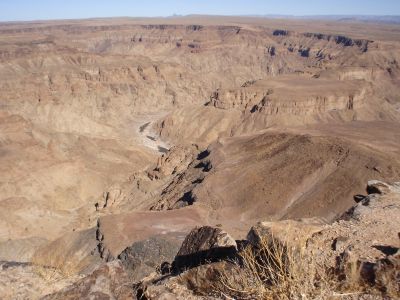
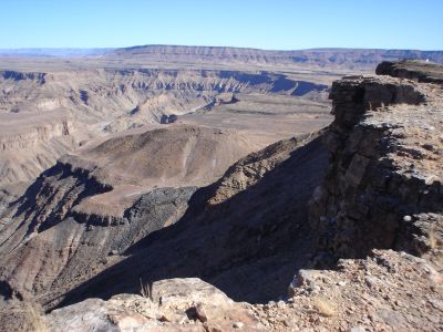
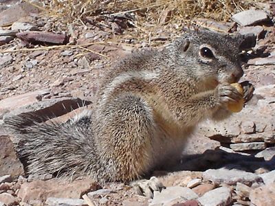
I am not a great fan of sport, but find that walking in the countryside is not only an excellent form of exercise to help combat the effects of the excellent food here at Pestalozzi, but also a very enjoyable way to pass a sunny weekend, looking at the beautiful scenery of the area, and spotting the fauna and flora of the area. With the aid of my new map, I have been on a number of very interesting walks - both locally, around the estate here, and further afield.

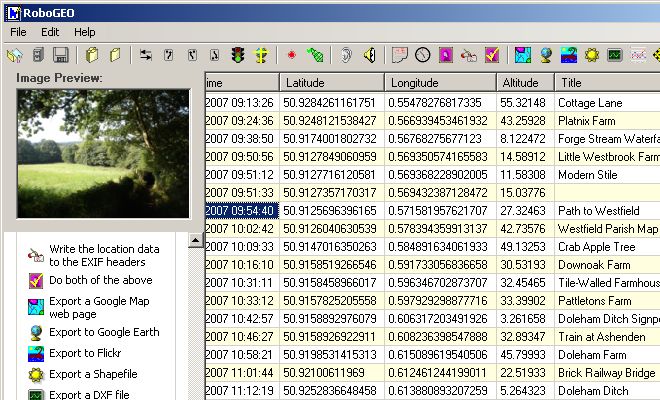
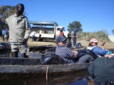
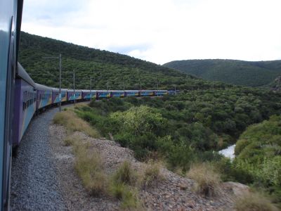
To share my walks with friends and family I thought of taking some photos and placing them on-line. However, following some research I realised that there was another, even more exciting possibility: showing the position of each photograph on a background map. This can be achieved by 'geo-tagging' the photos. The way this is done is explained in detail later on in this page, but basically the method used is to match the time that each photo is taken with a log of the walk that is collected automatically by a GPS receiver. I had been meaning to buy a GPS receiver anyway, for a new project I had in mind, and after some research of the different models available, I settled on a Garmin GPSmap60cx, and found one at the Global Gizmos site for a very good price.

The GPS receiver can perform a number of tasks. It can show my position and altitude, and display this on a basic map. It can monitor all my movements, and tell me how long I have been walking, how far I've been, and the speed I walk at. It can even tell me how long my lunch-break was! It records the route I take, and this 'track file' is the one that I match up with my photos when I get back from my walk. More about that on another page, if you are interested in the technical details. For now, I'll share my walks with you...

Copyright MapAbility.Com
Walk No. 1 - Pestalozzi to Sedlescombe

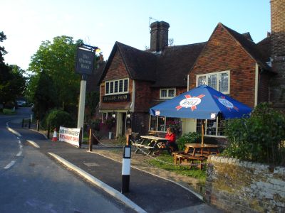
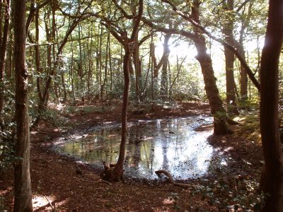
Walk No.1 (See on map : See in Gallery) was an exploratory walk through some of the woods on the Pestalozzi estate, then past the Sedlescombe playing fields and into the village of Sedlescombe, as far as the pub, just to 'test the technology'. Click HERE to open the map and photographs in a new browser. The route of my walk is overlaid on a combined map and satellite photo. Each of the red markers corresponds to a photo that I took along the way. Click on any one to see a thumbnail of the photo, with descriptive text. You can also click on the thumbnail to display the full-sized image in a new browser. Pretty neat, eh ?!

Useful tips: You can zoom in and out using the '+' and '-' buttons. To move the map, you can either click-and-drag with your left mouse-button, or use the directional buttons in the top-left of the screen. You can also click-and-drag the tiny blue overview-map at the bottom right of the screen. You can chose a background of either a map, the satellite image, or a hybrid of the two using the buttons at the top-right of the screen.

Copyright MapAbility.Com
Walk No. 2 - Pestalozzi via Battle and Whatlington

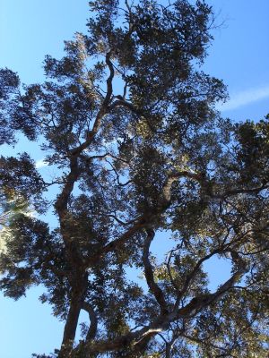
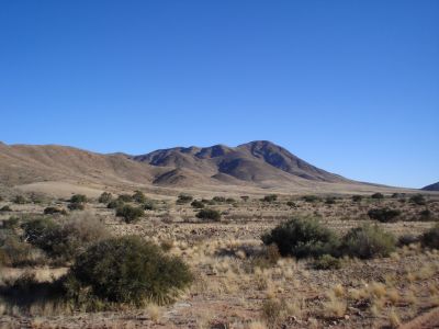
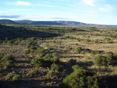
Walk No.2 (See on map : See in Gallery),a total of 20Km, saw me being a bit more adventurous. I started at Pestalozzi on a sunny August morning, and walked east then south to pick up the 1066 Country Walk, which is a 50km footpath from Pevensey to Rye. The footpath follows, or so it is claimed, the actual footsteps of William the Conqueror when he landed at Pevensey and then marched to the town of Battle, where he defeated King Harold in in what many people know as the battle of Hastings. It is a lovely route, through stunning countryside, fields and woodland with comparatively few people about. Crossing the busy A21 London Road, the walk continues across the Sedlescombe Golf Club, then through the Great Wood to the town of Battle, with its ancient church of St Marys, and the famous Abbey of St Martin, built in 1338. Battle is a very popular tourist destination, and was quite busy that day, so I didn't stay long, but headed up the Netherfield Road to the Battle Golf Club. A pleasant walk by the side of the fairways took me into Archer Wood, an ancient piece of English woodland with a very special atmosphere to it. Hidden right in the middle, I saw one of the most beautiful Beech trees ever - do look at the photograph. Crossing the busy A2100 London Road again, I headed across countryside again, through woods and down tiny leafy lanes. Just before Whatlington the path diverts along a little riverbank, with some of the biggest willows I have ever seen. Sitting on a little foot-bridge, eating my sandwiches, I was startled by the sudden appearance of a Mink which came dashing through the undergrowth and leapt on to the bridge. Whether he had smelt the Sandwich Spread, or whether he was just passing through, I don't know, but when he spotted me he leapt straight off the bridge and back into the bushes. I don't know which of us was the more startled! My walk finished by crossing the A21 road, then taking a tiny footpath that follows the water-meadows next to the River Brede, back to Sedlescombe village, and thence to Pestalozzi.

Copyright MapAbility.Com
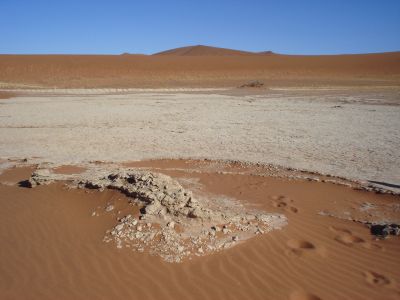
Walk No. 3 - Pestalozzi via Brede to Powdermill Reservoir

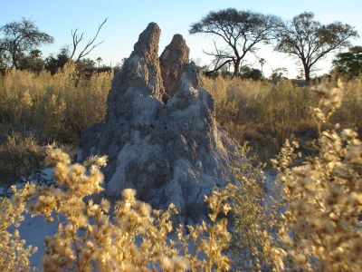
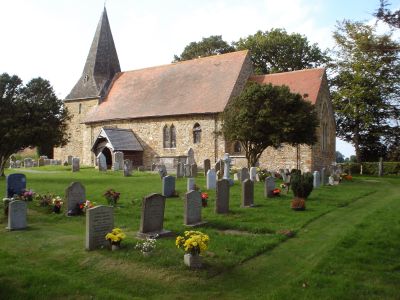
Walk No.3 (See on map : See in Gallery), also a total of 20Km, took place a couple of weekends later, once the rainy weather had come to an end. I headed back to the 1066 Country Walk, joining it at the same place as before, but this time I went east, to the village of Westfield. Through pleasant nut woods, then across open fields with fine views of the surrounding countryside. The path went under the railway line near Doleman, affording me a close look at a fine brick bridge, only seen these days by cattle and walkers. Continuing by the side of the pleasant Doleman Ditch, with views of the local swans, I met an elderly walker coming in the other direction. We stopped for a chat, and when he learnt where I had come from, he told me that he was involved in the original survey of land for the buildings at Pestalozzi! Its a small world, sometimes! After a break for lunch, watched by cormorants, I continued on to the quaint village of Brede, which has an imposing old church. Nearby is a beacon, one of a chain of more than 1000 that are sited on high points all over England. Originally designed to warn the countryside of invasion or other catastrophe, they are lit these days to celebrate great national events, such as the Queen's Golden Jubilee or the anniversary of the Battle of Trafalgar. Continuing on over fields and through woodland, I reached the picturesque Wards Wood, which surrounds the Powdermill Reservoir. Unfortunately the reservoir isn't open to the public, and the walk through the woods keeps well away from the water's edge, but the woods are a lovely place in themselves to walk through, with many broad-leaved and coniferous trees to be spotted. One area was obviously a hazel coppice at one time, but now has been left to run to its own devices, which is a pity. I guess there are just too few bodgers around these days. Heading south towards Sedlescombe, I came across a tiny stand of hop poles, with the hop vines growing up the strings in the traditional way. There used to be 1000s of acres of hops grown in the south of England, but these days, like the bodgers, they are few and far between. I finished my walk in the village of Sedlescombe, passing the pub and the village pump, then back across the River Brede to Pestalozzi International Village.

Copyright MapAbility.Com
Walk No. 4 - Hastings via Country Park to Covehurst Bay

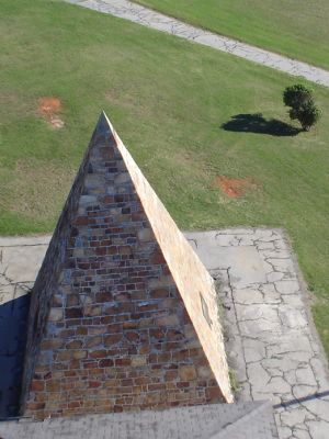
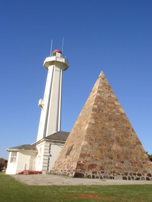
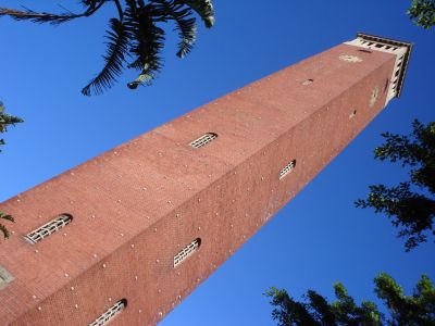
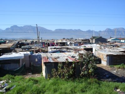
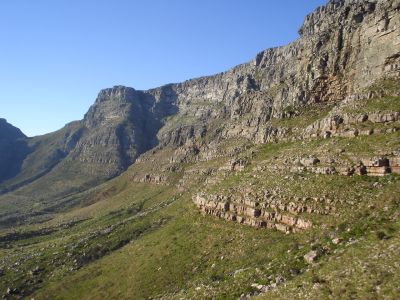
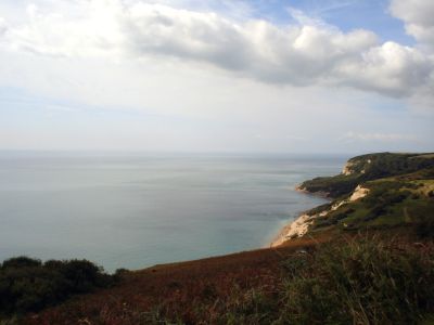
Walk No.4 (See on map : See in Gallery), a total of 10Km, took place along the cliffs just next to Hastings, my nearest large town. I had had to drive two people to the railway station: Amod, one of the 2nd year students, who was leaving to go to university in Boston, USA, and Alejandra, a Spanish volunteer who had spent the summer at Pestalozzi, helping in Swiss Hall. It seemed a good idea to take advantage of being in Hastings, and go for a walk along the picturesque Saxon Shore Way, another long distance path that runs the 262km from Hastings to Gravesend. This morning, though, I was just to do a few miles of it, as I had to get back to Pestalozzi for luncheon. For a change, I had a companion with me: Prawash Gautam, a Nepali student who had also spent the last 2 years at Pestalozzi and was due to fly to a university at Bremen tomorrow. We set out from the Hastings 'Old Town' with its iconic 'Net Shops'" — these are wooden constructions, weatherboarded and tarred, of various shapes and sizes, used for storage. The buildings were built tall and narrow to avoid payment of ground tax. Hastings has a small funicular railway that takes passengers to the top of the cliffs, but as this was closed for maintenance, we climbed the possibly-hundreds of steps to the top, 111 metres above the sea. The walk continues along the coast, though there is not as much view of the sea as you might expect, due to large bramble patches. This is a popular walk for the locals, especially on such a sunny day as this was, though it is not for the unfit or infirm as the path frequently descends and ascends large numbers of steps when ever a new bay or cove is crossed. Much of the walk is through mixed deciduous woodland, especially in Covehurst Wood, a protected National Park. We continued as far as Covehurst Bay to see the impressive though deserted Coastguard Lookout Station, with its tower of direction-finding and communications aerials and its huge coastal radar installation. Our path then joined the Hastings-link of the 1066 Country Walk, mentioned elsewhere on this page, and thus back across inland fields and footpaths to Hastings Old Town, and our parked car.

Copyright MapAbility.Com
Walk No. 5 - Brede High Woods to Robertsbridge

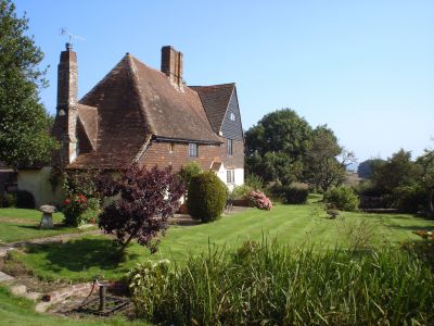
Walk No.5 (See on map : See in Gallery), a total of 27Km, was the longest one so far. With a weekend of driving duties ahead of me, I took the day off on the Friday beforehand. It was a lovely day for a walk - some clouds, and not as hot as it has been recently. Starting at Pestalozzi, I took a footpath that bypasses Sedlescombe village and heads for Lower Jacobs farm, and the suprise sighting of a lama. Continuing north to Brede High Woods again, I took a different path through some atractive woodland cleared of undergrowth, though still no views of the Powdermill Reservoir. Crossing the busy B2089 my walk took me across a picturesque valley to Colliers Green. Bypassing Staplecross, I walked north on tiny footpaths across farmland, orchards, and woodland, to the River Rother. I was hoping to have my luncheon at Robertsbridge Abbey, which is shown on the map as 'Remains of Cistercian Abbey' but this is now in private hands, and doesn't welcome visitors. At nearby Redlands Farm it was nice to see not only a large field of hop poles and hops still present in the English countryside, but also those hops being harvested and then dried and packed into the traditional long hop pockets. Crossing the A21 London Road via a convenient footbridge, I entered Roberstbridge, which a most attractive country town, with some lovely old houses. Unfortunately too many of these are obscured by a multitude of cars parked on every possible bit of road. Roberstbridge was to be the furthest north I would go that day. Leaving it, I crossed under the railway line and took the footpath that runs next to it, past the Darvell community, whose children I could hear playing in the distance. After more woods, the path crossed under the railway line again and headed for Mountfield Court, a beautiful and large country house set on a hilltop, with excellent views over the surrounding parkland. Apparently the house is open to the public occasionally, for charity, but today all was quiet and the house closed. The path passes the large walled garden, once providing food for the big house, though what it is being used for these days is hard to say. The satellite image below shows little activity in the garden, though this may have been a photo taken in the winter-time.


View Larger Map

Leaving Mountfield Court, I walked to the tiny village of Mountfield itself, which has a beautiful country church of All Saints. I spent a bit of time looking both inside and out, then noticing how time was getting on, I carried on across fields to Hoath Wood, and thence to the A2100 London Road, which was busy with evening commuters. The path after this leads through Spring Wood, though the owner would obviously prefer people not to go on this public right of way, as the gates are clearly marked 'No Access'. Obviously most people are put off entering by this, so the path through the woods is little used, though easy enough to follow as it runs along one of the tributaries of the River Line. It reminded me of 'The Wild Wood' from Kenneth Grahame's famous book The Wind in the Willows. Passing a flock of black sheep, I arrived at Whatlington. The rest of my route back to Sedlescombe and the Pestalozzi International village was on familar ground, as it duplicated a walk that I had done before. I arrived back at Swiss Hall just in time for dinner - very welcome after a walk of over 27kms!

]]>
travellingtim 2007-09-11T21:00:00+05:30
How to Geo-Tag Photos http://www.mapability.com/travel/blogs/2007/09/how_to_geotag_p_1.html This page describes my experiences whilst geo-tagging my photos, and how I used these photos online.

Some background: Digital photos saved in the .jpg or .tif format, as most of them are, have information included with the photos that many people are not aware of. The information is kept in two 'tags' that are embedded in the photo-file itself - the EXIF tag, and the IPTC tag. They can be easily viewed with the right software - more about that later.

Some of the information in the tags is saved automatically by many cameras, and may include details of the type of camera used, the shutter speed, aperture setting, ISO rating, time and date that the photo was taken, etc. Other information can be added manually - this might be such data as the photographer's name, a title or a caption. In the list of EXIF tags there is also a section for GPS position - in other words, the location of the camera when the photo was taken. This opens up all kinds of exciting possiblities, allowing a photo to be allied to an online map or earth-viewer, or to have its position entered to a database which could then be searched according to geographical coordinates, locating, for instance, a photograph nearest to a certain point or place.


View Larger Map in a new Browser

Here's a map of one of my walks. Each marker hides a photo - click on one to see! You can drag the map around, or zoom in and out. All of this is done with geo-code photos !

Why Geo-Tag Photos?

Geo-tagged photos can be used for a number of purposes. These might be:
1/ To show a view of a certain position or location.
2/ To record the position of a particular object or view.
3/ To show the location of views that can be seen whilst proceding from point to point.
4/ To capture the position of a unique event that doesn't normally occur there.

You might combine 1 or more of the above as reasons for geo-tagging your photos. For instance, I take photos on my walks to show people what the countryside around here is like, but I also like taking photos, and keep trying to take better ones. Most, though not all, of my photos try to be photos that stand alone by themselves. If I was just documenting my walks, I would take photos every 100 metres or so, regardless of what the photos came out like. I might also take photos that always looked in the direction I was walking, not to the sides, or behind me.

My photos, once geo-tagged, can be referenced to any mapping system. I can upload those photos to services such as Panoramio or Flickr. My photos carry their position permanently embedded in their EXIF tags. People could even use this data to find where I was at a particular time, or to see the view that I saw for themselves. The possibilities of geo-tagged photos are only just being discovered, but its a sure thing that they will be vital in the future. Protect yourself against image-obsolescence by Geo-Tagging right now!

How to Geo-Tag Photos

To save the location in the embedded EXIF tag of the photo, you can either do it when the photo is taken, or later on, when you are back at your computer.

To do this when a photo is taken, you will need a camera that has these capabilities. Not many do so. One popular model is the Nikon D200, which can be connected either directly to a GPS receiver using home made or purchased cables, or via a BlueTooth link using the RedHen unit and a GPS receiver equipped with BlueTooth. Other cameras include the Canon EOS 1D Mark III, the Fuji S5, Kodak's DC265 and DC290, and the Ricoh 500SE.

Choosing to geo-tag photos once you are back at your computer allows you to use practically any digital camera. You can even geo-tag scanned negatives or tranparencies! First, you will need some software that can accomplish this. Whilst a knowledgeable person could geo-tag with a simple text-editor, it is much more sensible to chose a program designed for the task. Various programs are available: these can be divided into the following categories:

a/ Command Line - Manual Entry
This category assumes that you have a list of coordinates ready to enter in the EXIF tag of each photos. An excellent and well-regarded tool that can do this is ExifTool by Phil Harvey. This program is platform-independent, and performs all manner of tasks to do with reading and writing photo tag-data. It also does it with out degrading the original image - an important point to note when considering a choice of software. The last thing you want is to do a batch-process on your original files and find that they have all been degraded whilst having their tags changed!

The problem with Command-Line entry is that it is not very user-friendly - many people these days prefer a program that will hold your hand a little and monitor what you are doing through a familiar window.

b/ Simple GUI (Graphics User Interface) - Manual Entry
For those who prefer a GUI, there are 2 progams that provide a shell for ExifTool, allowing you to use the same program as above without needing to know or type in a long list of complex commands.
The down-side, though, is that neither program provides the full functionality of ExifTool. Perhaps one day someone will write one, but in the meantime we have these:
1/ExifTool GUI for Windows
2/ExifAuto

c/ Complex GUI - Automatic Entry
The programs above assume you wish to enter the location for each photo from a list. But there are other, more automatic ways of geo-tagging. The first makes use of the popular Google Earth service to identify visually just where the photo was taken, and then grab the coordinates that you need. One program that can do this is Google's Picasa. Here are some tips to help. Alternatively, you can use RoboGeo, which has many facilities in addition to its Google Earth capabilities.

One of these takes automation even further, by tagging a whole folder of photos without the need for you to enter a single latitude or longitude! The way it does it is rather clever. When you set out for your morning photo-shoot, you turn on your GPS receiver, and tell it to create a Track. You then turn on your camera, and check that its internal clock is set to the same tme as the GPS. Having done that, you can put the GPS in your bag or clip it to your belt, and forget about it for the rest of the day. Whenever you snap a photo, your camera will record on the EXIF tag of that image the exact time, to the second, when the photo was taken. When you get back to your computer, you download the Track-file from your GPS. RoboGeo will then check the time that each photo was taken, and unless you are flying a jet-fighter plane, will work out from the Track-file exactly where you were, and write the EXIF location-tags accordingly. Pretty neat, huh ?!

You can use a dedicated GPS receiver made for this job, such as the Sony GPS-CS1KA GPS Location Recorder, which is small enough to hang on your belt-hook un-noticed, or you can use the GPS receiver you already have - for me this is the Garmin GPSmap60cx, which I found at the Global Gizmossite for a very good price.

RoboGeo is not the only software that can geo-tag photos in this way, though I do like its functionality, and its additional capabilities that let it output a Google Map complete with thumbnails (see one of mine here) or a Google Earth .kml file, or even ESRI shapefiles that can be used in more complex display and GIS appplications.

Also worth trying is GPicSync. It is a free download that works with any standard GPS receiver, and has an active user group.

Another program is PhotoMapper, a free GPL licensed GPS Photo-Tagging software application.

Important Points

The above 'automatic' programs rely on a log of your track, stored by a GPS receiver. This track will be composed of a number of tracklog points that record your position as you moved about during the day. In order that you can cross-reference your photos, it is VITALLY IMPORTANT that each point also has a time associated with it. You should be aware that when you Save a track in your Garmin receiver, not only is the time for each point deleted, but also 5 out of every 6 trackpoints are discarded!!! You should also be aware that GPX files, which are a collection of points from a track, DO NOT have the time for each point included, so for the purposes of geo-tagging photos, a .gpx file is USELESS !!! What can be done about this? Well, the only log in your GPS that retains the time for each position is the one called the Active Tracklog. This is the one that you need to use. RoboGeo uses this file when geo-tagging photos, though be aware that the Active Tracklog contains all the tracks you have made recently, and when presented with it, RoboGeo will include all the trackpoints with your map, which is a bit crazy if you only want to use one track. You could of course delete the old Active Tracklog before you start the day's photoshoot, in which case only your new track will be included in the Active Tracklog. Alternatively you can use a program that will let you choose which bit of the Tracklog to include. A useful program that does this is the free DNRGarmin GPS application from the Department of Natural Resources at Minnesota State University. You can easily select the section of the Active Tracklog that you need, and save it as a text-file that RoboGeo will utilise. Lets hope that one day Tim Helton will add this same functionality to RoboGeo itself, plus the ability to see the track on a map, and maybe alter it, before it is used in the tagging process.

Footnotes

You might like to look at the following WikiPedia pages for further ideas:
GeoTagging
Geocoded Photographs

]]>
travellingtim 2007-09-10T17:53:57+05:30
Back in England http://www.mapability.com/travel/blogs/2007/08/back_in_england.html I can't believe that I've been back in England for more than 3 weeks, but so it is! Where has the time gone, I ask? Where is my Blog update, you ask? The trouble with having so many interests is that there are always so many things to catch up on when I get back to base. All those ideas for projects that I have had whilst sitting in the truck watching the scenery pass and the miles go by now need to be put into action if they are not to get forgotten about. This happens all too frequently, despite best efforts. There's just not enough hours in the day!

'Base', once again, is the Pestalozzi International Village, in Sedlescombe, East Sussex, near to Hastings, on the south coast of England. You can see the location in Google Maps. (Tip: Maximise the window then Refresh). I am very fortunate to be invited to come back here - there's a lot that I can help with. The plan is to stay at Pestalozzi for the next 7 or so months, until my next adventure, which for those of you who like to know everything in advance, will be another Overland journey, travelling from London via Istanbul, Central Asia, Beijing, Mongolia, Kazakhstan, and back across Siberia to the Venice of the north: St Petersburg. It will be a long trip - about 6 months in all. You can see more details here, and my map of the route on the 'Where is Travelling Tim' page here.

That's all in the future, though. Right now I am concentrating on the work needed here. I expect to be very busy at Pestalozzi once again, involved in various projects as before. I was warmly welcomed back by everyone - there's such a great group of people that make up this community. The I.B. students are away on their summer break at the moment, but are expected back, starting at the end of August. No doubt I will be making a few runs to Heathrow airport to help collect them. The Pestalozzi village is still quite busy, though. The office and support staff carry on with work as usual. We also have a number of groups staying, who make use of the facilities. The kitchen staff and the maintenance people have their work cut out trying to keep up. At the moment we have a lot of French students here, and last weekend there were a judo-training group from London.

Copyright MapAbility.Com
Cheetah at the Cheetah Park, Northern Namibia

Africa already seems so far away, and the many friends I made on my travels are now just memories, photographs, and messages over the internet. I miss them all already. Did all those things really happen to me? I had better note down the events of the last trip before I forget them! Luckily, I have my diary as an 'aide-memoire' to some of the things I did and some of the places that I went to. Surprisingly, on the Kumuka trip I was practically the only person who was keeping a diary. This is very different from other Overland trips in the past, when most of the seats in the truck would be occupied after dinner with industrious diary-writers.

With the ever-lowering of prices for digital memory cards, everybody now takes LOTS of photos. That's all very well as long as you can remember what the photos are of, though! I noticed that many people couldn't remember even whilst they were still on the truck. Perhaps cameras need to revert to the days of the 'Autographic back'. This appeared on Kodak cameras from 1914 onwards, and allowed the photographer to write a note on to the back of the film with a special stylus. Today's digital cameras are not that clever (!) as they only allow editing of the 'IPTC' data when you download the photos to your computer, so whilst travelling I keep a notebook - good old pen and paper - with details of each photo taken.

Copyright MapAbility.Com
German architecture at Swakopmund

Since my last posting from Swakopmund, a lot has been happening, We did indeed head up the Skeleton Coast to the Cape Cross seal colony, where there were any number of fur seals to see. They were not particularly bothered by their visitors, though I suppose that with teeth like they have, they can look after themselves pretty much! I remember getting chased by fur seals in the Antarctic - its not something I want to repeat! You can see an aerial view of Cape Cross on Google Maps here (Tip: Maximise the page and then Refresh). I see there's a truck in the carpark - I wonder if its an Overland truck? Spot the company, anyone?

Copyright MapAbility.Com
Cape Cross - where the Portugese landed

In 1486 Portuguese Diego Cáo, the first European to get this far south, landed here and erected a stone cross in honour of King John of Portugal. 400 years or so later, in 1893, German sailors from the ship 'Falke' removed the cross and took it back to the oceanographical Museum in Berlin. In 1894, Kaiser Wilhelm II ordered that a replica be made with the original inscriptions in Latin and Portuguese, but decided to add a commemorative inscription in German! Sixty or so years after that, it was decided to put another replica cross at the exact position of the original, the German replica having been sited incorrectly. The second replica also showed the cross as is originally was, without the added German inscription. The first replica had become a historical artifact in it's own right though, so it was left where it was originally erected. Consequently, there are now 2 crosses to be seen at Cape Cross, and a third in Berlin. Quite funny, really, and almost as interesting as the seals.

From Cape Cross I waved goodbye (privately) to the Atlantic Ocean as I wouldn't be seeing it, or any other ocean, until I got back to dear old Blighty. We headed inland to Otjitotongwe - not a place to ask directions to if you are drunk! Not a place to visit if you are drunk, either, as this is the home of the Cheetah Park - an area of land set aside for injured and rescued cheetahs. They are an animal that can be quite hard to spot in the wild, so it was great to get amongst them (in the truck!) as they were being fed in the evening. Most of these here are still classed as 'semi-wild' though 2 had been brought up on the farm from kittens, and it was even possible to stroke them. I was surprised to find out that they have very coarse, wiry hair - not what they look like from a distance at all.

Copyright MapAbility.Com
Bird models at Etosha

The Etosha National Park came next - a real highlight for this leg of my journey. It promised, and delivered, a lot of game viewing, and was just as exciting as such parks as the Serengeti or Ngorogoro Crater. I was lucky enough to spot a pride of 17 lions. We saw plenty of other game: elephants, springbok, steenbok, impala, orxy, giraffe, zebra, wildebeest, warthogs, jackals, hyena, honey badgers, and many others.

Copyright MapAbility.Com
Traditional 'Makoro' canoes in the Delta

From Etosha we covered, for me, familiar teritory as we headed along the Caprivi Strip then into Botswana and the Okavango Delta. Slightly different, though, was the entry point - this time it was via the town of Maun, giving me a chance to see a new bit of the Delta. Was it better than the Umvuvu Camp, in the north west? Well certainly we didn't have to go via the Sepupo Truck Stop, who's rip-off proprietor had charged the Dragoman group 500 US dollars for a boat ride that should have cost 90. The Delta around Maun was much drier, though. Less time in the canoes. More time on the land. Less water-covered Delta. Much more wildlife, though. Easier access - this time we drove in by 4WD truck rahter than speedboat, before picking up the Makoro canoes. They were the traditional wooden ones too, rather than the fibreglass copies I had seen before. A more 'traditional' experience, but a wetter one. You had to sit very still in the wooden Makoros, as the water would slop over the gunnel with the slightest movement. All in all, I find it hard to judge between the two, so I'm sorry if you are looking for a lead whilst making up your mind. I enjoyed them both, a lot. If you get the chance, go to both too.

Copyright MapAbility.Com
A leopard in Chobe National Park - not tame this time!

Moving on north towards the top of Botswana, we stopped at Kasane, next to the Chobe River and adjacent to the Chobe National Park. This park excelled itself with the large variety of game that we saw. All the 'usual suspects' were there - elephant, buffalo, zebra, and various types of antelope. Hogwarts, too - whoops I meant 'warthogs' - bloody Harry Potter. The most exciting moment was when we saw 2 leopards; one of which climbed a tree to watch the other, and sat there for quite some time, oblivious to, or rather should I say uncaring of, its observers. With only a basic camera available, and no zoom facilities, I used the trick of photographing through the eyepiece of my binoculars again, with brilliant results. That's one of my photos, above. If you try this for yourself, I've found that its best if you extend the eyepiece-masks, to keep the camera lens slightly away from the glass of the binocular eyepiece, then let the camera work out the focussing through the pre-focussed binoculars. It takes a bit of practice, but well worth it for the memories you will take home with you. My binoculars are a cheap pair of 10x50s - that's the equivalent of a 500mm lens on a film camera!

Copyright MapAbility.Com
Elephants crossing the Chobe river

From Kasane it was just a short drive back into Zimbabwe, where the trip ended at the Victoria Falls. We were all under strict instructions not to comment at all on the political troubles currently besetting that sorry country, but now I'm back in England, its safe to talk a bit about it. Wow what a mess things have got to these days! 4500% inflation. Practically nothing in the shops. No diesel. No soap. No rice, even. Prices changin by the hour. The average people of Zimbabwe are REALLY struggling. I'm amazed the country hasn't collapsed into anarchy and civil strife yet - the ex American ambassador was predicting that it really won't be long before this happens. We can only hope and pray that when it comes, it will be as quick and as painless as possible, so that the ordinary people can pick up the threads of their lives. It won't be pretty, that's for sure. All the time I was there, I was continually aware how lucky I was that I could afford food, clothing and shelter, and that with my British passport I could leave whenever I wished. Lucky also that I had American dollars - the only currency that actually bought anything. The official exchange rate was, and has been for quite some time, 250 Zimbabwe dollars to 1 American dollar. On the black market in April, people were getting 17,000 to the US dollar. When I returned in July, the rate had reached 100,000 to the dollar.

Copyright MapAbility.Com
Mosi-oa-Tunya - 'The Smoke That Thunders'

I stayed at Victoria Falls for a few days before flying out, and enjoyed seeing the Victoria Falls themselves again. One day I went over to Zambia, to see them again from that point of view. There was certainly a lot less spray obscuring the falls than there had been in April, but there was still a LOT, so a visit definitely requires a full set of waterproof jacket and trousers!

By the time the day I was to leave Victoria Falls arrived, nearly everyone else from the Kumuka truck had already moved on. Martina and Sam had left to take the truck south again - it was to be Martina's last trip with Kumuka. Others had changed trucks, heading north to Kenya, or south to Mozambique. Some had flown on to their next adventure, whilst others had flown home. That last choice was mine too, with British Airways back to London via Jo'burg. The flight went well, despite my bags getting broken into by the Jo'burg baggage handlers. They didn't actually take anything, though - hey: I'm an Overlander - we don't have much to take, and what there is needed washing before anyone else would touch it!

Thanks to all for the emails and snail-mail letters of support over the last 8 months - you know who you are. Now I've a chance to draw breath, whilst helping everyone here at Pestalozzi. Watch this space - insha'Allah (if God wills it) Travelling Tim will be back on the road through Central Asia next March (2008).


]]>
travellingtim 2007-08-06T02:57:17+05:30
Map of Africa Overland Route http://www.mapability.com/travel/blogs/2007/08/map_of_africa_o_1.html Main
 

This map of Africa, made by me, shows the route taken on my recent Overland journey to Africa. The first section, shown in red, was with the Overland company 'Dragoman'. We started in Dover, UK, then travelled through France and Monaco to Italy. Next, an overnight ferry from Genoa to Tunis, then through Tunisia, Libya, Egypt, the Sudan, Ethiopia, Kenya, Tanzania, Malawi, Zambia, Botswana, Zimbabwe, Mozambique, Swaziland and Lesotho to Cape Town, South Africa. Whew! That's quite a distance! In Cape Town I said goodbye to the Dragoman truck, and spent the next month backpacking around South Africa by myself. Returning to Cape Town, I met up with a Kumuka Overland truck and travelled up the western side of southern Africa, through South Africa, Namibia, Botswana, and back to Victoria Falls in Zimbabwe, where my journey ended.

]]>
travellingtim 2007-08-04T02:56:11+05:30
Africa Photos - 17 http://www.mapability.com/travel/blogs/2007/08/africa_photos_1_8.html
Copyright MapAbility.Com
Bird models at Etosha

Copyright MapAbility.Com
Photographing lions at Etosha National Park

Copyright MapAbility.Com
Group photograph at the salt pans

Copyright MapAbility.Com
Kumuka driver Sam and Trip leader Martina

Copyright MapAbility.Com
Group photo in front of the Kumuka truck

Copyright MapAbility.Com
Etosha trees and salt pans

Copyright MapAbility.Com
Its busy at an Etosha waterhole

Copyright MapAbility.Com
Its busy at an Etosha waterhole

Copyright MapAbility.Com
Sunset on the Okavango River at Ngepi

Copyright MapAbility.Com
Traditional 'Makoro' canoes in the Delta

Copyright MapAbility.Com
Makoro canoes in the Okavango Delta

Copyright MapAbility.Com
Lee and Kylie in the Makoros

Copyright MapAbility.Com
Termite mounds in the Okavango

Copyright MapAbility.Com
Around the camp fire

Copyright MapAbility.Com
The beauty of trees

Copyright MapAbility.Com
The Okavango forest

Copyright MapAbility.Com
A palm tree, loved by elephants

Copyright MapAbility.Com
Poling through the Okavango

Copyright MapAbility.Com
Poling through the Okavango

Copyright MapAbility.Com
A lucky sighting of a leopard at Chobe

Copyright MapAbility.Com
It climbs a tree to spot its mate

Copyright MapAbility.Com
Taken through my binocular eyepiece

Copyright MapAbility.Com
Taken through my binocular eyepiece

Copyright MapAbility.Com
Leopard-spotters First Class!!

Copyright MapAbility.Com
A crocodile on the banks of the Chobe river

Copyright MapAbility.Com
Sunset on the Chobe river

Copyright MapAbility.Com
Sunset on the Chobe river

Copyright MapAbility.Com
Elephants crossing the Chobe river

Copyright MapAbility.Com
Elephants crossing the Chobe river

Copyright MapAbility.Com
Elephants crossing the Chobe river

Copyright MapAbility.Com
Elephants crossing the Chobe river

Copyright MapAbility.Com
Bungi jumping at Victoria Falls

Copyright MapAbility.Com
Victoria Falls - view from the bridge

Copyright MapAbility.Com
Victoria Falls - view from the bridge

Copyright MapAbility.Com
Victoria Falls from the Zambian side

Copyright MapAbility.Com
The Zimbabwe-Zambia Bridge from the Victoria Falls Hotel

Copyright MapAbility.Com
The Victoria Falls Hotel - tea on the terrace

Copyright MapAbility.Com
Victoria Falls from the Zimbabwean side

Copyright MapAbility.Com
Mosi-oa-Tunya - 'The Smoke That Thunders'

Copyright MapAbility.Com
Victoria Falls - View from 'Danger Point'

Copyright MapAbility.Com
Mosi-oa-Tunya - 'The Smoke That Thunders'

]]>
travellingtim 2007-08-02T03:27:43+05:30
Africa Photos - 16 http://www.mapability.com/travel/blogs/2007/08/africa_photos_1_5.html
Copyright MapAbility.Com
The Alpines Greenhouse at the Kirstenbosch Gardens, Cape Town

Copyright MapAbility.Com
Camphor trees at the Kirstenbosch Gardens

Copyright MapAbility.Com
A fine display of Proteas at the Kirstenbosch Gardens

Copyright MapAbility.Com
A cloudy Cape Town day

Copyright MapAbility.Com
Carved barrels at the Stellenbosch Vineyards

Copyright MapAbility.Com
Carved barrels at the Stellenbosch Vineyards

Copyright MapAbility.Com
The Fish River

Copyright MapAbility.Com
The Fish River Canyon

Copyright MapAbility.Com
The Fish River Canyon

Copyright MapAbility.Com
The Fish River Canyon

Copyright MapAbility.Com
The Fish River Canyon

Copyright MapAbility.Com
A Quiver Tree at the Fish River Canyon

Copyright MapAbility.Com
A Ground Squirrel testing a peanut sweet

Copyright MapAbility.Com
Typical dry Namibian countryside

Copyright MapAbility.Com
Best to stop now!

Copyright MapAbility.Com
Sossusvlei Pans

Copyright MapAbility.Com
Sossusvlei Pans

Copyright MapAbility.Com
Sossusvlei Dunes

Copyright MapAbility.Com
Sossusvlei Pans

Copyright MapAbility.Com
Sossusvlei Pans - Brooke and Scott

Copyright MapAbility.Com
Sossusvlei Pans

Copyright MapAbility.Com
Sossusvlei Pans

Copyright MapAbility.Com
Bushman-guide at Sossusvlei

Copyright MapAbility.Com
Dune 45, Namibia

Copyright MapAbility.Com
Climbing dune 45

Copyright MapAbility.Com
Climbing dune 45

Copyright MapAbility.Com
Climbing dune 45

Copyright MapAbility.Com
Namib desert at sunset

Copyright MapAbility.Com
Sesriem Canyon

Copyright MapAbility.Com
Tropic of Capricorn - where's the line gone?

Copyright MapAbility.Com
Curio sellers - Swakopmund

Copyright MapAbility.Com
Lighhouse at Swakopmund

Copyright MapAbility.Com
The beach at Swakopmund

Copyright MapAbility.Com
German Evangelical Lutheran church

Copyright MapAbility.Com
Swakopmund old Railway Station - now a hotel

Copyright MapAbility.Com
German architecture at Swakopmund

Copyright MapAbility.Com
Horse riding through the Swakopmund dunes

Copyright MapAbility.Com
Cape Cross - where the Portugese landed

Copyright MapAbility.Com
Cape Cross fur-seal colony

Copyright MapAbility.Com
Cheetahs, Northern Namibia

Copyright MapAbility.Com
Cheetah at the Cheetah Park, Northern Namibia

Copyright MapAbility.Com
Cheetahs fighting for their meat

Copyright MapAbility.Com
Cheetah at the Cheetah Park, Northern Namibia

]]>
travellingtim 2007-08-01T03:19:30+05:30
Its Nice in Namibia http://www.mapability.com/travel/blogs/2007/07/its_nice_in_nam.html I am currently in Swakopmund, which is about half way up the country of Namibia. Its on the coast; actually its on the Skeleton Coast, so named for all the shipwrecks there have been, and still continue to be along this dangerous shore of southern Africa. We are having a 2-day break here, to get a few things done, and to look around the amazing sand dunes. For some that means catching a brief look whilst sky diving and quad biking, but for me thats a little too hectic to get a good idea of the countryside and a sense of the beautiful surroundings, so I am planning a little horse riding later on this afternoon.

Copyright MapAbility.Com
Carved barrels at the Stellenbosch Vineyards

Hows the new Kumuka truck going?, you are probably all wondering... Its good. In fact, its very good. We have a really nice group of people: 17 in total. There are 2 Brits, 4 Irish, 1 American, 2 New Zealanders, and the rest are Aussies: 8 of them. The age range is from about 20 to 54, so there's a good range of personalities, and we all seem to be getting on together very well. These things are always a matter of chance, so its nice when you get a group who get on well together. There is no cook (Yippee!). The 'crew' consist of an Australian driver named Sam, and an Irish 'tour leader' named Martina, who organises everything and everyone in a very competent manner.

Copyright MapAbility.Com
Group photo in front of the Kumuka truck

The truck has a number of differences between others I've been on, some good and some bad. There's no roof-seats, and the windows are poorly designed such that when they are open, they slide down over the lower section so you end up looking through double glass. We have our own day-lockers under the seats, which is good, but the catches are so small they can't be locked! There is plenty of baggage-space, and the truck has good visiblity. The passenger compartment is separated from the drivers compartment, so in the back its a lot quieter than a Dragoman truck. There is an amplifier for music, but you can't turn down any of the loud speakers.

Copyright MapAbility.Com
The Fish River Canyon

The route has been well thought out, with some long driving days mixed in with plenty to see and do. I really enjoyed looking around the huge Fish River Canyon, and the BIG dunes to the south of here. We also got to spend some time in the desert with one of the local bushmen, and learned a lot about desert living and desert survival. I fed a squirrel - hey its not 'big game' but it made my day!

Copyright MapAbility.Com
Climbing dune 45

After Swakopmund we will be heading along the Skeleton Coast to the Cape Cross seal colony, and then to Etosha National Park for a lot of game viewing. After that its across the border to Botswana, and another look (for me) at the Okavango Delta. This truck goes in via Maun, which Hannah the Dragoman rep maintained was too touristy, so it will be interesting to compare the two and see what the truth turns out to be.

Copyright MapAbility.Com
Cape Cross fur-seal colony

After that its straight down the Caprivi Strip - that's the little thin purple bit on my Africa map, across the top of Botswana - and back into Zimbabwe, or rather back into Victoria Falls, which tries all it can to pretend it is not really part of that country! I'll be there for a few days before flying out, and hope to see the Victoria Falls themselves again, as there should be a lot less spray obscuring the falls than there was on my last visit earlier on in the year.

Oh, by the way - I did check for letters at the Swakopmund Post Office, on Garnison Street, but none were there. If YOU sent me a letter, please let me know. If it gets returned to you, don't be surprised - Namibia seems fairly organised.

]]>
travellingtim 2007-07-02T14:55:36+05:30
Backpacking in South Africa http://www.mapability.com/travel/blogs/2007/06/backpacking_in.html Hi to all my readers. I am now back in Cape Town, after a few weeks spent backpacking around South Africa.

As a big fan of travelling by rail whenever possible, especially long journeys in sleeper trains, my choice of route through South Africa, and how long I spent at each place was largely dictated by the frequency of trains. Unfortunately, since privatisation, the railway network - especially the number of stations and trains - have suffered substantial cutbacks. From a traveller's point of view, this means that although there are some excellent long-distance trains, they do not run very frequently: in some cases, even on very major routes they might only have one train a week! This makes it difficult to plan a circular schedule, but after a visit to the railway station for time-tables, and a lot of head-scratching, I came up with a route that, whilst not perfect, at least allowed me to see a bit more of South Africa and its countryside before I had to head back to Cape Town.

Copyright MapAbility.Com
Shosholoza Meyl dining car

There are a variety of different train services in South Africa, but the ones that are safe and suitable for tourists are called Shosholoza Meyl. They offer comfortable sleeper coaches with compartments for 2 or 4 people. The sleeper coaches are very comfortable, and have all the usual modern facilities, including a hot shower! On the train there will also be a restaurant car that serves a range of food and snacks, and even a bar/lounge car, where you can drink a glass of wine or beer whilst watching the excellent South African scenery go by past the big picture-windows.

Copyright MapAbility.Com
Shosholoza Meyl bar car

The route I ended up with was as follows:


Cape Town to Pietermaritzburg by train: 36 hours (2 nights) Timetable

Pietermaritzburg to Durban by coach: 1 hour

Durban to Port Elizabeth by Baz-Bus: 15 hours

Port Elizabeth to Johannesburg by train: 21 hours (1 night) Timetable

Johannesburg to Pretoria by coach: 1 hour

Pretoria to Johannesburg by coach: 1 hour

Johannesburg to Kimberley by train: 8 hours Timetable

Kimberley to Cape Town by train: 18 hours (1 night) Timetable

The above, coupled with the places in South Africa I had already seen on the Dragoman truck, and the time spent in and around Cape Town, whilst not extensive, have certainly given me an excellent introduction to South Africa.

I took a few photos of the trains, much to the amusement of the staff. You can see them on my new South Africa Rail page.

Whilst the trains are very nice, and quite safe for foreign travellers in my view, the same cannot be said for the stations. Many along the way have been abandoned,vandalised, stripped, and left to rot. Those that are in use are more often than not more like a battleground than a friendly places for passengers to come and go. If you have a ticket you can safely pass the security guards and go through the big steel gates to the relative comfort of the platform, but the station concourse itself is often quite a threatening environment, and I was always glad to leave it behind.

One exception to this, surprisingly enough, is Park Station in Johannesburg. Jo'burg these days has a terrible reputation for crime and violence, so I was rather nervous arriving by train, knowing that as the local Metro trains are definitely off-limits to foreigners, I would have to transfer to a coach for my onward journey to Pretoria. I need not have worried. Park Station concourse is clean and modern, with plenty of security guys everywhere you look. The booking offices for the coach companies, such as Greyhound, Interstate and TransLux, are right on the concourse itself, as are the coach-departure platforms, so it is not necessary to leave the station at all when transferring from train to one of the major coach companies. There are even some cafes near the coach offices - this is more than can be said for the platforms, which are clinical and bare of any amenities. The same is true for all of the other stations, and I just can't understand the reasoning behind this. Surely its better to rent out the buildings to people who want to run cafes and shops to serve the travellers, rather than trash the buildings and turn your stations into Stalingrad-lookalikes !! Its certainly a good way to put off potential travellers - I almost get the idea that Spoornet would much rather be a freight-only company!

Copyright MapAbility.Com
Street art in Port Elizabeth

As there are no rail-links between Durban and Port Elizabeth, I decided to give South Africa's famous Baz Bus a try. The Baz Bus is a service especially targetted at backpackers, and is designed to get let you backpack safely around this not-always-safe country. When you book your ticket, you tell them which hostel you are staying at, and which hostel you wish to go to in your destination-city. You then wait at your hostel at the pre-arranged time, the doorbell will ring, and there will be the driver waiting to escort you to the safety of the Baz Bus, which is usually a largish minibus with trailer for the bags. You spend your journey with like minded backpackers, and then at your destination they drop you off at the required hostel. Very handy indeed. No need to get a taxi from the central bus station. No need to get dropped in the middle of nowhere. The driver will even stand next to you while you use an ATM.

My question is, why does South Africa NEED a service like this? What has happened to society here that causes so much violence, so much unease, that such a service is required by visting foreign backpackers? Answers on a postcard, please, to The President, Government Buildings, Pretoria RSA.

On to pleasanter topics. What's South Africa got for the backpacker to look at? Actually, quite a lot, no matter where your interests lie.

Copyright MapAbility.Com
The only complete Dodo skeleton in the world!

For a start, they've got the world's only complete Dodo skeleton - its in Durban's Natural History Museum. They've got real-live sharks and piranhas swimming around in Pretoria Zoo's aquarium (different tanks, though. I wonder which would win in a fight?). There's lots of great architecture, in Pretoria, Durban, Cape Town, and elsewhere. They've got some great museums and galleries. Quite a bit of wildlife. Some amazing scenery, too, though if you are only travelling through the Free State on the way to Johannesburg you wouldn't think so. Rather too much scrubland that no one knows what to do with - I guess that's why the 'Blue Train' is so popular!

For backpackers, besides the hand-holding of the Baz Bus, there are a LOT of really excellent hostels. You would be well advised to book your hostels in advance, and to help with that, there's an excellent FREE guide that can be picked up at most hostels here. You can also download the latest edition from the web - just visit the Coast To Coast website.

In planning my travels, I estimated on a budget of 16 UK pounds per day. As is often the case, that turned out to be not quite enough - I seem to be averaging 280 Rand per day, which is about 20 UK pounds currently. This includes a single room, 3 meals per day, snacks, internet access, and all my travel expenses. OK, you could do it a bit cheaper than this if you tried, and I would have met my estimate if I had always stayed in shared dormitories, but I prefer a single room for privacy, security, control of the light switch, and an absence of snoring!

Copyright MapAbility.Com
No, this is a Museum!

My advice to anyone thinking of backpacking around South Africa: book your accomodation and travel beforehand, stay out of the cities at night, and always ask at your hostel for advice on which areas are safe and which are not. Get a good guidebook, get a copy of 'Coast To Coast', but above all, YES, do come - you'll have a great time, see some great things, and meet a lot of great people.

Well, I've got a few more days here in Cape Town, so will use it to see a few of the places I haven't yet managed to visit. I'm staying at the Zebra Crossing hostel again - you should too - its really nice there. Here's what Footprint have to say about it:

Zebra Crossing Backpackers, 82 New Church St, Centre, T/F 021-4221265, guest phone T 021-4239841, zebracross@ intekom.co.za Started life as a relatively small place, now expanded into house next door with more spacious rooms. Several spotless dorms plus double rooms, good views of Table Mountain, internet and travel centre, café and bar serving great breakfasts, snacks and meals, helpful management, but can be a bit too quiet.

As far as I am concerned, quiet is good! No doubt there will be plenty of noise next week when I join my second Overland Trip, this time with Kumuka, a new company for me. The trip, for which you can see more details here, departs Cape Town in South Africa on the 24th of June 2007, and takes 21 days to journey via Namibia and Botswana to the Victoria Falls in Zimbabwe, where it arrives on the 14th of July. Once again, an Overland Trip is ideal for travelling through Namibia, as there are many wild and desolate areas to see that are well outside the range of public transport.

Copyright MapAbility.Com
Fish River Canyon, Namibia

I'll stay at Victoria Falls for a few days, and will probably have time to add a new blog page before flying back to London on the 17th of July:

BA6282 d 1350 Tue17Jul07 Victoria Falls, Zimbabwe a 1530 Tue17Jul07 Johannesburg,South Africa
BA0056 d 2015 Tue17Jul07 Johannesburg,South Africa a 0620 Wed18Jul07 Heathrow Terminal 1

]]>
travellingtim 2007-06-22T07:28:27+05:30
South African Rail http://www.mapability.com/travel/blogs/2007/06/south_african_r.html Preserved and current railways of Southern Africa

This page contains some railway-related photos that I have taken during my recent travels backpacking around South Africa. I thought that they might be of interest to other steam-railway and railroading fans. No attempt was made to provide a complete picture of current or past railway operations in South Africa.

You can click on any of the photos to get the full-sized image in a new browser-window.

If you wish to place one or two (!not all!) images on your own non-commercial site, please download and save them on your server. DO NOT hot-link to them. The condition of use is that you include a link back to this page, and that they are not used commercially. For any other use, please contact me for permission and prices.

Click to see the fullsize image in a new window - Copyright MapAbility.Com
Abandoned steam locos near De Aar

Click to see the fullsize image in a new window - Copyright MapAbility.Com
Shosholoza Meyl kitchen staff

Click to see the fullsize image in a new window - Copyright MapAbility.Com
Shosholoza Meyl dining car

Click to see the fullsize image in a new window - Copyright MapAbility.Com
Shosholoza Meyl dining car

Click to see the fullsize image in a new window - Copyright MapAbility.Com
Shosholoza Meyl 2-berth sleeper compartment

Click to see the fullsize image in a new window - Copyright MapAbility.Com
2-berth compartment showing sink under the table

Click to see the fullsize image in a new window - Copyright MapAbility.Com
Shosholoza Meyl bar and lounge car

Click to see the fullsize image in a new window - Copyright MapAbility.Com
Shosholoza Meyl bar and lounge car

Click to see the fullsize image in a new window - Copyright MapAbility.Com
Shosholoza Meyl bar and lounge car

Click to see the fullsize image in a new window - Copyright MapAbility.Com
Shosholoza Meyl bar and lounge car

Click to see the fullsize image in a new window - Copyright MapAbility.Com
On the train to Pietermaritzburg

The next group of photos were taken at the Natal Railway Museum, in the small town of Hilton, which is just a few kilometres away from Pietermaritzburg. Click here to show the location in Google Maps. The museum is based at the old railway station at Hilton, which has not been connected to the main line since 1960, when the twin-bore Cedara tunnels were completed. They are a massive 6.023 kms in length, and completely bypass the station in Hilton. The museum was founded in the same year that the tunnels were completed and is today an interesting collection of steam locomotives, running stock, and a small indoor display of memorabilia, run by the local garden-centre. There is also a fine display of model railways housed in an adjacent building. Work on the models is undertaken by a small but dedicated band of enthusiasts, who meet on Friday mornings. The outdoor exhibits are open for viewing at normal office hours - if you are in the area, please go along and give them your support. They would also welcome an influx of volunteers and funds, as there is still a lot of work to do to maintain the locos and bring them up to working condition. Unfortunately the area along the tracks is not adequately fenced, and so the locos have suffered from some vandalism, and these days need access to the footplates protected with razor-wire!!

NB: The notes below come from the society's own pamphlet.

Click to see the fullsize image in a new window - Copyright MapAbility.Com
Class 1 (No 1276)

Designed by Hendrie, these engines were the first class of tender locomotives on the NGR. They were powerful and capable of running longer distances than the tank engines being used at the time. Although not the first eight-coupled type, they were the prototype design from which later eight-coupled designs evolved, through Classes 3, 12, 14, and 15 and finally the 15F, 23 and 25 classes. This Class 1 locomotive was NGR 306 and SAR 1276. She was in service for just over 70 years. In her final years she was used for shunting at Glencoe, Vryheid and Empangeni.

Click to see the fullsize image in a new window - Copyright MapAbility.Com
Class 1 (No 1276)

Click to see the fullsize image in a new window - Copyright MapAbility.Com
4-man Bicycle Inspection Vehicle

Click to see the fullsize image in a new window - Copyright MapAbility.Com

Click to see the fullsize image in a new window - Copyright MapAbility.Com

Click to see the fullsize image in a new window - Copyright MapAbility.Com

Click to see the fullsize image in a new window - Copyright MapAbility.Com

Click to see the fullsize image in a new window - Copyright MapAbility.Com

Click to see the fullsize image in a new window - Copyright MapAbility.Com

Click to see the fullsize image in a new window - Copyright MapAbility.Com

Click to see the fullsize image in a new window - Copyright MapAbility.Com

Click to see the fullsize image in a new window - Copyright MapAbility.Com

Click to see the fullsize image in a new window - Copyright MapAbility.Com

Click to see the fullsize image in a new window - Copyright MapAbility.Com

Click to see the fullsize image in a new window - Copyright MapAbility.Com

Click to see the fullsize image in a new window - Copyright MapAbility.Com
Hilton Railway Station, dates from 1884

Click to see the fullsize image in a new window - Copyright MapAbility.Com
Part of the model railway displays at Hilton

Click to see the fullsize image in a new window - Copyright MapAbility.Com
Pietermaritzburg Railway Station, built 1892

Click to see the fullsize image in a new window - Copyright MapAbility.Com
Pietermaritzburg Railway Station, built 1892

Click to see the fullsize image in a new window - Copyright MapAbility.Com
Pietermaritzburg Railway Station platform

The platform at Pietermaritzburg Railway Station is the one made famous where in 1893, the young lawyer Mohandas Karamchand Gandhi, later to be better known as the Mahatma Gandhi, was unceremoniously thrown out of a railway carriage, after refusing to move from the first class to a third class coach despite holding a valid first class ticket. Click here to show the location in Google Maps.

Click to see the fullsize image in a new window - Copyright MapAbility.Com
On the train to Johannesburg

Click to see the fullsize image in a new window - Copyright MapAbility.Com
Leaving Johannesburg

Click to see the fullsize image in a new window - Copyright MapAbility.Com
Mayfair railway station, near Johannesburg

Click to see the fullsize image in a new window - Copyright MapAbility.Com
In the corridor of a sleeper carriage

Click to see the fullsize image in a new window - Copyright MapAbility.Com
Preserved loco on Klerksdorp platform

Click to see the fullsize image in a new window - Copyright MapAbility.Com
Klerksdorp loco nameplate

Click to see the fullsize image in a new window - Copyright MapAbility.Com
Loco footplate inside Kimberley rail museum

Click to see the fullsize image in a new window - Copyright MapAbility.Com
Right view of the footplate

Click to see the fullsize image in a new window - Copyright MapAbility.Com
Left view of the footplate

Click to see the fullsize image in a new window - Copyright MapAbility.Com
Preserved loco on Kimberley station platform

Click to see the fullsize image in a new window - Copyright MapAbility.Com
Preserved loco on Kimberley station platform

Click to see the fullsize image in a new window - Copyright MapAbility.Com
Preserved loco on Kimberley station platform

Click to see the fullsize image in a new window - Copyright MapAbility.Com
Preserved loco on Kimberley station platform

Click to see the fullsize image in a new window - Copyright MapAbility.Com
Preserved loco on Kimberley station platform

Click to see the fullsize image in a new window - Copyright MapAbility.Com
Kimberley railway station - platform 1

Click to see the fullsize image in a new window - Copyright MapAbility.Com
A steam tram in the Kimberley Big Hole Museum

Click to see the fullsize image in a new window - Copyright MapAbility.Com
A steam tram in the Kimberley Big Hole Museum

Click to see the fullsize image in a new window - Copyright MapAbility.Com
Preserved tank engines from the De Beers mines

Click here to show the Kimberley Big Hole Museum location in Google Maps.

Click to see the fullsize image in a new window - Copyright MapAbility.Com
Preserved tank engines from the De Beers mines

Click to see the fullsize image in a new window - Copyright MapAbility.Com
Preserved tank engines from the De Beers mines

Click to see the fullsize image in a new window - Copyright MapAbility.Com
Approaching Cape Town on the train

Click to see the fullsize image in a new window - Copyright MapAbility.Com
Approaching Cape Town on the train

]]>
travellingtim 2007-06-20T16:06:12+05:30
Africa Photos - 15 http://www.mapability.com/travel/blogs/2007/06/africa_photos_1_7.html
Copyright MapAbility.Com
The Orange River - well its supposed to be!

Copyright MapAbility.Com
Shosholoza Meyl dining car

Copyright MapAbility.Com
Shosholoza Meyl 2-berth compartment

Copyright MapAbility.Com
Shosholoza Meyl bar car

Copyright MapAbility.Com
Sunset over the Karoo

Copyright MapAbility.Com
Budget-cuts in Pietermaritzburg!

Copyright MapAbility.Com
Memories from not so long ago

Copyright MapAbility.Com
Pietermaritzburg railway station

Copyright MapAbility.Com
Pietermaritzburg station platform

Copyright MapAbility.Com
Marching band in Durban

Copyright MapAbility.Com
The old and the new in Durban

Copyright MapAbility.Com
The only complete Dodo skeleton in the world!

Copyright MapAbility.Com
The old and the new in Durban

Copyright MapAbility.Com
The Transkei homeland

Copyright MapAbility.Com
Shop in the Transkei

Copyright MapAbility.Com
No, everything's not alright!

Copyright MapAbility.Com
Port Elizabeth docks

Copyright MapAbility.Com
Elizabeth Donkin memorial-pyramid

Copyright MapAbility.Com
Port Elizabeth lighthouse and pyramid

Copyright MapAbility.Com
Street art in Port Elizabeth

Copyright MapAbility.Com
Port Elizabeth carillon tower

Copyright MapAbility.Com
Memorial to horses killed in Boer War

Copyright MapAbility.Com
On the train to Jonannesburg

Copyright MapAbility.Com
Crossing the Karoo

Copyright MapAbility.Com
Pretoria Zoo has some interesting exhibits..

Copyright MapAbility.Com
..a swimming turtle

Copyright MapAbility.Com
..and even a real-live shark!

Copyright MapAbility.Com
Pretoria Zoo from the air

Copyright MapAbility.Com
A Ground Hornbill shares its luncheon

Copyright MapAbility.Com
Gorilla through the window

Copyright MapAbility.Com
Meeting the gorilla

Copyright MapAbility.Com
Maybe Bodiam needs some of these?!

Copyright MapAbility.Com
Red and beautiful

Copyright MapAbility.Com
A cheetah resting

Copyright MapAbility.Com
Leaving Johannesburg

Copyright MapAbility.Com
Kimberley war memorial

Copyright MapAbility.Com
Cecil John Rhodes, in Kimberley

Copyright MapAbility.Com
A 19thC Kimberley pub

Copyright MapAbility.Com
Reconstruction at Kimberley Big Hole Museum

Copyright MapAbility.Com
Kimberley Big Hole Museum

Copyright MapAbility.Com
Kimberley Big Hole Museum

Copyright MapAbility.Com
Kimberley Big Hole Museum

Copyright MapAbility.Com
Kimberley Big Hole Museum

Copyright MapAbility.Com
Kimberley Big Hole Museum

Copyright MapAbility.Com
A steam tram at Kimberley Museum

Copyright MapAbility.Com
The Kimberley Big Hole

Copyright MapAbility.Com
Model of the Big Hole

Copyright MapAbility.Com
Model of the Big Hole

Copyright MapAbility.Com
Vineyards near Worcester

Copyright MapAbility.Com
Working on the vines

Copyright MapAbility.Com
Preserved Boer War blockhouse

Copyright MapAbility.Com
Cape Town shanties

Copyright MapAbility.Com
Cape Town shanties

Copyright MapAbility.Com
Approaching Cape Town

Copyright MapAbility.Com
Back in Cape Town

]]>
travellingtim 2007-06-19T15:51:17+05:30
Cape Town continued http://www.mapability.com/travel/blogs/2007/06/cape_town_conti.html
Copyright MapAbility.Com
The northern slopes of Table Mountain

I had a bit of time to spare in Cape Town today, so thought that I may as well upload some additional photos, taken recently. I have been in Cape Town for just over a week. Today, I am waiting to catch a night-train to Durban. Actually, that should read: a 'night then a day then another night' train - its a long journey to Durban! Its raining today, so rather than tramp around town getting wet, I may as well get a few things done on the internet whilst waiting until I can go to the station.

Copyright MapAbility.Com
The upper cable-car station

As you can tell, it hasn't been raining everyday; in fact the weather here has been very good for most of the time, so I've been able to get out a lot. I've had a good look around town at the various sights, exhibitions, and museums here. I've also ventured a little further afield, down the Cape Peninsula to Cape Point and the Cape of Good Hope. Despite what I thought previously, these are not the same thing. Who says that travel doesn't broaden the mind?!

Copyright MapAbility.Com
On the summit of Table Mountain, looking south

Copyright MapAbility.Com
The view north, over Cape Town

Copyright MapAbility.Com
Looking south along the Atlantic coast

These first few photos were all taken from the top of Table Mountain. I went up by cable-car, as the people at the hostel all advise visitors not to walk up the mountain alone. The cable car was an interesting journey though, with good views once you get used to the fact that the floor revolves whilst it is going up. A bit annoying if you are trying to take photos through the one open window, but hey that's technology for you. I'm sure the inventor thought it was a neat idea.

Copyright MapAbility.Com
Camouflaged lizard - can you spot it?!

Copyright MapAbility.Com
Cape Town harbour, from Table Mountain

Up on the top of the mountain, its truly spectacular, as well as being safe from muggers. These photos here certainly don't do it justice. The top is flat, as you might expect, and spacious enough to have room for a 2-hour walk, which you might not. There are a number of footpaths, clearly marked yet blending in quite well with the natural landscape. Lots of flowers and plants - apparently more species up here than in the whole of the UK - wow. Some frogs too, which I heard but didn't spot. A number of lizards, some of which are easier to spot than others. Quite a few birds, including some eagles. Even some Rock Hyraxes, which are rat-like creatures related to Manatees and Dugongs. I spent most of the day up there, wandering about and admiring the views. A good photograph of Cape Town is difficult to get though, as the city is to the north of the Mountain, and as everyone knows, but I forgot, the sun in the southern hemisphere goes to the north at noon, rather than to the south as we are used to in the northern hemisphere!

Copyright MapAbility.Com
Cape Town Harbour, through the noonday-haze

Copyright MapAbility.Com
Cable car to Cape Town

Another day, I went to explore the Victoria and Alfred Waterfront, in Cape Town. 'Victoria and Alfred' - shouldn't that be 'Albert'? Apparently not. Prince Alfred, second son of Queen Victoria, began construction of the harbour in 1860. The first basin was named after himself, the second after his mother, hence the name. I guess Albert stuck to museums.

The waterfront is a bit tacky these days, with plenty of malls for those who need them. There were some interesting things to watch, though, including the 'SA Aghulas', which is the South African antarctic research ship, and some oil-exploration rigs, all of which reminded me of old times. There's a great view of Table Mountain, too, which I have duely included.


Copyright MapAbility.Com
Cape Town Waterfront, and Table Mountain


Copyright MapAbility.Com
Carved figures at Hout Bay


Copyright MapAbility.Com
The Atlantic coast near Simonstown

On another of the days, I went to explore the Cape Peninsula. The Atlantic coast here is very picturesque, and the route from Hout Bay, along Chapman's Peak Drive, and south into the Cape of Good Hope Nature Reserve is well worth doing. There are even ostriches to be seen!

Copyright MapAbility.Com
More ostriches

Copyright MapAbility.Com
Cape Point National Park

Copyright MapAbility.Com
The lighthouse at Cape Point

The very south of the peninsula is called 'Cape Point', and is notable for its spectacular lighthouse, right at the very top of the peak. This light used to be the most powerful in the world, at 19 million candlepower (that's a lot of candles) but has now been reduced to a mere 10 million. Apparently it was a little too high for some vessels near at hand to spot - they were sunk on the nasty rocks here, so a second lighthouse was built much lower down the cliff.

Copyright MapAbility.Com
The Cape of Good Hope, and Cape Point

The Cape of Good Hope is on the Atlantic side of the peninsula, a tiny bit north of Cape Point. You can see some information about it on this excellent Wikipedia page. Don't forget - neither are at the extreme tip of Africa - that distinction goes to Cape Aghulas - you can see photos of that on my African Photos - 14 page.

Copyright MapAbility.Com
Jackass Penguins at Simonstown

I popped into Simonstown to see the Jackass Penguins - so called because of the sound they make, which really is remarkably like a donkey! It was very strange for me to see penguins away from the Antarctic, but a nice reminder of past adventures.

Well, I will stop typing, and embark on adventures new. Keep watching this space for further updates...

Copyright MapAbility.Com
Changing the guard at Castle of Good Hope

]]>
travellingtim 2007-06-06T18:42:08+05:30
Cape Town Overland Completed http://www.mapability.com/travel/blogs/2007/05/cape_town_overl.html WOW - WE GOT HERE!!! London to Cape Town in one piece!!!

Yes folks its official - this epic journey across 86 degrees of latitude has reached its end, and we arrived safely in Cape Town, on schedule, on the 27th of May. Congrats to everyone who took part in it, especially Nigel, who drove some of the way, and Zoe, who single-handedly drove the rest!!!

Copyright MapAbility.Com
Sailing off the Bazerute Archipelago, Mozambique

A big surprise - who should we meet in Cape Town but Nancy Askin, who had flown down from Nairobi. (She was on the truck for quite a few of the earlier sections). If you want the Encounter gossip, you'll have to ask her yourself.

So, I'm sure you want to know about the previous section: Victoria Falls to Cape Town. I can best sum it up by saying that there were a lot of contradictions. In some way we learned a lot about East and Southern Africa, and in some ways we learned very little. Overlanding through this part of the continent is a little more 'organised' than other parts of the world. That's not something I would have chosen myself if there had been a choice, being a great fan of rough-camping and getting 'up close and personal' with the local community, but that's the way most Overland companies operate in this region, and Dragoman have to copy to compete. Wow - its amazing just how many Overland trucks you see on the road in East Africa! Its not like anywhere else in the world. There are plenty of organised campsites, and we even get to take a shower quite regularly these days!

Copyright MapAbility.Com
Poling through the Okavango Delta

I've had emails asking how the cook on our truck got on. Here's my thoughts about cooks on Overland trucks... Well, as with most things in life, there are good ones and bad ones. We had one of each (they swapped over in Maputo). What a difference there was between them - the first was lazy, wasteful, and often too hungover to make it to breakfast. His food was greasy and monotonous. The other was completely different: enthusiastic, competent, always friendly, and one of the first to shower each morning. His food was brilliant, he took more care and trouble than he needed to, and he actually did his washing-up as well!

To chat about cooks generally: When I first heard that there was to be a cook on the truck, I thought Hmm, well, I'd rather take my turn doing the shopping and the cooking myself, as on all the other Overland journeys I've done, but if we HAVE to have one, at least he'll be able to bargain to get food cheaper than a Westerner can, and at least we will have a wider range of local food that if only the passengers were doing the cooking.

WRONG ON BOTH POINTS!! For a start, the cost of the food kitty (the amount paid by the passengers for their communal food) actually DOUBLED!! Rather than shopping at local markets as the passengers have done previously, the cooks insisted on shopping at supermarkets for all items, including vegetables. They never once went to any of the many markets in Africa, where cheap and fresh food is readily available. Neither did they ever cook any local food, or use local ingredients. Instead, they would buy things that previously we (the passengers) wouldn't have dreamed of getting, such as pre-sliced cheese, tins of curried vegetables, tins of chopped onions, pre-sliced mushrooms in trays, baby sweet corn also in trays, even fire-lighters!! OK, so we all might use these things back home without thinking twice, but in Africa they are not only highly inappropriate, but they are often imported too, are over packed and certainly over-priced. In short, they are unnecessary, and a big waste of passenger's money.

With these exotic (for Africa) ingredients, the cooks would make Western food, never local. One of the cooks even admitted he had no idea what to do with lentils or pulses. The only time they used flour was to make pancakes. Did we come to Africa to eat food like this?? I certainly didn't. Do I think cooks have any place on an Overland truck? Most emphatically No, not at all.

Copyright MapAbility.Com
Mlilwane, Swaziland

Cooks aside, don't think that I didn't enjoy myself, or get a lot out of the trip. I did, and am very glad that I have had the chance to experience and learn a little about this vast continent, and a small selection of the people who live here. Wow was it ever different!! Not only did the scenery change dramatically, from the flooded and hot Okavango Delta to the snow-covered mountains (and campsites!) of Lesotho, but the whole mood of one country was different from its neighbour.

Copyright MapAbility.Com
Malealea village hut, Lesotho

Take just 3 examples: Zimb@bwe, Mozambique, and South Africa. Zimb@bwe has an air of waiting, with people just sitting around, unable to pull themselves out of their present problems. Mozambique, though in a sorry state after their years of internal conflict, plus the ever present threat of land-mines, is showing real signs of lifting itself out of the ashes as people pull together in many small ways, starting businesses and community projects that will eventually restart the whole economy.

In South Africa, meanwhile, the majority of black inhabitants seem to have been completely side-lined by the whites. South Africa is very much a first world country if you are white. If you are black, though, and one of the poorer majority, you continue to live in poverty in squatter camps outside the cities, and lack many of the amenities that others don't even think of, such as piped water, sanitation, electricity, or much public transport.

Therefore, if you are black, this might annoy you, and make you want a bit of what the white folks have. It might even tempt some people into crime, as a quick way to get it. Consequently, there's quite a bit of crime here, and certainly a lot of protection against it. The white folks live in a society where electric fences, razor-wire, guard dogs, automatic gates, and armed response-teams are not only the norm, but an essential part of everyday life. Its very strange for the foreign visitor to experience code-locks on every hotel, or remotely-operated steel gates on the entrance to most shops. One wonders what it must have been like before apartheid ended!

Copyright MapAbility.Com
Cape Aghulas lighthouse

I am, of course, just an observer here. As a white tourist, I have been lucky enough, and privileged enough, to explore some of the more wonderful places in Eastern and Southern Africa. The itinerary on this section packed a lot in to the time available...

After examining Victoria Falls from the Zimbabwe side of the water, we travelled to such amazing places as the Okavango Delta in Botswana, wildlife parks and ancient ruins in Zimbabwe, the beautiful Bazerute Islands of Mozambique, the mountain scenery of Lesotho, and the Zulu battlefields of South Africa. I did quite a bit of horse-riding through some spectacular scenery, and even had time for the odd day or two on the beach alongside the Indian Ocean. See my latest photo-pages (12, 13, 14) for all the images.

I had a birthday, too - my 50th! Spent the day before riding around the rails near Bulawayo on the footplates of 2 Beyer-Garrats, which are THE most impressive of all steam engines. How neat was that?! What an amazing 'birthday present', and completely unplanned! You can see all the photos on THIS page.

Copyright MapAbility.Com
Great Zimbabwe ruins

Just a word about our SOLO driver, Zoe. She did brilliantly, despite her lack of experience. I think it is rather naughty of Dragoman to put a novice in sole charge of an Overland truck. It was lucky that we suffered no major breakdowns in the last section. If we had, Zoe would have undoubtedly managed to cope, but would have taken much longer than someone with an appropriate amount of training and experience. Anyway, she did OK, and no doubt will continue to succeed as she carries on with Drago-driving on the west coast - I wish her much luck for the future.

Now in South Africa, I have changed from an Overlander to a Backpacker, as I spend the next month exploring South Africa. I am currently exploring the wonderful city of Cape Town, and am staying for a few days in a lovely hostel here, called 'Zebra Crossing'. Its cheap, clean, friendly, and situated just near the centre of town.

Had to go to a dentist about my 4-way bridge which was loose. It turned out that the back tooth that was acting as a support for the gap of 2 false ones was rotten and had to be pulled out, so I now have a gap of 3 teeth where the other day there was some - it is taking some getting used to! The dentist was Swiss, and very nice, though. I'll no doubt get some implants in India one of these days.

One other thing that I have done here is to check at the Post Restante counter to see if there was any mail waiting for me. This time yes (whoopee again again) - there were an amazing 5 letters, from Margaret Makins, Rosemary Holland, Jill Monagahan, Sue Bourne, and a postcard from Dinah and Wayne Rogers. The post generally took 12 days from Europe to get here, and 20 days from Canada!

If you would like to send me a letter to my final mail-stop of this journey, (all most welcome) go to this page for the next address, which is for Swakopmund, in Namibia.

Further developments - I have just booked some tickets for a number of long-distance trains to help me see a bit more of the beautiful country here. Are the trains safe in South Africa for a foreign traveller, you might be asking? Well, the knowledgeable guys at www.seat61.com advise that the trains I'm going on, the 'Shosholoza Meyl' Tourist Class trains, are both safe and recommended for families and women, so it should be alright. I'm planning to go from Cape Town to Durban, then by bus to Port Elizabeth, then back on the train to Pretoria, then by train to Kimberley, then by train back to Cape Town, to be here in readiness for the final leg of my trip, by Kumuka Overland truck through Namibia to Victoria Falls. I'll let you know how it all goes...

]]>
travellingtim 2007-05-30T14:33:35+05:30
Footplating Beyer-Garrats http://www.mapability.com/travel/blogs/2007/05/footplating_bey.html This page contains some photos I have taken during my whilst visiting the Steam Yard at Bulawayo railway station, Zimbabwe. I thought that they might be of interest to other steam-railway and railroading fans. You can click on any of the photos to get the full-sized image in a new browser-window.

If you wish to place one or two (!not all!) images on your own non-commercial site, please download and save them on your server. DO NOT hot-link to them. The condition of use is that you include a link back to this page, and that they are not used commercially. For any other use, please contact me for permission and prices.

A bit of background info to the pictures: I visited the excellent Railway Museum in Bulawayo, Zimbabwe, and found out that there were still working Beyer-Garrat steam locomotives in use around the yards. They are still maintainable by the skilled staff there, and Zimbabwe has plenty of coal, so why not use them?! I went to the main railway station at Bulawayo, and on asking about the locos, was directed to the Steam Shed, which is about ten minutes walk from the station, along the tracks and following the curve to the south. Click here to show the location of the Steam Shed in Google Maps. (Note: That link will open a new browser. For best results, you should maximise the browser, and then click Refresh.)

I had few expectations, but hoped that I would be able to at least see one of them in the shed. Imagine my surprise when I got there to find that not only were there a lot of them in the shed, but that there were a couple in steam, even though it was a Sunday morning.

Click to see the fullsize image in a new window - Copyright MapAbility.Com
The Steam Yard at Bulawayo, Zimbabwe

Click to see the fullsize image in a new window - Copyright MapAbility.Com
The Steam Yard at Bulawayo, Zimbabwe

Click to see the fullsize image in a new window - Copyright MapAbility.Com
Beyer-Garrat No.416

I had a chat with one of the engineers working there, and he suggested that I might be able to have a ride on one as well, if I asked the driver. Wow this was getting better and better! The chance of doing such a thing anywhere else in the world is nil. Would I be any luckier here?

Click to see the fullsize image in a new window - Copyright MapAbility.Com
Steamed up, and ready to go!

Click to see the fullsize image in a new window - Copyright MapAbility.Com
No.416 being used for shunting duties

I had a chat with the driver, and he invited me for a ride around the yards. They were just taking no.416 to be coaled, and were pulling no.525 with them. I mentioned that it was my birthday on the next day, and what a wonderful treat it was to be able to ride on one of the most famous locomotives in the world. He was very pleased that he could help, and make a dream come true.

Click to see the fullsize image in a new window - Copyright MapAbility.Com
She's being used to take another loco for coaling

Click to see the fullsize image in a new window - Copyright MapAbility.Com
The engine-driver invited me to footplate with him

We drove to the coaling point, and first coaled no.525, and then no.416, which I was in. The engine is inched forward until the tender is right under the hopper, then the signal is given to the operator who dumps a load of coal into the tender. This is quite exciting, as some of it shoots through the open tender access point and onto the footplate, too!

Click to see the fullsize image in a new window - Copyright MapAbility.Com
Off we go - wow this is amazing

Click to see the fullsize image in a new window - Copyright MapAbility.Com
I'm in the fireman's seat..

We had to go for water too, which goes into the front water-tender. The Beyer-Garrat loco is quite self sufficient, for a while at least. Unfortunately I could only stay a couple of hours here, as the Dragoman truck was waiting to leave. I got a lift on no.424 back towards the station, as the loco was 'steaming-down' at a suitable place on the way - quite a spectacular operation.

Click to see the fullsize image in a new window - Copyright MapAbility.Com
as we leave the Bulawayo Steam Shed

Click to see the fullsize image in a new window - Copyright MapAbility.Com
View from the fireman's position

Click to see the fullsize image in a new window - Copyright MapAbility.Com
whilst the fireman stokes the firebox

Click to see the fullsize image in a new window - Copyright MapAbility.Com
Stoking the firebox

Click to see the fullsize image in a new window - Copyright MapAbility.Com
Driving Beyer-Garrat No.416

Click to see the fullsize image in a new window - Copyright MapAbility.Com
Passing other locos in the yard

Click to see the fullsize image in a new window - Copyright MapAbility.Com
Some of them have been canibalised for spares

Click to see the fullsize image in a new window - Copyright MapAbility.Com
There are plenty of Beyer-Garrats here!

Click to see the fullsize image in a new window - Copyright MapAbility.Com
A lovely shot of a loco in steam

Click to see the fullsize image in a new window - Copyright MapAbility.Com
Underway through Bulawayo Steam Yard

Click to see the fullsize image in a new window - Copyright MapAbility.Com
The fireman loads coal

Click to see the fullsize image in a new window - Copyright MapAbility.Com
Looking through the smoke

Click to see the fullsize image in a new window - Copyright MapAbility.Com
Approaching the coaling gantry

Click to see the fullsize image in a new window - Copyright MapAbility.Com
Approaching the coaling gantry

Click to see the fullsize image in a new window - Copyright MapAbility.Com
At the coaling gantry

Click to see the fullsize image in a new window - Copyright MapAbility.Com
No.525 goes for coal first

Click to see the fullsize image in a new window - Copyright MapAbility.Com
No.525 getting coal

Click to see the fullsize image in a new window - Copyright MapAbility.Com
No.525 getting coal

Click to see the fullsize image in a new window - Copyright MapAbility.Com
No.525 getting coal

Click to see the fullsize image in a new window - Copyright MapAbility.Com
No.525 getting coal

Click to see the fullsize image in a new window - Copyright MapAbility.Com
No.525 getting coal

Click to see the fullsize image in a new window - Copyright MapAbility.Com
Bulawayo's B-G No.525

Click to see the fullsize image in a new window - Copyright MapAbility.Com
Bulawayo's B-G No.525

Click to see the fullsize image in a new window - Copyright MapAbility.Com
Under the coaling gantry

Click to see the fullsize image in a new window - Copyright MapAbility.Com
No.416 waiting for coaling

Click to see the fullsize image in a new window - Copyright MapAbility.Com
No.416 waiting for coaling

Click to see the fullsize image in a new window - Copyright MapAbility.Com
No.416 waiting for coaling

Click to see the fullsize image in a new window - Copyright MapAbility.Com
Tim enjoying the ride of a liftime

Click to see the fullsize image in a new window - Copyright MapAbility.Com
What a brilliant 50th birthday present!

Click to see the fullsize image in a new window - Copyright MapAbility.Com
The engine-driver at the controls..

Click to see the fullsize image in a new window - Copyright MapAbility.Com
..whilst the fireman takes a break

Click to see the fullsize image in a new window - Copyright MapAbility.Com
No.525 back in the Steam-Shed

Click to see the fullsize image in a new window - Copyright MapAbility.Com
In the Bulawayo Steam Shed

Click to see the fullsize image in a new window - Copyright MapAbility.Com
Steam in the Steam Shed

Click to see the fullsize image in a new window - Copyright MapAbility.Com
Beyer-Garrats in steam!

Click to see the fullsize image in a new window - Copyright MapAbility.Com
Rebuilding a Beyer-Garrat locomotive

Click to see the fullsize image in a new window - Copyright MapAbility.Com
Keeping the Beyer-Garrats on the rails

Click to see the fullsize image in a new window - Copyright MapAbility.Com
Looking around the sheds

Click to see the fullsize image in a new window - Copyright MapAbility.Com
No.416 - 'Inuncu'

Click to see the fullsize image in a new window - Copyright MapAbility.Com
Looking around the steam-shed

Click to see the fullsize image in a new window - Copyright MapAbility.Com
Looking around the steam-shed

Click to see the fullsize image in a new window - Copyright MapAbility.Com
Awaiting repairs

Click to see the fullsize image in a new window - Copyright MapAbility.Com
Waiting for the next run on the rails

Click to see the fullsize image in a new window - Copyright MapAbility.Com
No.525 going for water

Click to see the fullsize image in a new window - Copyright MapAbility.Com
No.525 getting filled with water

Click to see the fullsize image in a new window - Copyright MapAbility.Com
No.525 getting filled with water

Click to see the fullsize image in a new window - Copyright MapAbility.Com
My next ride, no.424, waiting for the driver

Click to see the fullsize image in a new window - Copyright MapAbility.Com
First, it needs its ashbox emptying

Click to see the fullsize image in a new window - Copyright MapAbility.Com
Emptying out the ashes from Beyer-Garrat No.424

Click to see the fullsize image in a new window - Copyright MapAbility.Com
A different fireman for No.424..

Click to see the fullsize image in a new window - Copyright MapAbility.Com
..but the same driver

Click to see the fullsize image in a new window - Copyright MapAbility.Com
No.424 steaming-down

Click to see the fullsize image in a new window - Copyright MapAbility.Com
No.424 steaming-down

Whilst I was at the Steam Shed, I used my digital camera to take a couple of small movies, which are available for you to download and watch if you wish. They are in colour, and have sound. It was the first time I had ever used the camera to take movies, but they came out quite well - in retrospect I wish that I had taken a few more!

The first one, which you can get HERE is 14582KB in size, and shows a bit of what it is like on the footplate of a moving Beyer-Garrat locomotive.

The second one, which you can get HERE is 5750KB in size, and shows first loco no.525 in the Steam Shed, before panning around to show loco no.424.

Neither file has been edited at all, so I make no claims for technical excellence, but at the least they are a nice reminder of a GREAT day out!

]]>
travellingtim 2007-05-29T14:32:43+05:30
Steam in East Africa - 2 http://www.mapability.com/travel/blogs/2007/05/steam_loco_in_e.html Steam Locomotives of East and Southern Africa

This page contains some photos I have taken during my recent travels overland through Africa. I thought that they might be of interest to other steam-railway and railroading fans. You can click on any of the photos to get the full-sized image in a new browser-window.

If you wish to place one or two (!not all!) images on your own non-commercial site, please download and save them on your server. DO NOT hot-link to them. The condition of use is that you include a link back to this page, and that they are not used commercially. For any other use, please contact me for permission and prices.

Hwange Colliery, Zimbabwe

Click to see the fullsize image in a new window - Copyright MapAbility.Com
Hwange Colliery locomotive, Zimbabwe

Click to see the fullsize image in a new window - Copyright MapAbility.Com
This loco now on show at colliery-entrance

Click to see the fullsize image in a new window - Copyright MapAbility.Com
Hwange Colliery steam engine

Bulawayo Railway Museum, Zimbabwe

Click to see the fullsize image in a new window - Copyright MapAbility.Com
Loco no.1 'Rhodesia' 0-6-0 Weight 36 tons. Built by Hudswell, Clarke and Co. in 1929 for GBP3830 for service at Beira Port.

Click to see the fullsize image in a new window - Copyright MapAbility.Com
No. 43, the oldest loco in the museum that is still allowed to steam on occasions. 4-8-0 built by North British Locomotive Works in 1903. Cost GBP 3153. Weight 83 tons.

Click to see the fullsize image in a new window - Copyright MapAbility.Com
Another shot of No.43.

Click to see the fullsize image in a new window - Copyright MapAbility.Com
No.600 built by Beyer Peacock and Co., England in 1929. 2-8-2/2-8-2. Tractive force 52,364lb. Cost GBP 12467. Weight 159 tons. Mileage 1,621,994.

Click to see the fullsize image in a new window - Copyright MapAbility.Com
Another shot of No.600.

Click to see the fullsize image in a new window - Copyright MapAbility.Com
Dining Car no.644 'Vumba'. Built by Cravens Railway Carriage and Wagon Co. in 1930. Cost GBP 6706.

Click to see the fullsize image in a new window - Copyright MapAbility.Com
Loco no.122. 4-8-0. Tractive force 29,750 lb. Built by American Locomotice Corporation in 1917. Cost GBP 8067. Weight 111 1/4 tons. Mileage 1,279,804.

Click to see the fullsize image in a new window - Copyright MapAbility.Com
Another shot of Loco no.122.

Click to see the fullsize image in a new window - Copyright MapAbility.Com
Loco no.19. 4-8-2. Tractive force 18,660 lb. Built by Nelson Reid and Co. in 1906. Cost GBP 3830. Weight 59 1/2 tons. Mileage 1,107,778.

Click to see the fullsize image in a new window - Copyright MapAbility.Com
Loco no.115. 4-8-0. Tractive force 28,900 lb. Built by North British Loco Co. in 1912. Into service 3rd No 1917. Cost GBP 8,124 6s 0d. Weight 108 tons. Mileage 2,084,819 km.

Click to see the fullsize image in a new window - Copyright MapAbility.Com
Crane no. R.R. 14. 7 ton capacity steam travelling crane. Built by J. Booth and Bros. Ltd., Leeds, England. Put into service at Beira in 1913 and transferred to Rhodesia in 1933.

Click to see the fullsize image in a new window - Copyright MapAbility.Com
Loco no.507. 2-6-2 x 2-6-2. Tractive force 39,168 lb. Built by Beyer-Peacock and Co., England in 1929/30. Into service 12th March 1930. Cost GBP 10,634 3s 2d. Weight 125.35 tons. Mileage 2,282,150 km.

Click to see the fullsize image in a new window - Copyright MapAbility.Com
Footplate of no.507 showing some canibalisation for the working locos in the Steam Yard at Bulawayo.

Click to see the fullsize image in a new window - Copyright MapAbility.Com
View from the fireman's steam in loco no.507.

Click to see the fullsize image in a new window - Copyright MapAbility.Com
Coal-tender and rear cylinders of locomotive no.507.

Click to see the fullsize image in a new window - Copyright MapAbility.Com
Forward-facing view of no.507 showing some canibalisation for the working locos in the Steam Yard at Bulawayo.

Click to see the fullsize image in a new window - Copyright MapAbility.Com
Another view of loco no.507

Click to see the fullsize image in a new window - Copyright MapAbility.Com
Travelling Crane no.65 - no other details.

Click to see the fullsize image in a new window - Copyright MapAbility.Com
General Manager's Coach no.754 - originally no.89049. One of the two private saloons, the other being no.753 - the Governor's Coach, originally no.89048. Built by Cravens Railway Carriage and Wagon Co. for the Mashonaland Railways. Into service 1929. Cost GBP 7,212 4s 3d each. No info on the loco no.1314 also in the photo.

Click to see the fullsize image in a new window - Copyright MapAbility.Com
View inside the engine and generator compartment of loco no.1407.

Click to see the fullsize image in a new window - Copyright MapAbility.Com
View inside the cab of loco no.1407.

Click to see the fullsize image in a new window - Copyright MapAbility.Com
N.R.Z. locomotive no.1407.

Click to see the fullsize image in a new window - Copyright MapAbility.Com
N.R.Z. locomotive no.1708.

Click to see the fullsize image in a new window - Copyright MapAbility.Com
Internal view of Cecil Rhode's Private Saloon, here set for dining. This saloon was also used for his funeral. Purchased by de Beers Consolidated Mines Ltd. from Pulman Palace Company, Chicago, U.S.A. for GBP 2,650 14s 9d. Presented to Rhodesia Railways in 1944.

Click to see the fullsize image in a new window - Copyright MapAbility.Com
Exterior view of Cecil Rhode's Private Saloon.

Click to see the fullsize image in a new window - Copyright MapAbility.Com
Information plate affixed to Cecil Rhode's Private Saloon.

Click to see the fullsize image in a new window - Copyright MapAbility.Com
See below..


I just love the odd and eccentric - mainly because I am odd and eccentric myself! The following example was spotted in a manual of regulations for the 'C.G.R. and Rhodesia Railways, Vryburg to Gwelo and Wankie Line' at the Bulawayo Railway Museum...

Special Rates for Articles of Light Weight - Frail packages, and packages which are very bulky in proportion to their weight, are charged 50 per cent. more than the ordinary Parcels Rates, such as :-
Articles (brittle) such as Glass or China,
Parcels containing..
Band-boxes and Paper Bonnet-boxes (Drapers, Milliners, and Hatters)
Barometers
Birds (Small - except Live Pigeons) alive in cases or cages
Birds and Animals Stuffed, Cases of
Bonnets (Straw)
Caneware
Clocks (Marble or Fancy), packed in cases
Flowers (Artificial)
Frames (Picture)
Furniture (Light)
Hat-boxes (Paper) loose or in crates
Lace, Packages of
Medicine, Single bottles of
Millinery (Light) or Feathers in Pasteboard Boxes
Moulding, Parcels of
Thermometers
Violins
Wedding Cakes
Wickerware
Whips (Driving)

Note - This Regulation does not apply to packages containing Bottles of Beer, Wine or Spirits, nor to Earthenware, Students' Drawings, Soft Felt Hats in hat boxes or crates, nor to similar traffic.

One wonders how this list was ever arrived at? How were these articles chosen in preference to other ones? Were there backhanders involved in the preparation of the list, or lobbying of officials, or favoured suppliers? I would think so, if only to justify such specific yet divisive categories. Why violins and not violas? Why wedding cakes but not Christmas cakes? Were barometers and thermometers frequently sent by the railways? This list generates more questions than answers for me, at least!

Click to see the fullsize image in a new window - Copyright MapAbility.Com
'Jack Tar' no.7. Small class locomotive. Built by Manning Wardle and Co. in 1896. Tractive force 7,160 lb. Weight 19 tons 1 cwt. Used on the construction of the Beira - Umtali line. First locomotive to operate in Zambia.

Click to see the fullsize image in a new window - Copyright MapAbility.Com
2'-0" gauge locomotive no.27. Built by Falcon Engine-Carriage Works in 1897. Tractive force 3,987 lb. Weight 20 tons 4 cwt. Used on the Beira - Umtali narrow gauge line.

Click to see the fullsize image in a new window - Copyright MapAbility.Com
Seen in the Bulawayo Railway Museum, Zimbabwe.

Maputo Railway Station, Mozambique

Click to see the fullsize image in a new window - Copyright MapAbility.Com
Preserved loco no.9, now on the platform of Maputo Railway Station, Mozambique.

Click to see the fullsize image in a new window - Copyright MapAbility.Com
Information plate for loco no.9. My poor Portugese translates this as: Locomotive of the 10-wheeler type. One of the first machines used on the railway line from Lourenco Marques to Pretoria. Put into service in 1895. Was used until 1940.

Click to see the fullsize image in a new window - Copyright MapAbility.Com
Front-view of preserved loco no.9.

Click to see the fullsize image in a new window - Copyright MapAbility.Com
View of the footplate of preserved loco no.9.

Click to see the fullsize image in a new window - Copyright MapAbility.Com
Rear-view of preserved loco no.9.

Click to see the fullsize image in a new window - Copyright MapAbility.Com
Another preserved locomotive at Maputo Railway Station, Mozambique.

Click to see the fullsize image in a new window - Copyright MapAbility.Com
I translate this information plate as: Locomotive of the four-wheeler type, the first loco on the Gaza Railway, which was the first line to penetrate to the north of Lourenco Marques. ?Also served on the line to the Xai-Xai? Brought into service on 23-8-1910, continuing in use until 1928.

Click to see the fullsize image in a new window - Copyright MapAbility.Com
Another shot of the same plate, without shadow.

Click to see the fullsize image in a new window - Copyright MapAbility.Com
A side-view of this locomotive.

Click to see the fullsize image in a new window - Copyright MapAbility.Com
And here's the footplate - fairly basic compared to the Beyer-Garrats!!

Click to see the fullsize image in a new window - Copyright MapAbility.Com
Here's a closeup of the maker's plate.

Click to see the fullsize image in a new window - Copyright MapAbility.Com
Front view of Maputo Railway Station, Mozambique.

Talana Museum, South Africa

Click to see the fullsize image in a new window - Copyright MapAbility.Com
This loco was seen at the Talana Museum, Dundee, South Africa. I don't have any other information about it.

Click to see the fullsize image in a new window - Copyright MapAbility.Com

Click to see the fullsize image in a new window - Copyright MapAbility.Com
Footplate of the Talana loco - why all black? Even the lubricator!

]]>
travellingtim 2007-05-28T18:30:39+05:30
Steam in East Africa - 1 http://www.mapability.com/travel/blogs/2007/05/steam_locomotiv.html Steam Locomotives of East and Southern Africa

This page contains some photos I have taken during my recent travels overland through Africa. I thought that they might be of interest to other steam-railway and railroading fans. You can click on any of the photos to get the full-sized image in a new browser-window.

If you wish to place one or two (!not all!) images on your own non-commercial site, please download and save them on your server. DO NOT hot-link to them. The condition of use is that you include a link back to this page, and that they are not used commercially. For any other use, please contact me for permission and prices.

Nairobi Railway Museum, Kenya

Click to see the fullsize image in a new window - Copyright MapAbility.Com
Loco No.301 at the Nairobi Railway Museum, Kenya

Click to see the fullsize image in a new window - Copyright MapAbility.Com
This loco was used in "Out of Africa"

Click to see the fullsize image in a new window - Copyright MapAbility.Com
Used in the movie "Out of Africa"

Click to see the fullsize image in a new window - Copyright MapAbility.Com
The "Out of Africa" film-locomotive

Click to see the fullsize image in a new window - Copyright MapAbility.Com
Footplate of No.301

Click to see the fullsize image in a new window - Copyright MapAbility.Com
Carriages used in film "Out of Africa"

Click to see the fullsize image in a new window - Copyright MapAbility.Com
Carriages used in film "Out of Africa"

Click to see the fullsize image in a new window - Copyright MapAbility.Com
Carriages used in film "Out of Africa"

Click to see the fullsize image in a new window - Copyright MapAbility.Com
Carriages used in film "Out of Africa"

Click to see the fullsize image in a new window - Copyright MapAbility.Com
Carriages used in film "Out of Africa"

Click to see the fullsize image in a new window - Copyright MapAbility.Com
Tim standing where Meryl Streep came out

Click to see the fullsize image in a new window - Copyright MapAbility.Com
Interior of carriage

Click to see the fullsize image in a new window - Copyright MapAbility.Com
Meryl Streep's carriage

Click to see the fullsize image in a new window - Copyright MapAbility.Com
Carriage interior

Click to see the fullsize image in a new window - Copyright MapAbility.Com
As used by Meryl Streep?!

Click to see the fullsize image in a new window - Copyright MapAbility.Com
Carriage-makers plate

Click to see the fullsize image in a new window - Copyright MapAbility.Com
Beyer-Garrat at Nairobi Railway Museum

Click to see the fullsize image in a new window - Copyright MapAbility.Com
Beyer-Garrat at Nairobi Railway Museum

Click to see the fullsize image in a new window - Copyright MapAbility.Com
Beyer-Garrat at Nairobi Railway Museum

Click to see the fullsize image in a new window - Copyright MapAbility.Com
Tim and Ken keep up with a B-G!

Click to see the fullsize image in a new window - Copyright MapAbility.Com
Tim on footplate of Beyer-Garrat no.5930

Click to see the fullsize image in a new window - Copyright MapAbility.Com
Tim on footplate of Beyer-Garrat no.5930

Click to see the fullsize image in a new window - Copyright MapAbility.Com
Beyer-Garrat no.5930 'Mount Shengena'

Click to see the fullsize image in a new window - Copyright MapAbility.Com
Beyer-Garrat no.5930 maker's plate

Click to see the fullsize image in a new window - Copyright MapAbility.Com
Beyer-Garrat no.5930 footplate

Click to see the fullsize image in a new window - Copyright MapAbility.Com
View from the driver's seat

Click to see the fullsize image in a new window - Copyright MapAbility.Com
View from the driver's seat

Click to see the fullsize image in a new window - Copyright MapAbility.Com
View from the fireman's seat

Click to see the fullsize image in a new window - Copyright MapAbility.Com
Nairobi Railroad Museum

Click to see the fullsize image in a new window - Copyright MapAbility.Com
Beyer-Garrat no 87 at Nairobi

Click to see the fullsize image in a new window - Copyright MapAbility.Com
Beyer-Garrat no 87 at Nairobi

Click to see the fullsize image in a new window - Copyright MapAbility.Com
Game-shooting seat used by Theo Roosevelt

Click to see the fullsize image in a new window - Copyright MapAbility.Com
The game-seat in use!

Click to see the fullsize image in a new window - Copyright MapAbility.Com
"Out of Africa" locomotive

Livingstone Railway Museum, Zambia

Click to see the fullsize image in a new window - Copyright MapAbility.Com
Livingstone Railway Museum, Zambia

Click to see the fullsize image in a new window - Copyright MapAbility.Com
Loco no.955 at Livingstone Railway Museum

Click to see the fullsize image in a new window - Copyright MapAbility.Com
Beyer-Garrat at Livingstone Railway Museum

Click to see the fullsize image in a new window - Copyright MapAbility.Com
An old carriage

Click to see the fullsize image in a new window - Copyright MapAbility.Com
Steam locomotives at Livingstone

Click to see the fullsize image in a new window - Copyright MapAbility.Com
N.C.C.M. pannier-tank loco

Click to see the fullsize image in a new window - Copyright MapAbility.Com
Views in the museum

Click to see the fullsize image in a new window - Copyright MapAbility.Com
Bees nesting in the cylinder!

Click to see the fullsize image in a new window - Copyright MapAbility.Com
Steam engine at Livingstone

Click to see the fullsize image in a new window - Copyright MapAbility.Com
Beyer-Garrat at Livingstone museum

Click to see the fullsize image in a new window - Copyright MapAbility.Com
Loco no.955 at Livingstone

Click to see the fullsize image in a new window - Copyright MapAbility.Com
Loco no.955 at Livingstone

Click to see the fullsize image in a new window - Copyright MapAbility.Com
A Beyer-Garrat steam-engine

Click to see the fullsize image in a new window - Copyright MapAbility.Com
Beyer-Garrat no.401 at Livingstone

Click to see the fullsize image in a new window - Copyright MapAbility.Com
Beyer-Garrat no.708 at Livingstone

Click to see the fullsize image in a new window - Copyright MapAbility.Com
No.156 in full working order

Click to see the fullsize image in a new window - Copyright MapAbility.Com
Livingstone's only working locomotive

Click to see the fullsize image in a new window - Copyright MapAbility.Com
Info on steam-locomotive no.156

Click to see the fullsize image in a new window - Copyright MapAbility.Com
Footplate view of no.156

Click to see the fullsize image in a new window - Copyright MapAbility.Com
Footplate view of no.156

Click to see the fullsize image in a new window - Copyright MapAbility.Com
Z.S.R. steam engine at Livingstone

Click to see the fullsize image in a new window - Copyright MapAbility.Com
Steam engine at Zambia railway museum

]]>
travellingtim 2007-05-28T10:30:39+05:30