
« Africa Photos - 17 | Main | Back in England »
August 04, 2007
Map of Africa Overland Route
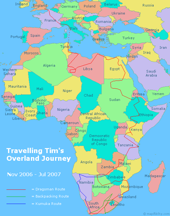
This map of Africa, made by me, shows the route taken on my recent Overland journey to Africa. The first section, shown in red, was with the Overland company 'Dragoman'. We started in Dover, UK, then travelled through France and Monaco to Italy. Next, an overnight ferry from Genoa to Tunis, then through Tunisia, Libya, Egypt, the Sudan, Ethiopia, Kenya, Tanzania, Malawi, Zambia, Botswana, Zimbabwe, Mozambique, Swaziland and Lesotho to Cape Town, South Africa. Whew! That's quite a distance! In Cape Town I said goodbye to the Dragoman truck, and spent the next month backpacking around South Africa by myself. Returning to Cape Town, I met up with a Kumuka Overland truck and travelled up the western side of southern Africa, through South Africa, Namibia, Botswana, and back to Victoria Falls in Zimbabwe, where my journey ended.
Posted by travellingtim at August 4, 2007 02:56 AM