« April 2005 | Main | June 2005 »
May 20, 2005
Creating Scrap, Using Scrap
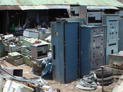
Radars and Radio Sets
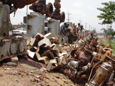
Gearbox Dismantling
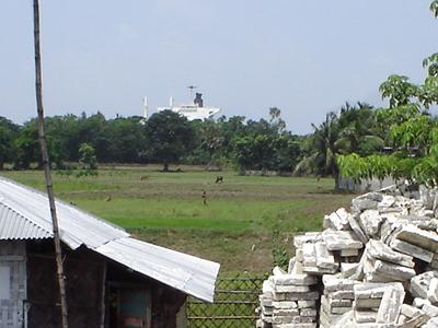
Driving along the road south from Comilla, as you start to near the port city of Chittagong, the stalls along the side of the road change dramatically. Instead of the usual vegetables, paan and cigarettes, basic food-stuffs seen all over South Asia, their contents are surprising to say the least. A stall full of identical western toilets. A shed with huge steel cylinders outside. Engine parts, on a mighty scale. Radios and radars. Gearboxes much bigger than the biggest railway locomotive. Where could it all have come from?
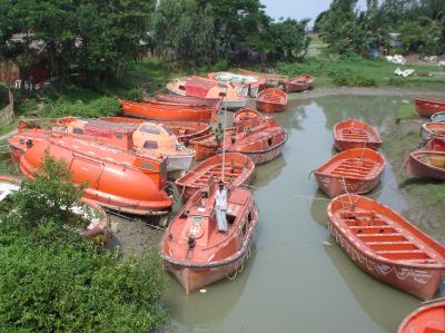
A Fleet of Lifeboats
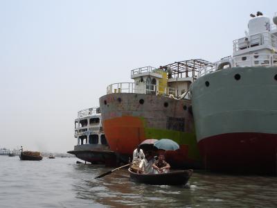
The bus draws level with a small river inlet, which is full of lifeboats, as if some marine disaster has just taken place, but where are all the passengers? A clue comes quite shortly, as way in the distance, peeping out above the trees, a large super-tanker is sighted. No, it has not drifted in too close to shore but was beached here on purpose, for this area of the coast is famous for its ship-breaking industry. Old and worn out ships from all over the seven seas are floated onto the sands at high tide, and then taken to bits piece by piece, to be recycled in different ways.
Supertanker Ahoy
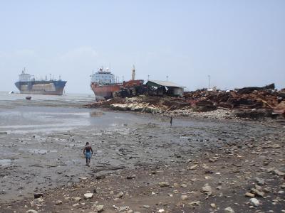
The obviously re-useable items are taken off whole, to be sold to anyone who needs a monster searchlight, 10,000 teaspoons, or a portrait of the father of the Turkish nation, Kemal Attaturk. The huge engines are dragged out in sections, to dismantled by hand, whilst the ships themselves are attacked by an army of men with hacksaws and cutting torches - from a distance they look like ants swarming over the body of some huge dead animal.
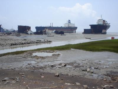
Ship Breaking - 1
I went to visit some of these 'ship-cutting yards' as they are locally known, and it was fascinating to watch as huge steel plates or propellor shafts were cut free to fall on the sands, then to be dragged up the beach by monster winches, and loaded on to the backs of lorries. Although the yard owners were happy for me to wander around and watch the work, photos were not allowed, due to the hornets nest stirred up by some journalists eager to write an expose of coastal pollution. The two photos here were taken outside the yards, from a distance.
Ship Breaking - 2
Chittagong is a noisy and crowded city with few attractions to recommend for the tourist. After visiting the shipyards, there was little else to keep me, so I headed north again, this time to the hills and tea gardens of Sylhet.
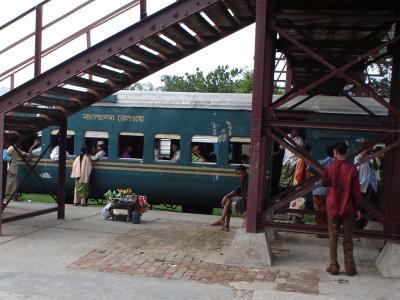
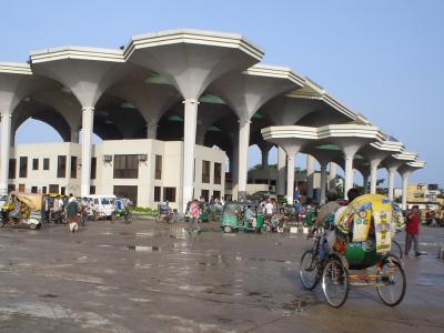
Chittagong Station
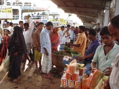
I went by rail for a change. The Bangladesh railway network is quite old, but does its job fairly adequately, and maintains a number of regular routes that offer long distance travel at surprisingly cheap rates. As elsewhere in the sub-continent, a stop at a station means an assault on the train by an army of vendors, selling all manner of goods and foodstuffs, such as peeled cucumbers, green coconuts, ripe bananas, bombay mix, roasted peanuts in their shells, fresh mangos, and a dozen other interesting things to keep the traveller fed and watered along the way.
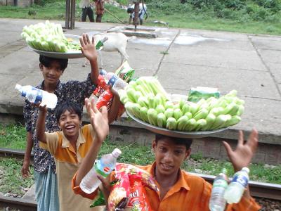
Cucuumber Sellers
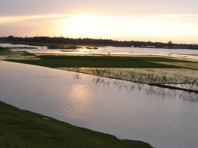
There had been quite a bit of rain over the last few days, as the monsoon was starting, and frequent depressions would roll over the country bringing torrential downpours, ear-splitting thunder claps, and startling amounts of lightning. So easily, with just a few days of rain, the fields began to flood, ruining crops and isolating homes and communities. It is frightning how quickly this can happen in Bangladesh; so flat and low-lying over the whole southern coastal plain. Of course its just the beginning of the monsoon season - much more is to come for this beleaguered country and its population.
Flooded Fields
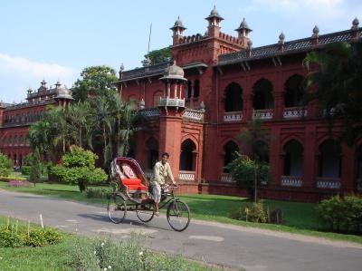
On to Sylhet, a pleasant smaller city in the north of the country. It is famous for its tea, also for its emigrants who staff a thousand Indian restaurants all over England and beyond. Many return to this area when they retire, and build large houses for themselves and their families.
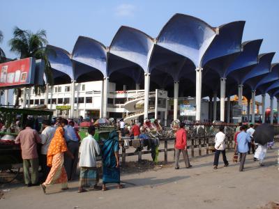
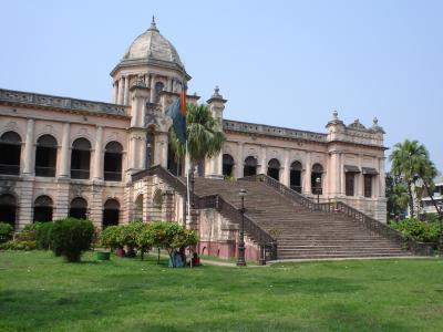
Sylhet Station
Sylhet railway station is an impressive structure, with a series of mushroom-like canopies towering over the station buildings themselves. Nearby, crossing the Surma River, is the Kean Bridge. It has such an incline on either side that the bicycle-rickshaw drivers can't manage the ascent themselves, and employ extra pushers at 1 taka a time. Once over the top, their passengers hope that the brakes are working as they come rushing down the other side, straight into oncoming traffic.
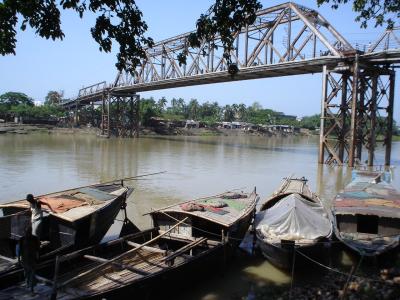
Kean Bridge
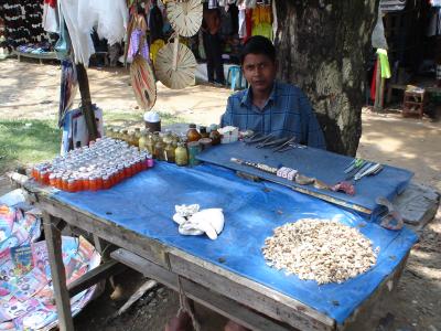
Denture Stall
I found this stall on the roadside, for the benefit of all of those who need dentures. This guy will make a set of false teeth for you: actually, that is not strictly true. Whilst the base is made by hand, the teeth used are real ones, extracted from other people, most presumably alive? That pile on the right of the table is his stock of teeth - I presume you choose the ones that match your own the closest.
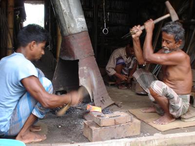
Sylhet Blacksmiths
This diary-entry started with the generation of scrap metal. It finishes the other way around, by using scrap metal to create something new. As many of you know, I've always been interested in blacksmithing, and have been building a small forge in my workshop and getting tools together for the last few years. Whilst wandering down a back-street near the river in Sylhet, I came across a whole row of blacksmiths: trades often tend to stick together like that in Asia and the Middle East. I spent a while watching what they were up to, and then at one particularly friendly family group of father and two sons, I commissioned them to make me a knife and a pair of tongs, and sat watching the whole process!! It took them about an hour and a half all together: the knife was made from part of an old lorry-spring, with a wooden handle, and a curved blade about 8" long. It is properly tempered, and very sharp. The tongs are made from a length of concrete-reinforcing rod, with a rivetted joint in the middle. Total cost: 300 taka (about 2-40 in UK money) though I gave them an extra 200 to say thank-you. They were very touched that a foreigner should spend time interested in their craft, and my presence attracted a huge crowd as well, all wondering why I was there, and then watching the work themselves, though the blacksmiths didn't let it put them off, apart from to order someone to run to get cups of tea at frequent intervals! It was a privilege to watch these craftsmen and I learned a lot; an amazing morning - about the best one I can think of.
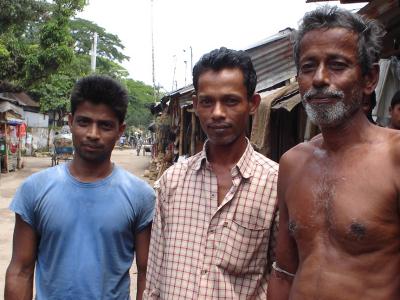
Father and Two Sons
Posted by travellingtim at 07:15 PM
May 14, 2005
Mosques, Mandirs, and Monasteries
Shait Gumbad Mosque
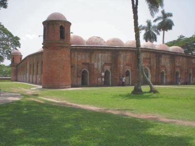
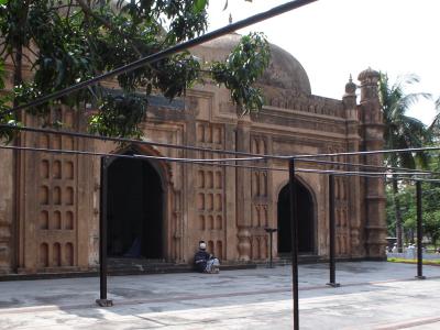
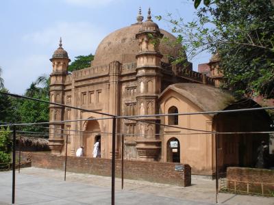
Near to Khulna is the town of Bagerhat, famous for one of the most magnificent mosques in Bangladesh, the 'Shait Gumbad'. I took a local bus to visit it, and some of the other mosques in the area. Built in 1459, it is some 60 metres long, and has 77 domes and 35 doorways. Although classed as an ancient monument, it is still in use as a place of prayer 5 times a day. Whilst I was there, the Bangladesh minister for food popped in on a visit; I had noticed his official convoy earlier, as the roads were cleared to let it pass.
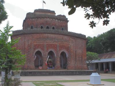
Kantanagar Temple
A night train north took me to the city of Dinajpur, famous for the nearby Hindu temple of Kantanagar. This spectacular building appears on nearly every tourist brochure and poster for Bangladesh, and was well worth the complicated journey by bus and foot required to get there. Built in 1752 in the late-Mughal style, its exterior is covered with thousands of sculptured terracota tiles depicting scenes from the Hindu epics.
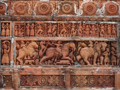
Temple Terracotta Tiles
Back in Dinajpur, I went to see the 'Rajbari' there. Rajbaris are the homes of wealthy Zamindars, or land-owners, and occurred throughout the countryside at one time. Many were destroyed in the great earthquake of 1897, but this one was preserved and rebuilt; today it is abandoned to a number of poor squatter-families who greet occasional visitors and are pleased to show them around. As usual, the children giggle with delight to see themselves on the screen of a digital camera.
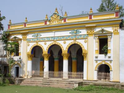
Dinjpur Rajbari
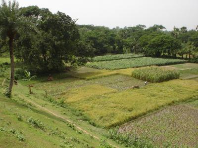
Some people have emailed to ask about the everyday landscape and farms of Bangladesh. Here is a shot that I hope sums up the scenery and typical small fields used all over the South Asian sub-continent. Note the lack of fences; it would be more expensive to provide them than to use the services of a small boy or elderly member of the family to watch where the goats, sheep and cattle wander.
In the bottom right, you can see a rice field that has been recently harvested, by hand, of course. Above and to the left are three other rice fields, still ripening. The taller stalks of a maize field show above that; the remaining fields are of vegetables.
A Typical Rural Scene
If you've ever wondered what rice looks like on the stalk, here's a closeup to show you.
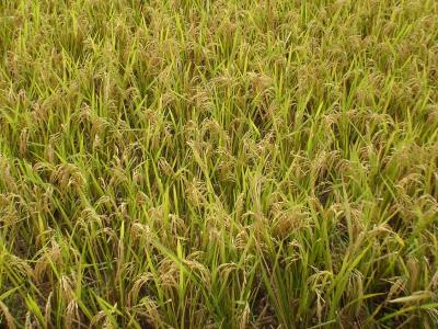
Rice Plants
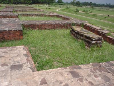
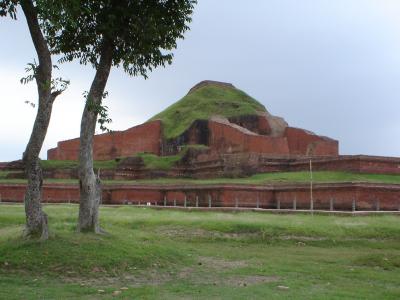
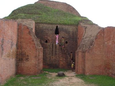
A little further south-east, near to the market-town of Jaipurhat are the splendid Buddhist remains at Paharpur. The Somapuri Vihara there was formerly the biggest Buddhist monastery south of the Himalayas, and today, though dilapidated, still rivals the Buddhist monastery at Nalanda, in Bihar. It dates from the 8th century AD, and is in the shape of a large quadrangle covering 11 hectares.
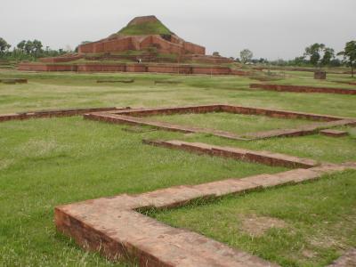
The Somapuri Vihara at Paharpur
Monks Cells and Statue Base
The 170 or so monks cells make up the walls, and enclose the central courtyard, from the centre of which rises the 20 metre high remains of a stupa that once dominated the countryside. The entire building is made from brick, though the walls in some places are decorated with sculptured terracotta tiles. A small museum nearby houses some excellently maintained relics, both domestic and religious, found in the excavations. The highlight is a large bronze Buddha. Entry to the museum and the site costs 2tk.
Stupa From The North
Stupa Closeup
Posted by travellingtim at 02:11 PM
May 10, 2005
The Best 8 Pounds I Ever Spent
Pari Bibi's Mausoleum
Lalbagh Fort Gatehouse
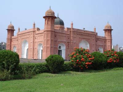
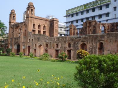
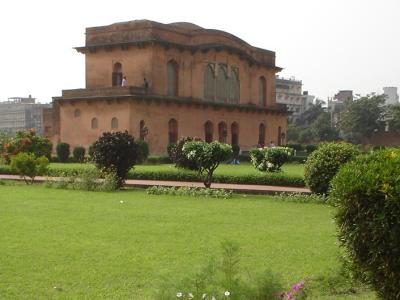
A final bit of sightseeing in Dhaka: I went to visit the Lalbagh Fort, in the old city. Built in 1677 under the guidance of the 3rd son of Emperor Aurangzeb, it was handed over to Shaista Khan for completion. Unfortunately, the death occurred of his daughter, Pari Bibi. This was considered such a bad omen that the fort was never finished; today, only a few buildings remain, surrounded by a huge set of walls. The rest of the area is today a most attractive set of gardens, very popular as an escape from the city noise.
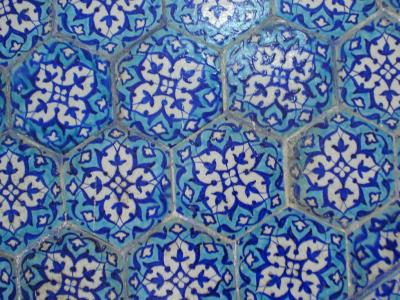
Tiles in the Governor's Residence
Governor's Residence
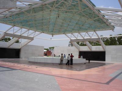
You may be wondering about the title to this diary-entry: 'The Best 8 Pounds I Ever Spent', and what it refers to. Well, the answer is coming up right now - it refers to the cost of a first-class cabin ticket on the famous Rocket Steamer from Dhaka to Khulna, in the south. You can see a photo of the Rocket Steamers on my previous blog page. Some of you may have seen the recent Michael Palin TV series 'Himalaya', in which they featured. After seeing the series myself, and reading about these old paddle steamers in various guidebooks, I just couldn't resist taking a journey wherever they went. The cost of a first-class ticket is indeed just 1010 taka, or about 8 pounds. For this, you get a berth in a twin cabin on the upper deck, plus use of the first-class dining-room, and the first-class observation deck at the front of the steamer.
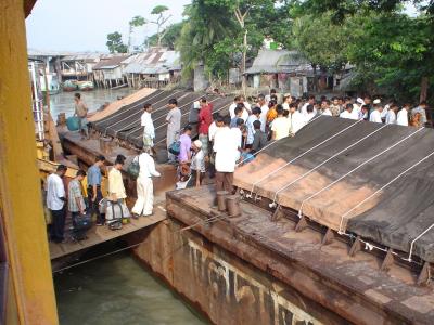
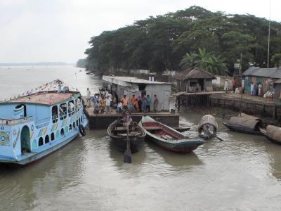
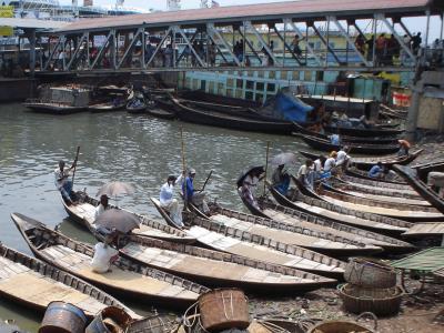
Sadarghat Ferry-Jetty
River Scenes
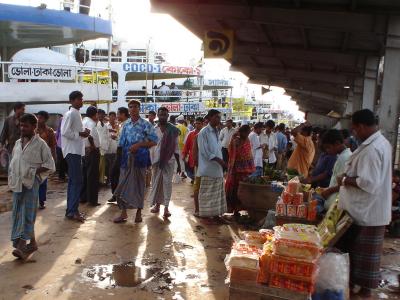
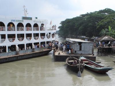
The BIWTC ticket office takes some finding: a Dickensian establishment in Motijheel, where ceiling fans lazily move the dust around, and ancient paperwork slowly climbs to meet them. The ticket requests are entered by hand in an old ledger by a very friendly gentleman who complimented me on the clarity of my diction. Ticket in hand, I caught a 'Baby Taxi' down to the Sadarghat ferry jetty to board the 'M.V. Tern', built in 1935 and still going strong. There was an unbelieveable number of people on the jetty, as it was berth for a large number of other ships as well, not just the Rocket Steamers. I found the right one, and was welcomed aboard by the steward, who was expecting me. I was the only foreigner on the Rocket today, and attracted the usual friendly attention as elsewhere in Bangladesh.
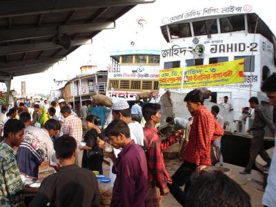
Ferries and Passengers
Provisions for the Journey
We set sail on time, and dinner was served in the dining room at 8:30 pm - a tasty egg curry with fried rice and mixed vegetables. I spent the evening sitting in one of the armchairs on the front observation deck, drinking tea and watching the lights of other river traffic pass by, whilst a welcome breeze kept everyone cool.
On the Tetulia River
Going Ashore
The trip takes a total of 27 hours; departing from Dhaka at 6pm, and arriving the following evening at Khulna about 9. The day was very relaxing: a late breakfast of omelette, toast, and mango jam, then a day spent watching the riverbank go by, reading, and listening to the BBC on my small radio. Lunch and dinner were served as required, and the ship's small shop sold additional snacks, drinks, bananas etc.
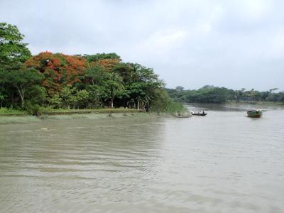
Small Riverside Communities
A Small Ferry Picks UP Passengers
We stopped at various small towns and villages along the way, to pick up or drop cargo and passengers. Not all the stops had a jetty; at these towns, the 'Tern' would anchor in the river, and the passengers would arrive on small and rickety launches from the bank.
A Larger Ship Arrives
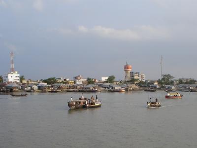
The Port of Mongla
It was quite an anti-climax arriving at Khulna, which although quite a big town, has little if anything of interest to the tourist. It would have been very tempting to stay on board the 'M.V. Tern', and make the return journey to Dhaka !!
Posted by travellingtim at 02:02 PM
May 06, 2005
Dhaka, capital of Bangladesh
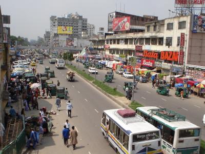
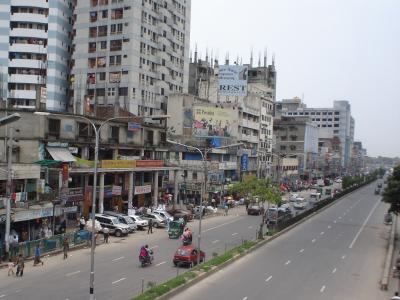
Downtown Dhaka
Kamalapur Station
I had been considering a visit to Bangladesh at the end of this trip, if the monsoon had abated somewhat, but whilst in Agartala, I found that there was a Bangladesh Consulate that issues visas. A trip west through Bangladesh does away with the long haul by road back through Assam and the top of West Bengal, besides being a new and interesting country for me, so the decision was not hard to make. I caught the daily bus between Agartala and Dhaka, and despite some demands for 10% of my Indian cash at the border, and the CRAZY driving habits of the bus drivers on the fast and good quality roads in Bangladesh, the journey was uneventful, and I arrived at Dhaka late in the evening, and found an excellent room at the Hotel Alfaruque, near to the main Kamalapur railway station.
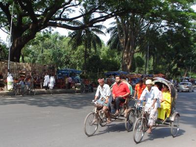
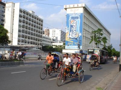
Bicycle Rickshaws
If there is one thing that immediately strikes the visitor to Dhaka, and indeed Bangladesh itself, it is the vast numbers of cycle rickshaws. They are to be seen everywhere, in town and country; the main roads have specially-marked rickshaw lanes to help them avoid the suicidaly speeding buses. The charges are very reasonable: even as a foreigner, I was only paying about 10 taka per kilometre. The current exchange rate is about 120 taka to the pound.
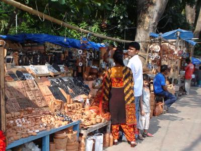
Terracota Stalls
Although my first day in Bangladesh was a Friday, the Muslim holy day when most shops and offices are closed, I got a rickshaw to the New Market area, and managed to find a row of book stalls, one of which had a pirate-copy of the 4th edition Lonely Planet 'Bangaldesh' guidebook. It is amazing how disconcerting it feels to be in a big city and have no idea of the direction of anything, or what the main buildings and areas are. I'm much happier when I have a map to look at.
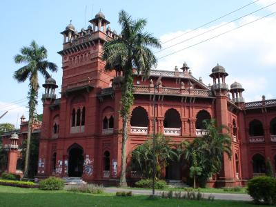
Curzon Hall - 1
Curzon Hall - 2
Although in the new city, some older buildings still remain. The fine brick Curzon Hall was built in 1905, and is now part of Dhaka University. The Hazrat Haji Shabaz Mosque was built in 1679; the tomb of its builder, the Dargarh Sharif, is just across the courtyard.
The Hazrat Shabaz Mosque
Dargarh Sharif
Next to the Mosque is the astonishing 'Shrine of the Three Leaders', an ingeniously designed canopy structure.
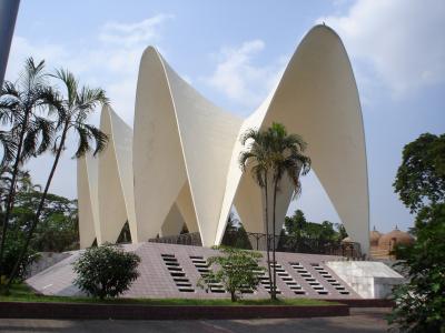
Memorial to the Three Ministers
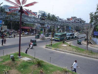
In the New City
The new city area of Dhaka is surprising light and airy, with wide streets and boulevards. There are plenty of modern multi-storey buildings, with numerous shopping plazas and a pleasant lake-side park in the rich Dhanmondi district, and skyscrapers representing many international finance businesses in downtown Motijheel. Other parks are found near the University.
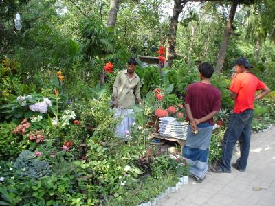
A Flower and Plant Salesman
Dhaka Street Scenes
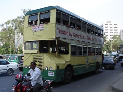
A Double-Decker Bus
To the north of the city, in the Crescent Lake Gardens, is the tomb of General Ziaur Rahman. Close by is the modern National Assembly building, designed by Louis Kahn.
General Zia's Tomb
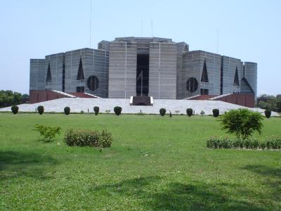
The National Assembly
The Wide Streets of New Dhaka
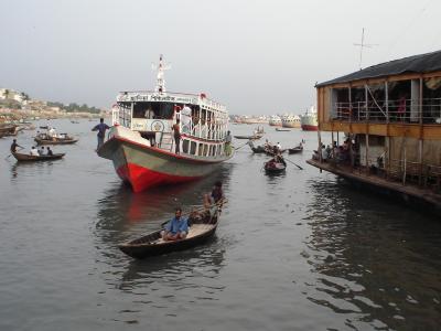
Another view of New Dhaka's wide streets and modern buildings. Towards the River Buriganga, the old city starts; its narrow alleys and twisting streets in stark contrast to the more modern quarter. I went to look at the river: a busy and bustling highway of huge numbers of ships, ferries and boats that cross up, down, and along the waters. There are the famous rocket ferries, with their distinctive paddle-wheels, plus a large number of other ferries that ply the numerous waterways of this water-dominated country. Cargo ships and freighters rush down towards the sea, tossing the many water-taxis that criss-cross the river in their wake. I bargained for one of these to take me on a small tour of the river, and got a front-row view of life on the river. Excellent value at just 50 takas for the hour.
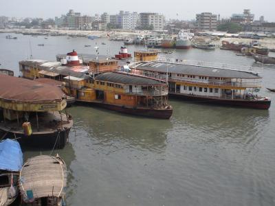
Rocket Ferries
On the River Buriganga
Water Taxis - 1
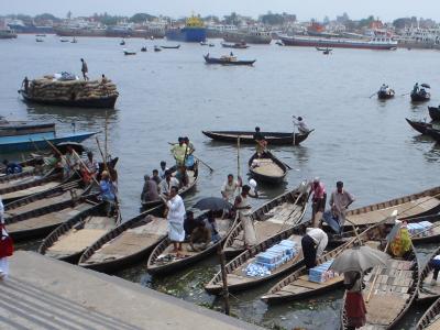
Water Taxis - 2
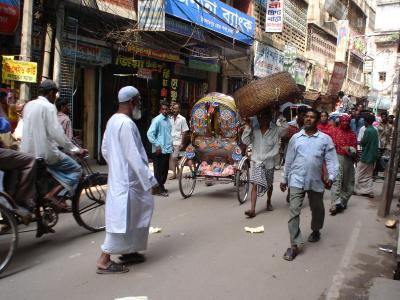
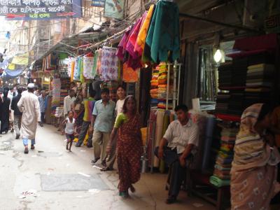
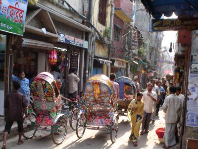
Back from the river, I wandered through the tiny streets of Old Dhaka. Barely wide enough for two rickshaws to pass in places, they are crowded to capacity by a mass of people hurrying about their business, as the many small shops overflow their stock onto the pavements, vying for space with other hawkers and small traders.
Old Dhaka - 1
In the centre of this seething mass is an island of calm, the Ahsan Manzil. Built in 1872, it was the home of the Nawab Abdul Ghani, and the site of the foundation of the All India Muslim League. Though abandoned for a number of years, it was fully restored in the 1980s to form a most interesting museum. Luckily, a series of photographs exist that show the rooms as they were in 1902; they have been recreated to this period to form a close copy of how they would have looked. Unfortunately, no cameras were allowed inside.
Ahsan Manzil
Old Dhaka - 2
Hindu Street
Posted by travellingtim at 11:06 AM
May 03, 2005
Agartala, Capital of Tripura State
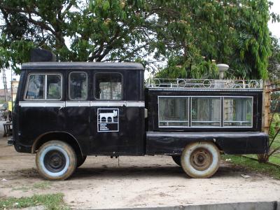
An Agartala Hearse
With all the mention of terrorists and soldiers in my last diary entry, I hope you don't think that this first photo is as a result, but I just couldn't resist grabbing a snap of the most unusual hearse I've seen for a while. Whether it is reserved for special occasions, or whether all hearses are like that here, I'm not sure, but it definitely deserves inclusion for its unique construction.
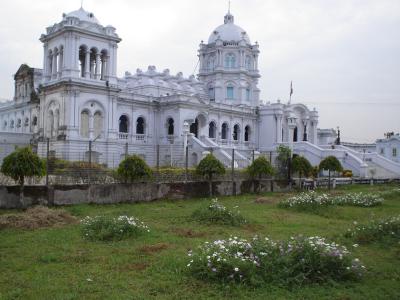
The Ujjayanta Palace
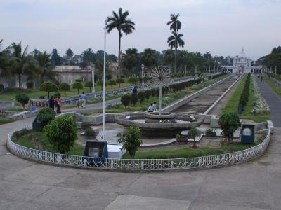
Ujjayanta Palace Gardens
The Ujjayanta Palace was built as a private residence for (I won't say 'by'!) Maharaja Radha Kishore Manikya in 1901, and stands amidst large, well kept gardens in the Mughal style. It is now used for the State Legislature, but opens to tourists each evening between 5 and 7pm; rather late for photos at this extreme east of the Indian timezone, hence the gloomy views above. The twilight is especially popular with courting couples, though, who sit at regular intervals on the walls around the empty fountains.
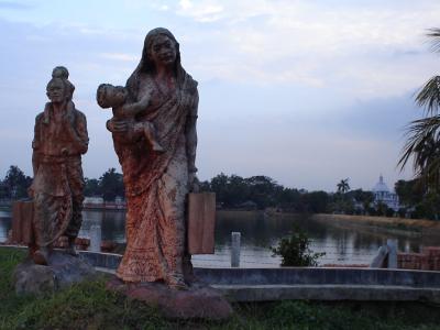
Statues in the Palace Grounds
This statue is one of a series in the Ujjayanta Palace grounds, bordering one of the lakes, and is life sized. Agartala has very few other scenic points of note, hence the lack of photos here. The state of Tripura is very small, and its capital, likewise, is no bigger than many Indian market towns; easy to walk around, difficult to get lost in its regular grid of streets. The locals, unused to tourists in their city, initially regarded me with some interest, but soon got used to seeing me walking around, and greeted me on the most friendly of terms.
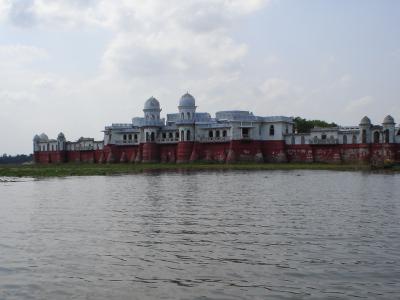
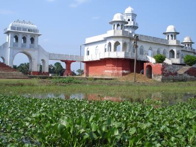
The Neermahal Palace
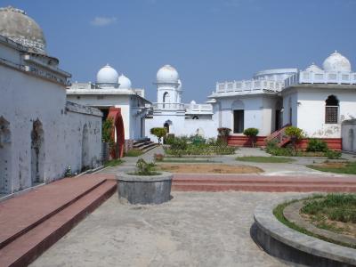
Inside the Neermahal
After a few days in Agartala, I headed south to visit the Neermahal Palace, situated on the shore of the huge Rudrasagar lake, near to the town of Melagarh. Built in the 1930s as a water-palace for the Maharaja, it is now empty, and badly in need of rennovation beyond the installation of colored floodlights presently in hand. It would make a wonderful study centre or hotel; now it is just a series of battered empty rooms visited by the public at 3rs per head.
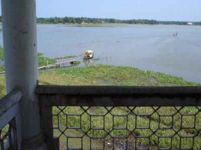
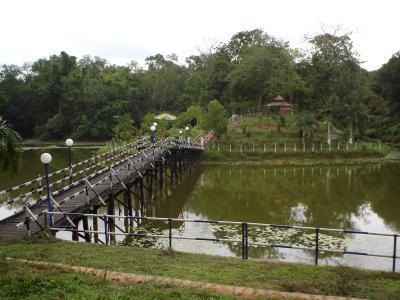
The Rudrasagar, and Sagarmahal
I stayed in the Sagarmahal Guest House, on the opposite shore of the lake: it can just be seen as a white dot to the top right of the photo above. The guest house, run by the Assam Tourist Board, provides lovely rooms with onsuite bathrooms and private balconies for just £2 per night. Mine had a lovely view of the lake and the palace, which was illuminated in the evening for the delight of tourists. In this case, though, it was 'tourist', in the singular: I was the only guest at the Sagamahal that night, and received excellent attention from the hotel and kitchen staff. They were only annoyed that I didn't eat more!
The Neermahal Palace
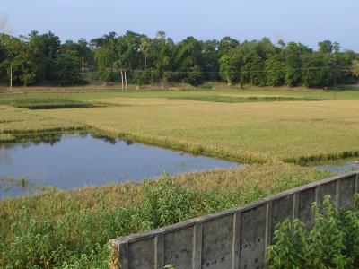
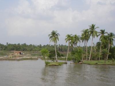
Rice Paddy-Fields
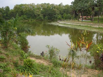
Sipahijala Lake
Sipahijala, on the road back to Agartala, is an extensive forest nature reserve, lakes and zoo. The site is very large: 4.5km from the entrance gate to the first item of interest for example, so it is difficult to explore without personal transport, though I was lucky to get lifts on a couple of passing vehicles. The zoo is quite well maintained, with large enclosures, though I still wonder just why its here and what good it, like many other zoos, are doing for the birds and animals captured for us to stare at. As always, I am tempted to open the cages and let the occupants out, but sadly, I lack the courage to do so.
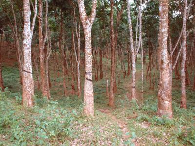
In case you have been wondering where rubber comes from, here are some rubber trees in a small plantation. The bark is cut with a grooving knife, and the latex sap runs into small cups, where it is collected and processed to produce natural rubber.
Posted by travellingtim at 11:01 AM