New for 2020 - tested on Win 7, 8, 10
Full-size image in a new window - More Screenshots
 Introducing the North American Overlay Mapper
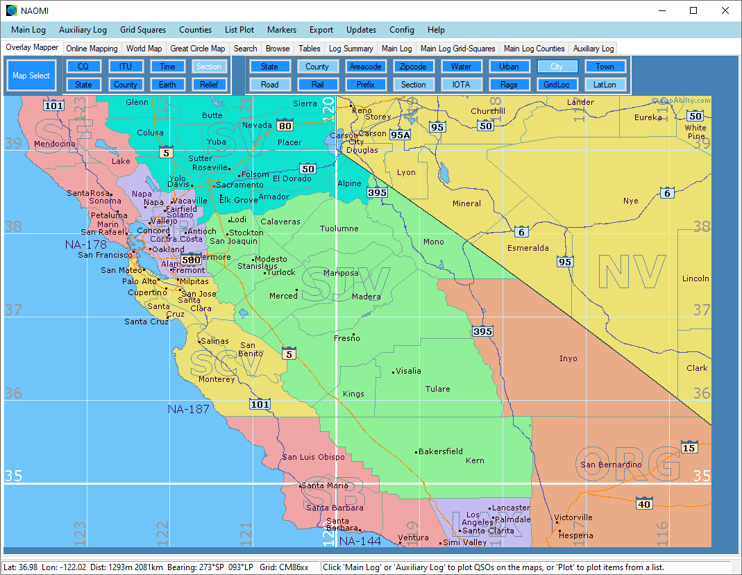
Welcome to 'NAOMI' - the North American Overlay Mapper - a unique Windows mapping program for Radio Amateurs that combines over 50 distinctive maps with built in callbooks for the USA and Canada, plus a range of data-tables with plot, search, browse, and import facilities.
'NAOMI' can import ADIF logs, Cabrillo logs, and a variety of lists, and then georeference them from the latest FCC and ISED databases, and then plot North American QSOs, Grid Locators, and Counties, onto 47 maps at 1:2,000,000 scale, 2 North American overview maps at 1:20,000,000 scale, a zoomable Online Map with a choice of map-providers, a full-screen World Map, and a Great Circle Map with a choice of 16 different backgrounds.
You can edit logs, check for errors, parse for counties, export data in different formats, search and browse the databases, overlay a variety of lists, export the maps for use in other applications, or to share online. For further reference, see the comprehensive Help Guide.
Program FAQs
- Q: What operating system does the program run on?
A: Any recent version of Windows: 7, 8, 10.
- Q: Does the program have a minimum window size?
A: Yes: it's 1024 x 739 pixels.
- Q: Can I see some screenshots of the program?
A: Yes, here are a few on the Screenshots page.
- Q: Is there a list of program-features?
A: Yes, please visit the Features page.
- Q: Can I see the Help Guide online?
A: Yes, just click here: Help Guide
- Q: Is there a free evaluation period?
A: Yes, you can trial the program with full functionality for 30 days. After that, you'll need a license.
- Q: How much is the license and where do I get it?
A: Click this link: Buy a license: 15.00 USD or equiv in GBP, EUR, AUD.
- Q: What is the latest version and what is new?
A: Current Version: v4.0.0.2
- Quicker program-startup.
- Improved County Parsing.
- Faster import of large logs.
- Improved log-value error-trapping.
- Allow up to 12 bands or modes per log.
- More comprehensive log-summary.
- List modes per band when the log not collecting a specific entity.
- Log Plotting shows Band/Mode values when hovering over a column-header.
- Fixed errors when deleting/merging log lines.
- Changed to new ULS database address.
- Improved Compass Rose design.
NAOMI Download
To obtain your copy of the North American Overlay Mapper program (v4.0.0.2), please enter your details in the boxes below. An email will be sent with the Download Link.
|